 |
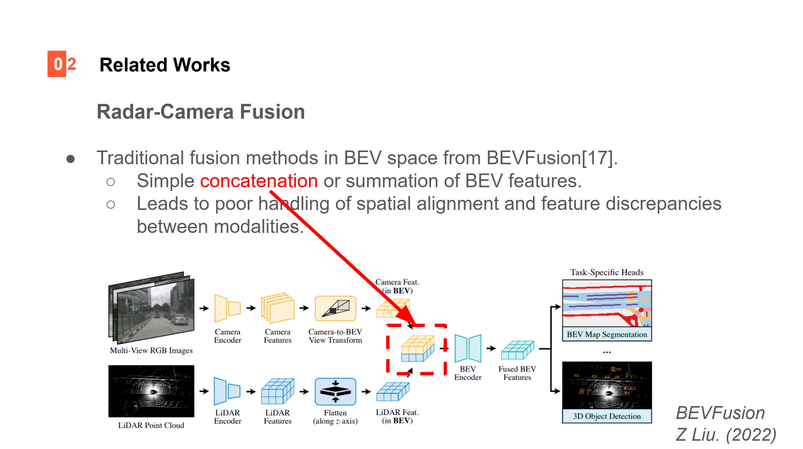
BEVFusion, in 2022, introduced an effective method to project both LiDAR and camera features into a shared Bird¡¯s Eye View (BEV) space. This approach allows the conversion of 3D sensor data type into 2D representation while preserving geographic information. However, once LIDAR and camera features are being projected into BEV space as shown in figure, they are simply concatenated and passed to the BEV encoder to produce fused feature. Since simple concatenation does not provide a way to prioritize or weigh important features, this can lead to poor handling in spatial alignment and feature discrepancies for downstream tasks.
|
 IEEE/ICACT20250226 Slide.04
[Big Slide]