 |
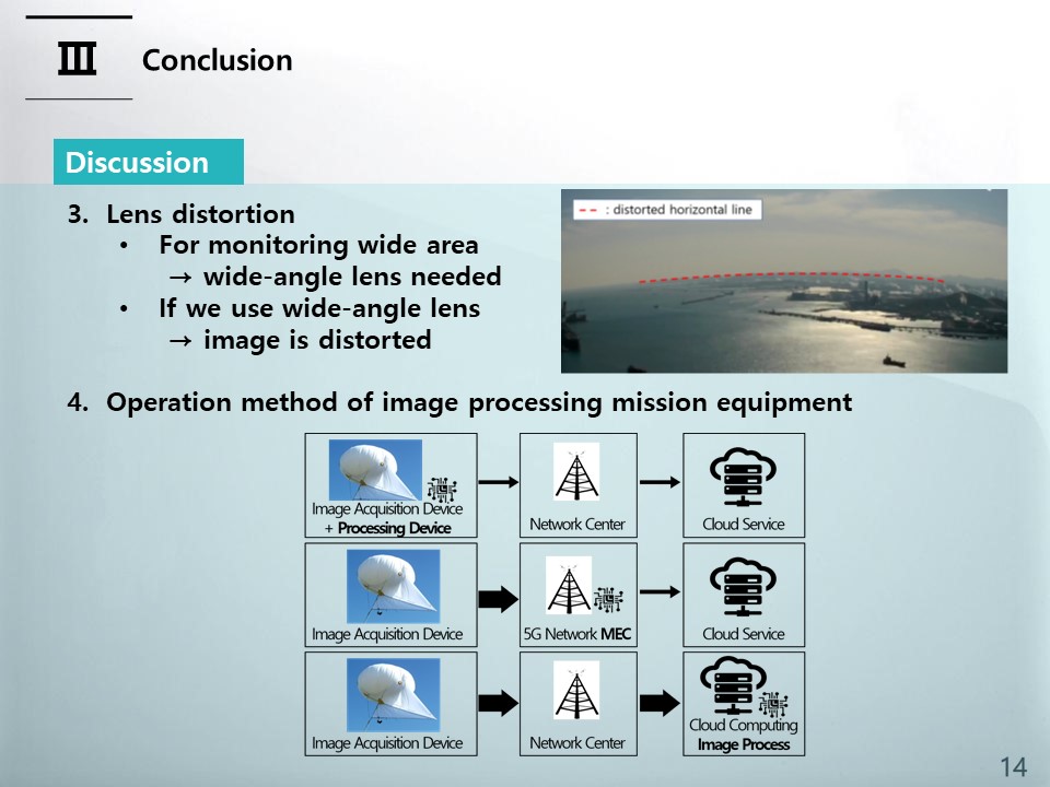
and, If we use a wide-angle lens with a wide field of view of the camera, we can monitor a wide area, but this may cause a problem that the image is relatively severely distorted. In addition to visual problems, this image distortion is especially problematic when physical coordinate numerical calculations such as exact position calculation through image analysis are required. Obtaining the distortion-corrected image coordinates from the distorted image coordinates is a very difficult problem without a closed form solution, and the development of technology to correct images in real-time moving unmanned aerial vehicles such as helikites is a problem to be solved.
The operation method of image processing mission equipment can be largely divided into three methods as shown in figure of bottom of slide. The first method is to install an image acquisition and processing device on an aerial device such as a helikite, and obtain image processing results directly from the air device. The second method is to use a centralized image processing center such as a cloud center. And the last method is to operate the cloud at the end of the network, similar to the operation in MEC (Multi-access Edge Computing) of the 5G network. In the case of port monitoring, since it is difficult to build a network infrastructure, additional research is needed on which method is suitable for port monitoring.
|
 IEEE/ICACT20230138 Slide.13
[Big Slide]
[YouTube]