ICACT20260373 Slide.20
[Big slide for presentation]
[YouTube] |
Chrome Text-to-Speach Click!! |
 |
Thanks for your attention! Now! Floor is open for QnA. Welcome any comment or question.
|
|
ICACT20260373 Slide.19
[Big slide for presentation]
[YouTube] |
Chrome Text-to-Speach Click!! |
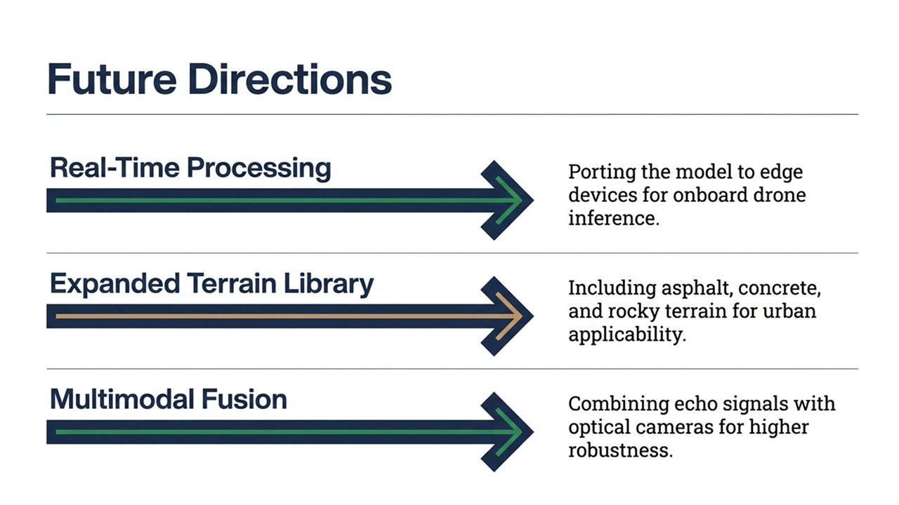 |
Looking ahead, our future research will focus on three directions. We aim to achieve real-time processing by porting the model to edge devices for onboard drone inference, expand our terrain library to include urban surfaces like asphalt and concrete, and explore multimodal fusion by combining echo signals with optical cameras for even greater robustness.
|
|
ICACT20260373 Slide.18
[Big slide for presentation]
[YouTube] |
Chrome Text-to-Speach Click!! |
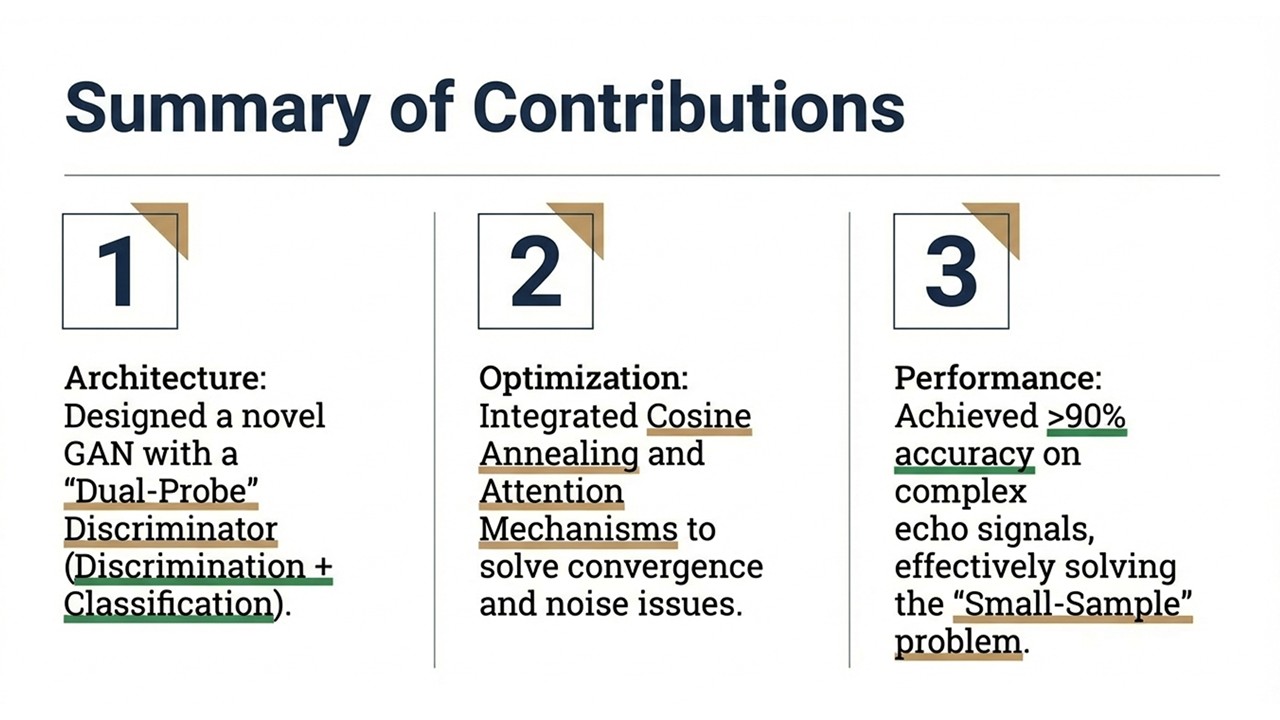 |
To summarize, our study makes three key contributions.
We designed a novel GAN architecture with a "Dual-Probe" Discriminator that combines discrimination and classification,
we integrated Cosine Annealing and Attention Mechanisms to solve convergence and noise issues,
and finally, we achieved over 90% accuracy on complex echo signals, effectively solving the "Small-Sample" problem.
|
|
ICACT20260373 Slide.17
[Big slide for presentation]
[YouTube] |
Chrome Text-to-Speach Click!! |
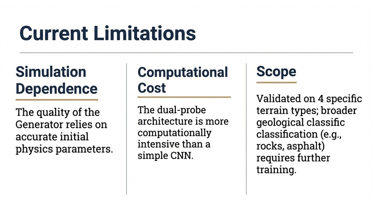 |
However, it is important to acknowledge the current limitations of our approach. The quality of the Generator is heavily dependent on the accuracy of the initial physics parameters in the simulation, and the dual-probe architecture is computationally more expensive than a simple CNN. Additionally, our current scope is validated on four specific terrain types, and expanding to others like rocks or asphalt will require further training.
|
|
ICACT20260373 Slide.16
[Big slide for presentation]
[YouTube] |
Chrome Text-to-Speach Click!! |
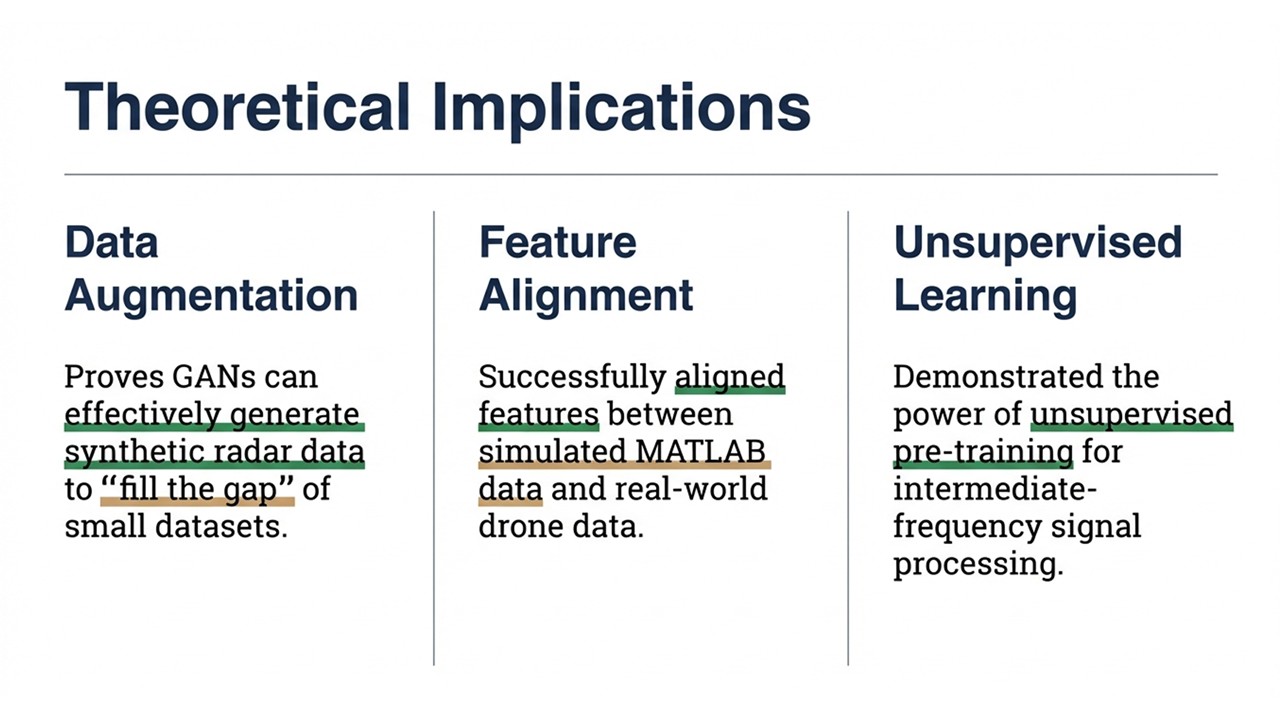 |
Our findings have three major theoretical implications for the field. First, we proved that GANs can effectively generate synthetic radar data to fill the data scarcity gap; second, we successfully aligned features between simulated MATLAB data and real-world drone data; and third, we demonstrated the power of unsupervised pre-training for processing intermediate-frequency signals.
|
|
ICACT20260373 Slide.15
[Big slide for presentation]
[YouTube] |
Chrome Text-to-Speach Click!! |
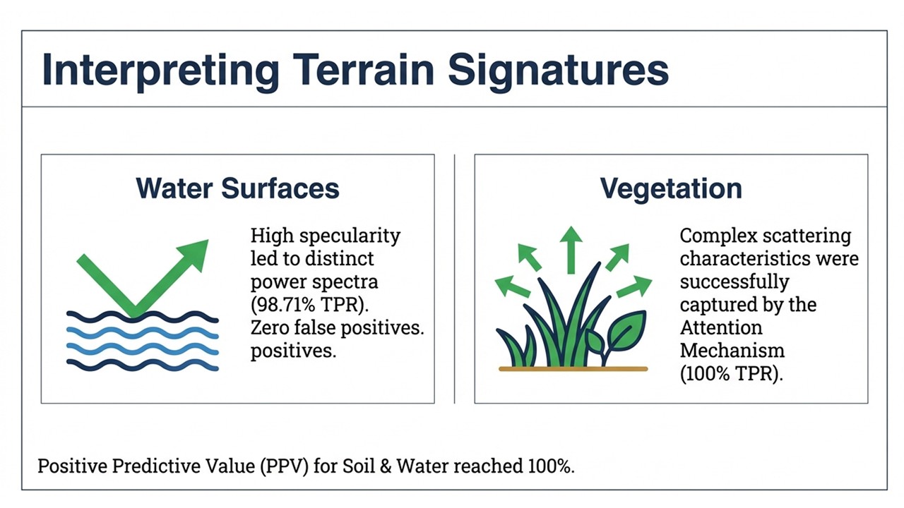 |
From a physical perspective, the model successfully interpreted distinct terrain signatures. For water surfaces, the high specularity led to distinct power spectra that the model identified with zero false positives. For vegetation, despite the complex scattering characteristics, the Attention Mechanism successfully captured the unique features, resulting in a 100% True Positive Rate.
|
|
ICACT20260373 Slide.14
[Big slide for presentation]
[YouTube] |
Chrome Text-to-Speach Click!! |
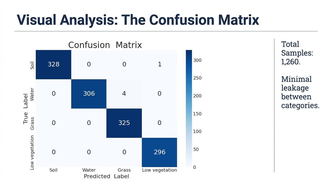 |
A visual analysis via the Confusion Matrix reveals the high precision of our model. You can see high precision for Soil at 99.7%, and essentially perfect separation between texturally similar classes like Grass and Low Vegetation, as indicated by the zero values in the off-diagonal elements. This confirms that the model has minimal leakage between categories and is highly reliable.
|
|
ICACT20260373 Slide.13
[Big slide for presentation]
[YouTube] |
Chrome Text-to-Speach Click!! |
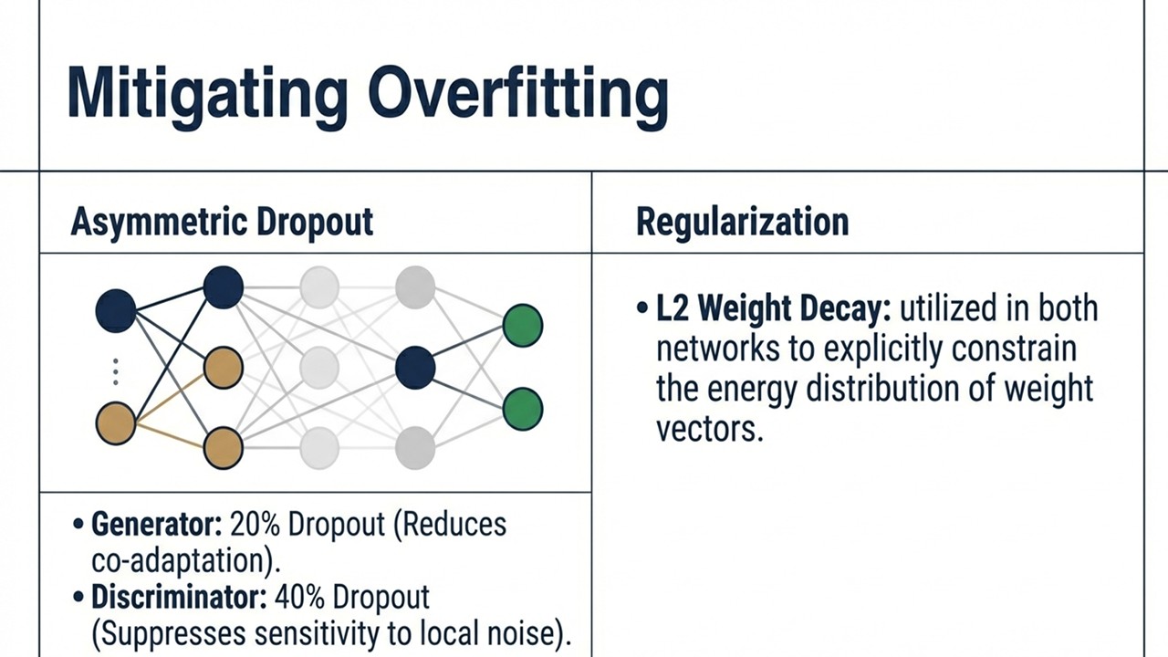 |
To tackle the risk of overfitting inherent in small datasets, we implemented specific regularization techniques. We used Asymmetric Dropout, applying a 20% rate to the Generator to reduce co-adaptation and a higher 40% rate to the Discriminator to suppress sensitivity to local noise, alongside L2 Weight Decay in both networks to explicitly constrain the energy distribution of the weight vectors.
|
|
ICACT20260373 Slide.12
[Big slide for presentation]
[YouTube] |
Chrome Text-to-Speach Click!! |
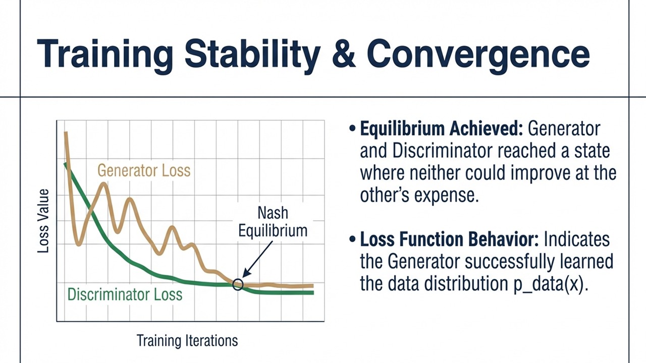 |
We also closely monitored the training stability and convergence of the model. This graph tracks the Generator and Discriminator loss values over training iterations, showing that they successfully reach a Nash Equilibrium. This state indicates that the Generator has learned the data distribution so well that neither network can improve further at the others expense, marking a successful training process.
|
|
ICACT20260373 Slide.11
[Big slide for presentation]
[YouTube] |
Chrome Text-to-Speach Click!! |
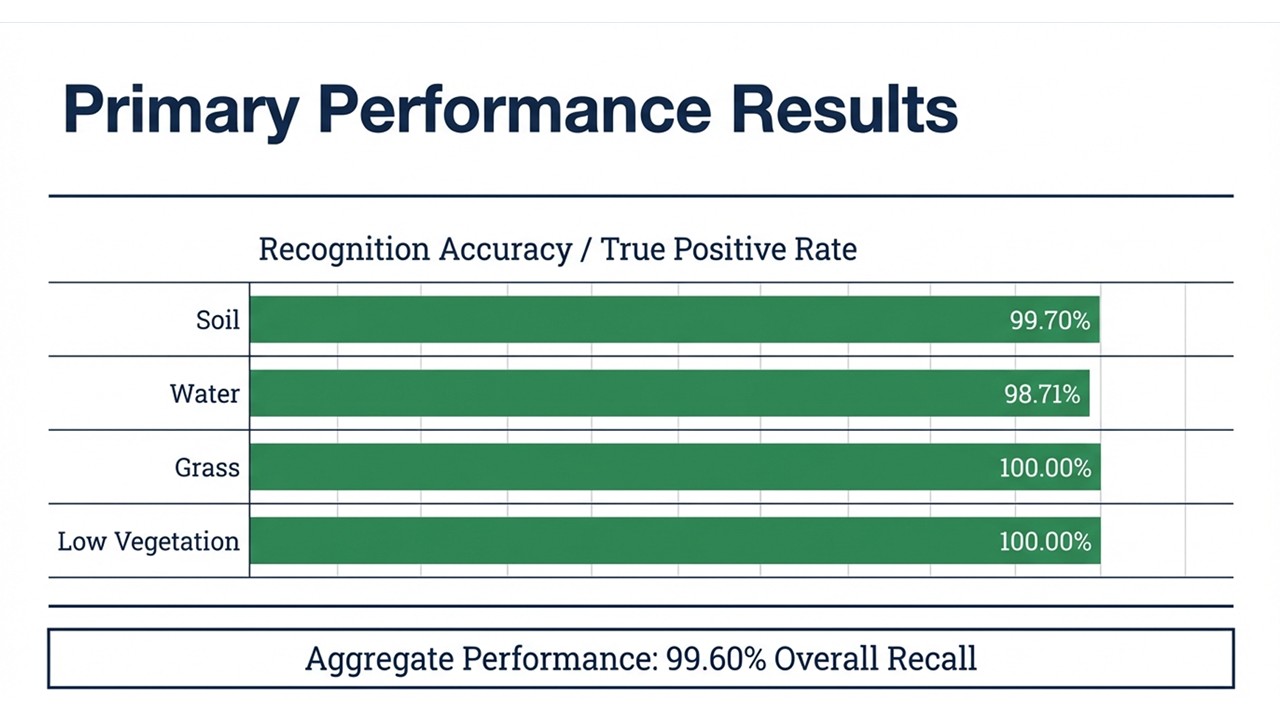 |
The primary performance results are exceptionally strong, as demonstrated by the bar chart. We achieved high recognition accuracy across all categories, with Grass and Low Vegetation specifically reaching a 100% True Positive Rate. The aggregate performance of the model is impressive, attaining an overall recall of 99.60%, which validates the effectiveness of our proposed GAN architecture.
|
|
ICACT20260373 Slide.10
[Big slide for presentation]
[YouTube] |
Chrome Text-to-Speach Click!! |
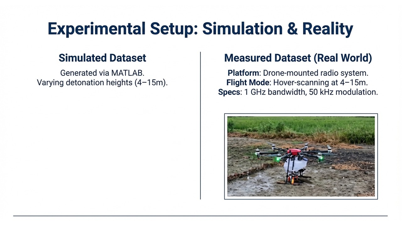 |
Our experimental setup bridges simulation and reality to validate the model. We generated a simulated dataset using MATLAB with varying detonation heights, and we also collected a real-world measured dataset using a drone-mounted radio system operating in a hover-scanning mode at heights of 4 to 15 meters. The table you see displays a sample of the raw power spectral data points collected for different terrain classes.
|
|
ICACT20260373 Slide.09
[Big slide for presentation]
[YouTube] |
Chrome Text-to-Speach Click!! |
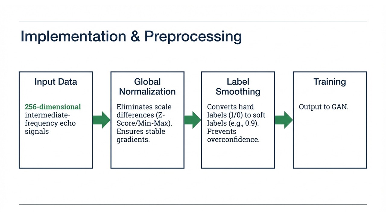 |
For our implementation and preprocessing, we treat the 256-dimensional intermediate-frequency echo signals with two crucial steps. We apply Global Normalization to eliminate scale differences and ensure stable gradients, and we use Label Smoothing to convert hard binary labels into soft labels (e.g., 0.9), which prevents the model from becoming overconfident and significantly mitigates the risk of overfitting.
|
|
ICACT20260373 Slide.08
[Big slide for presentation]
[YouTube] |
Chrome Text-to-Speach Click!! |
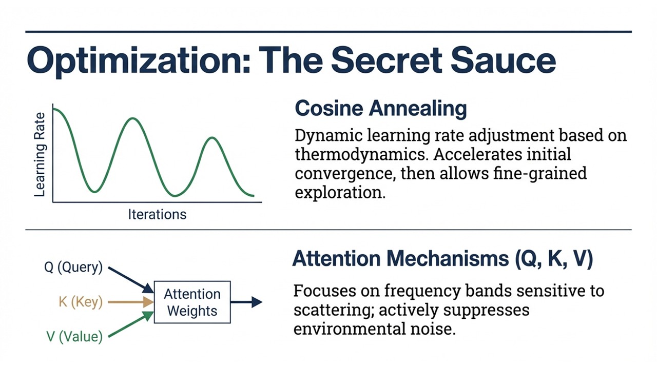 |
To ensure this complex network converges effectively, we employ two key optimization strategies. First, we use Cosine Annealing to dynamically adjust the learning rate based on thermodynamic principles, accelerating initial convergence while allowing for fine-grained exploration later. Second, we integrate Attention Mechanisms (Query, Key, Value) to help the model focus specifically on frequency bands sensitive to scattering, actively suppressing irrelevant environmental noise.
|
|
ICACT20260373 Slide.07
[Big slide for presentation]
[YouTube] |
Chrome Text-to-Speach Click!! |
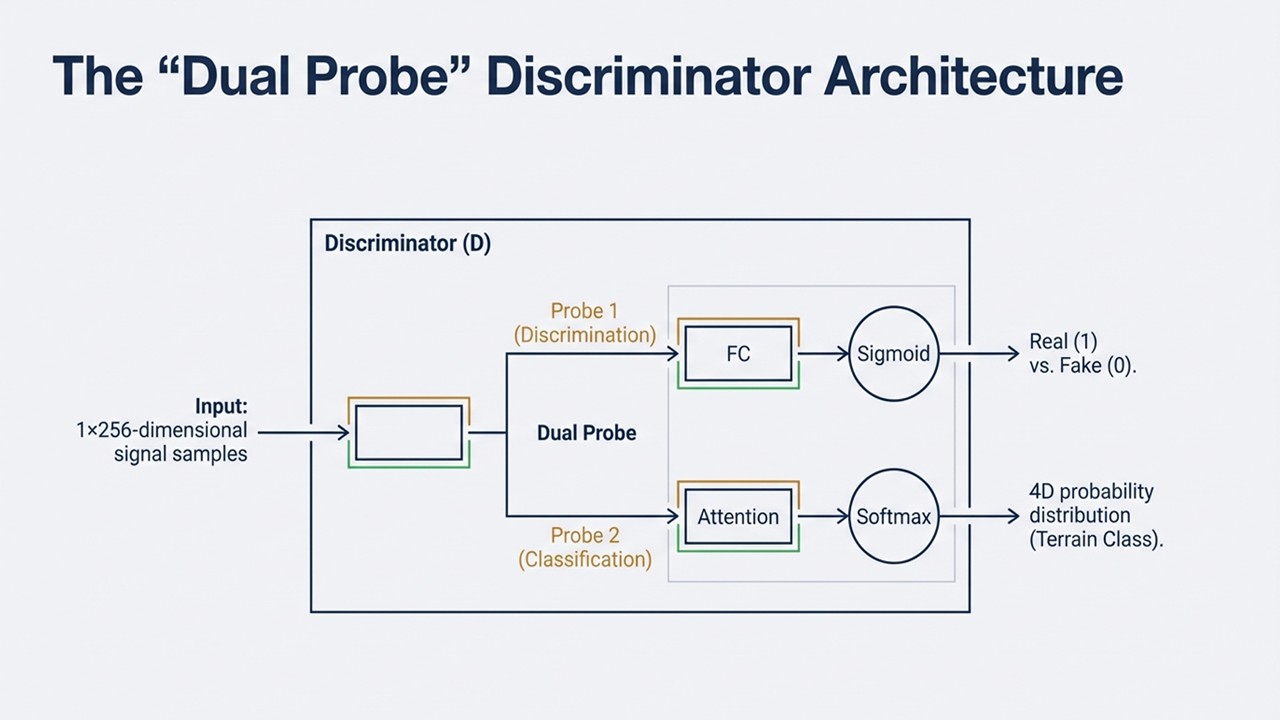 |
Our core innovation lies in the "Dual Probe" Discriminator architecture, which processes 1x256-dimensional signal samples. The input signal is split into two paths: Probe 1 acts as a discrimination head using a Sigmoid function to distinguish real from fake data, while Probe 2 acts as a classification head utilizing an Attention Mechanism and Softmax to output a 4D probability distribution, effectively categorizing the terrain.
|
|
ICACT20260373 Slide.06
[Big slide for presentation]
[YouTube] |
Chrome Text-to-Speach Click!! |
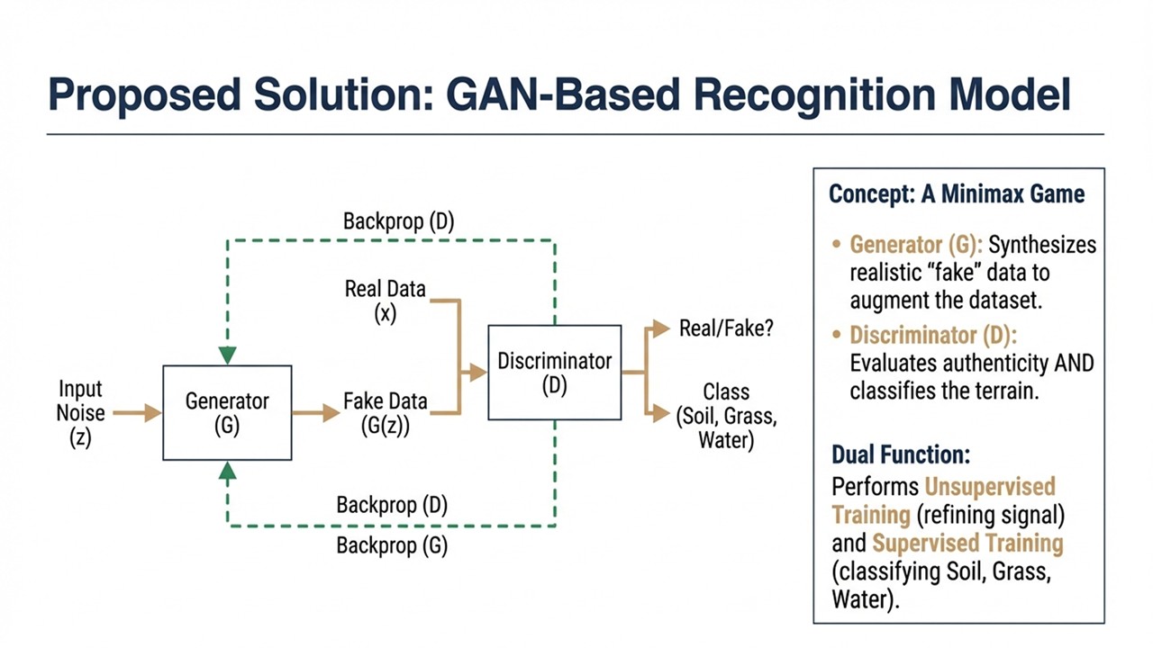 |
To bridge this gap, we propose a GAN-Based Recognition Model that operates as a minimax game between a Generator and a Discriminator. The Generator synthesizes realistic "fake" data to augment our training set, while the Discriminator performs a dual function: it not only evaluates the authenticity of the data in an unsupervised manner but also performs supervised classification to identify terrain types like soil, grass, and water.
|
|
ICACT20260373 Slide.05
[Big slide for presentation]
[YouTube] |
Chrome Text-to-Speach Click!! |
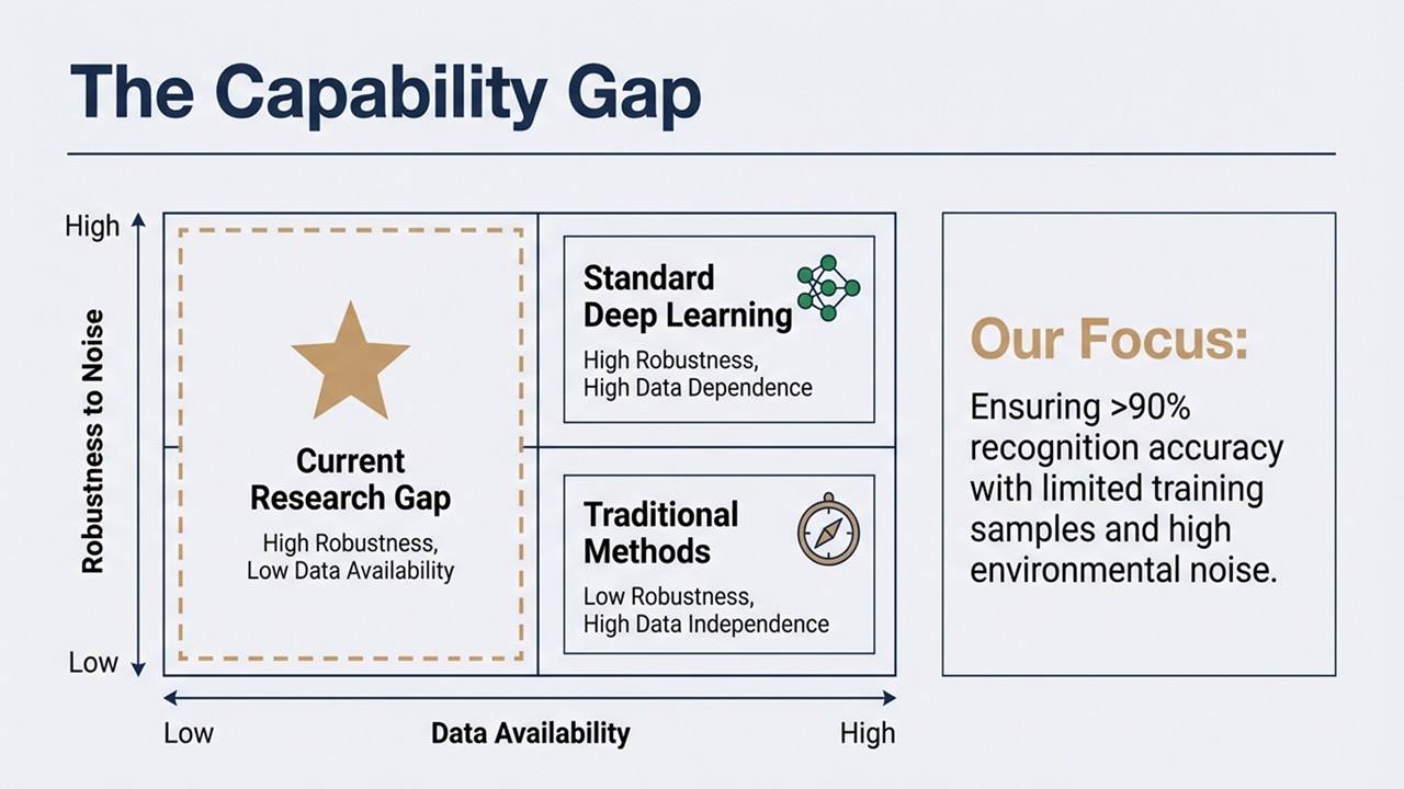 |
This chart highlights the specific research gap we aim to address. Current standard deep learning models offer high robustness but require high data availability, while traditional methods are independent of large data but suffer from low robustness. Our research targets the top-left quadrant—achieving high robustness despite low data availability—with the specific goal of ensuring over 90% recognition accuracy even with limited training samples and high environmental noise.
|
|
ICACT20260373 Slide.04
[Big slide for presentation]
[YouTube] |
Chrome Text-to-Speach Click!! |
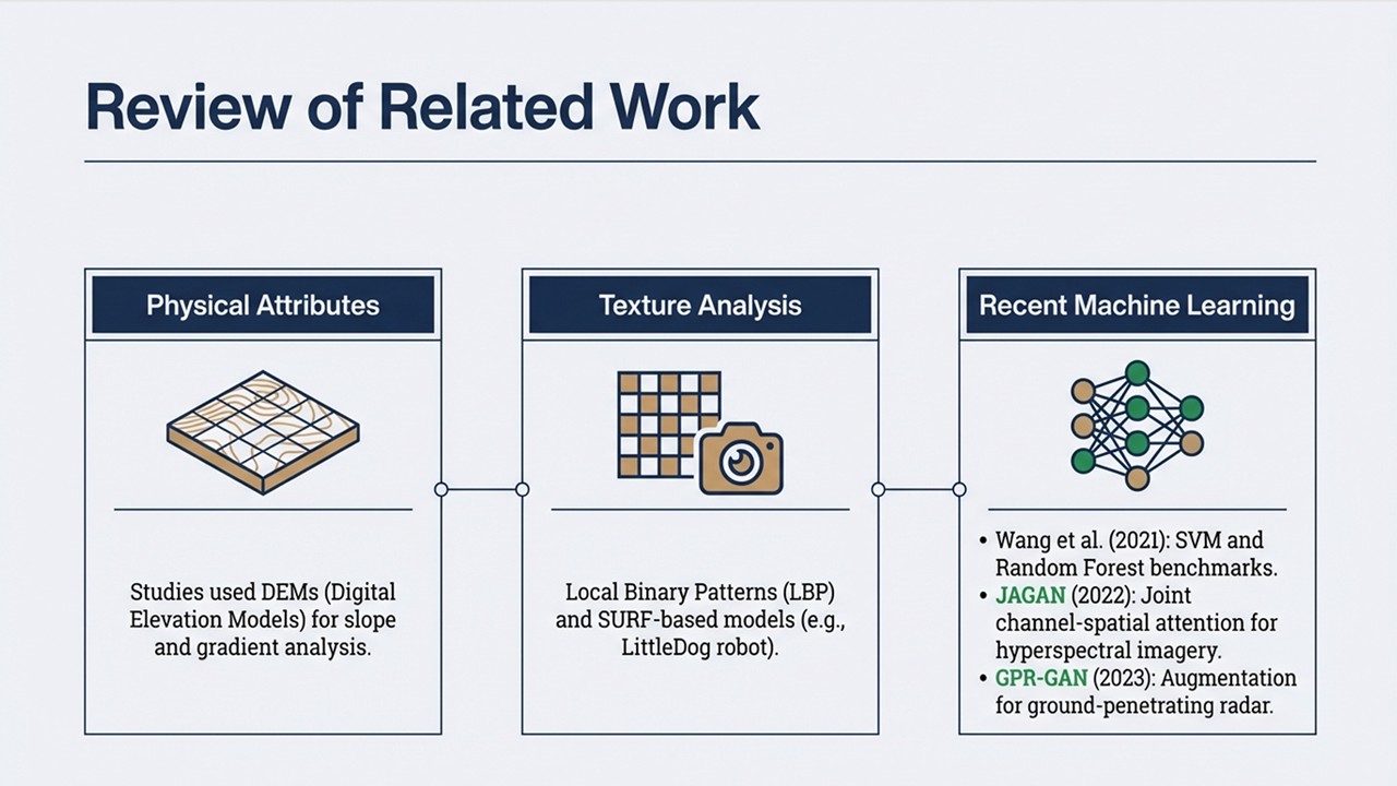 |
In reviewing related work, we see that most existing methods rely on physical attributes derived from Digital Elevation Models or texture analysis using algorithms like Local Binary Patterns, which often lack robustness. While recent studies have begun employing machine learning, such as the JAGAN framework for hyperspectral imagery or GPR-GAN for ground-penetrating radar, there remains a need for a specialized model that can effectively handle intermediate-frequency echo signals under data-constrained conditions.
|
|
ICACT20260373 Slide.03
[Big slide for presentation]
[YouTube] |
Chrome Text-to-Speach Click!! |
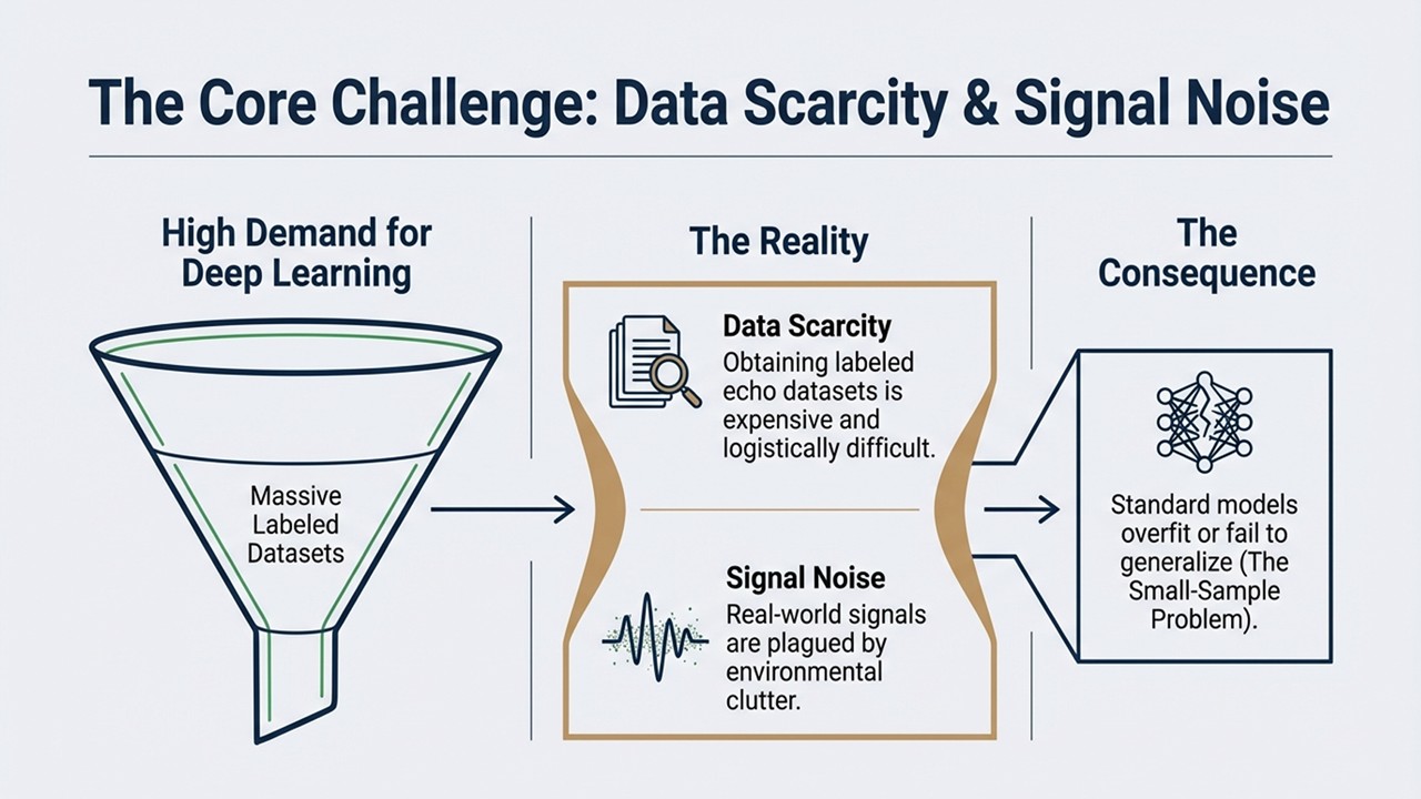 |
However, the transition to deep learning brings a critical challenge known as the "Small-Sample Problem". Although deep learning models demand massive labeled datasets to function effectively, obtaining such datasets for echo signals is expensive and logistically difficult, and real-world signals are often corrupted by environmental noise. Consequently, standard models trained on limited data tend to overfit or fail to generalize to new environments.
|
|
ICACT20260373 Slide.02
[Big slide for presentation]
[YouTube] |
Chrome Text-to-Speach Click!! |
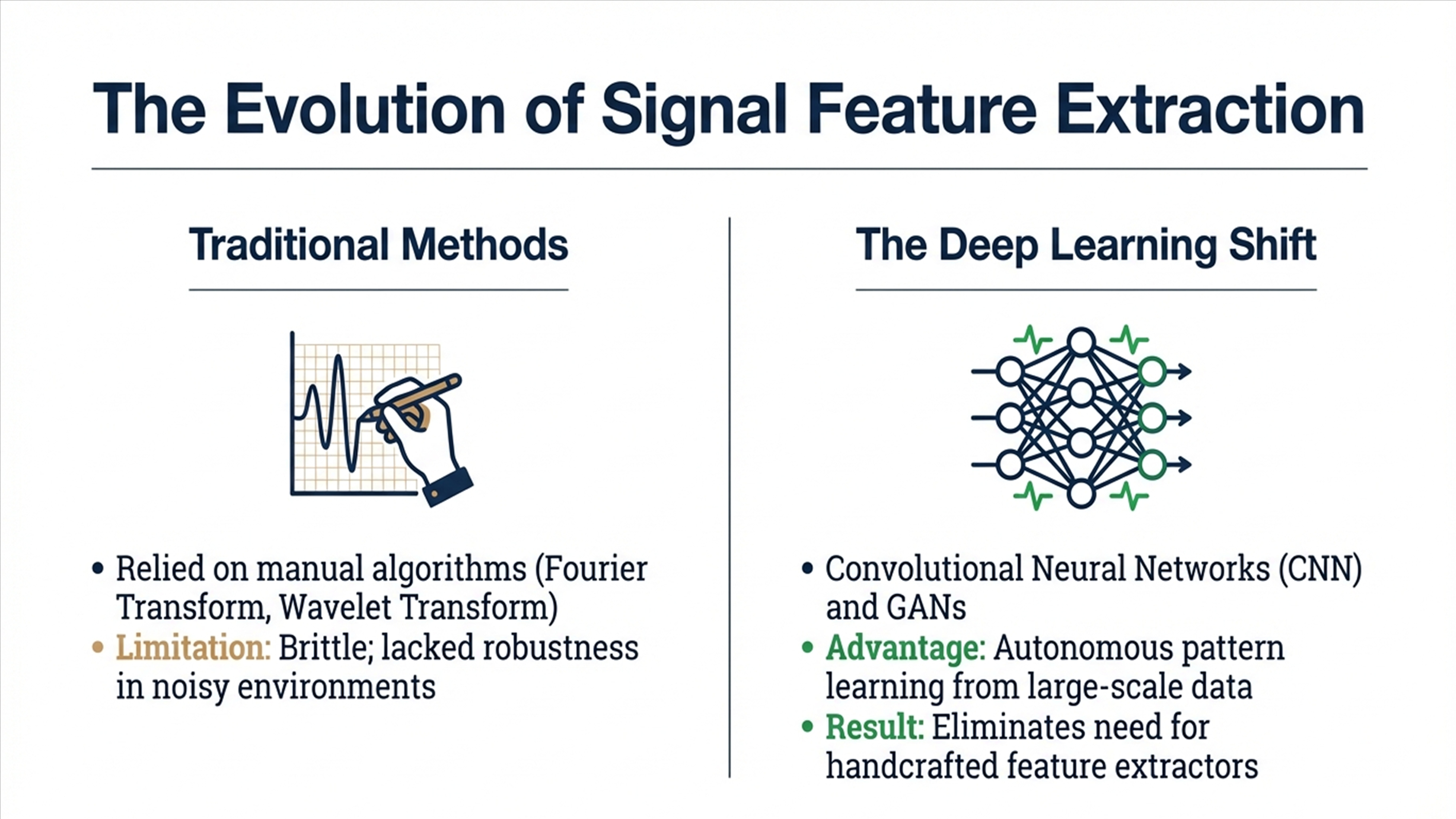 |
To provide some context, the field of signal feature extraction has shifted dramatically in recent years. While we used to rely on traditional, manual algorithms like Fourier and Wavelet Transforms, these methods were often brittle and struggled in noisy environments. The industry is now moving towards deep learning models like CNNs and GANs, which have the distinct advantage of autonomously learning patterns from large-scale data, thereby eliminating the need for handcrafted feature extractors.
|
|
ICACT20260373 Slide.01
[Big slide for presentation]
[YouTube] |
Chrome Text-to-Speach Click!! |
 |
Hi everybody, my name is Zeyu Jin. Our presentation today is about a method of landform feature recognition based on deep learning, which focuses on a novel approach to identifying complex terrain features using Generative Adversarial Networks to solve traditional recognition challenges.
|