ICACT20210158 Slide.01
[Big Slide]
[YouTube] |
Chrome  Click!! |
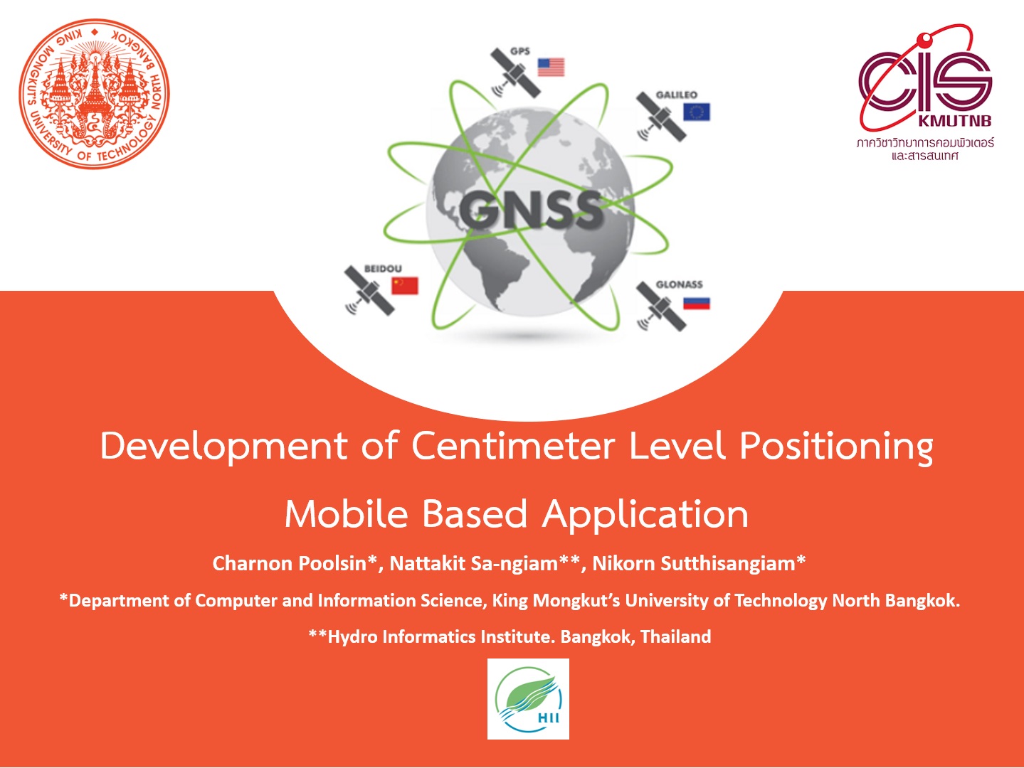 |
Hi everyone. My name is Charnon Poolsin
I’m master student in Department of Computer and Information Science from King Mongkut’s University of Technology North Bangkok.
Today, I would like to present about The Development of Centimeter Level Positioning Mobile Based Application.
|
| ICACT20210158 Slide.02
[Big Slide]
|
Chrome Click!! |
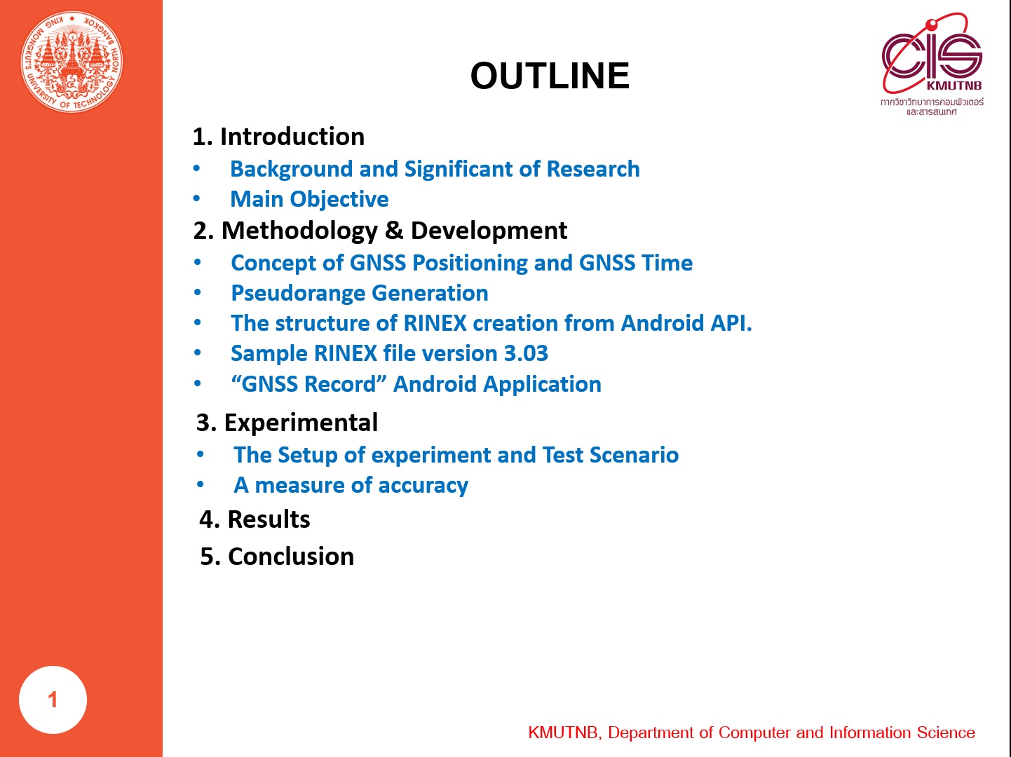 |
I split this presentation into 5 topics that consist of
Introduction, Methodology & Development, Experimental & Results, Finally I’m going to Conclusion.
|
| ICACT20210158 Slide.03
[Big Slide]
|
Chrome Click!! |
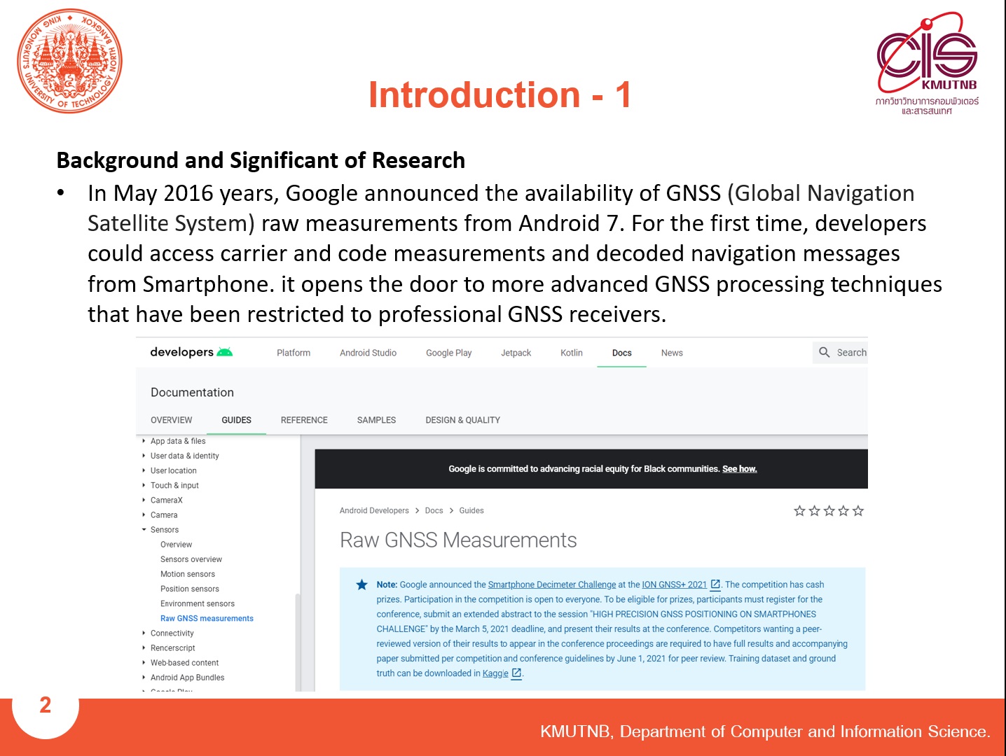 |
In May 2016 years, Google announced the availability of GNSS (Global Navigation Satellite System) raw measurements from Android 7.
That was the first time, developers can access carrier and code measurements and decoded navigation messages from smartphones.
We can also access more advanced GNSS processing techniques that have been restricted to professional GNSS receivers.
|
| ICACT20210158 Slide.04
[Big Slide]
|
Chrome Click!! |
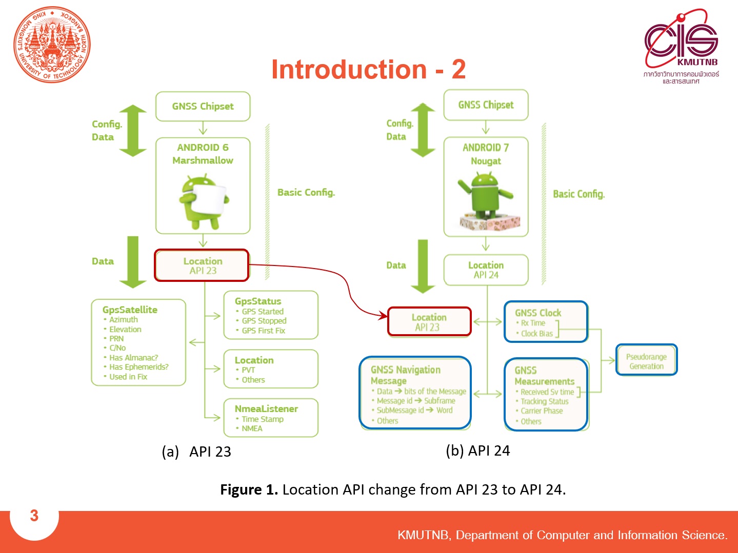 |
We can access GNSS data from this API 24 level or above.
GNSS Data such as GNSS Navigation Message, GNSS Clock, GNSS Measurement.
This GNSS information is the key to Psedorange generation in order to find high-level positioning.
|
| ICACT20210158 Slide.05
[Big Slide]
|
Chrome Click!! |
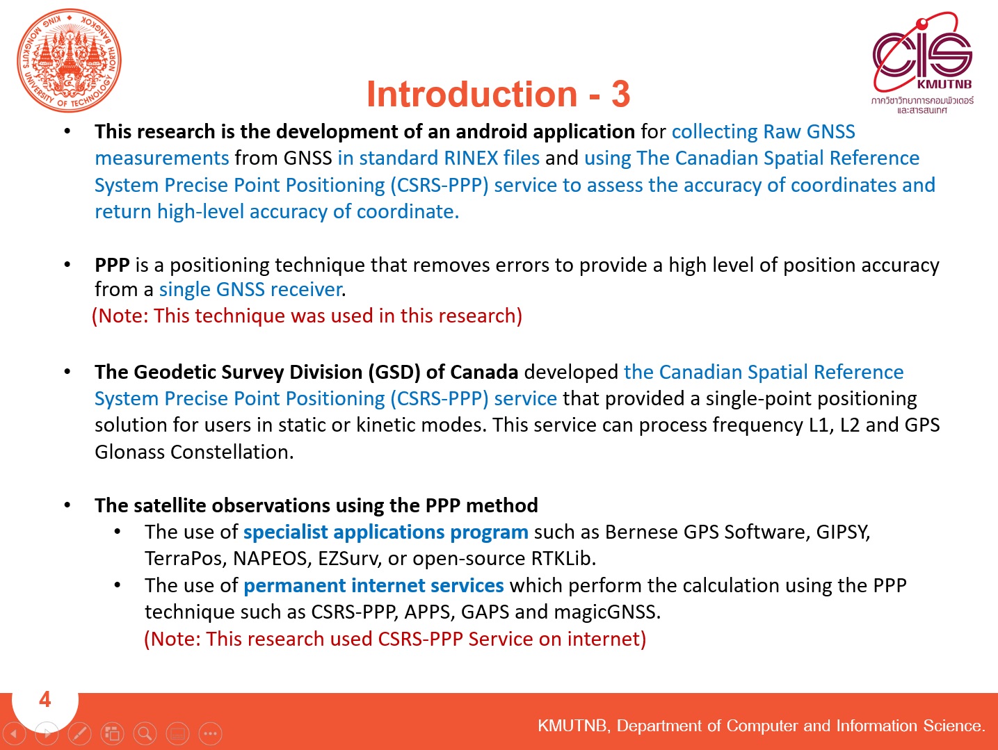 |
This research is the development of an android application in order to collect raw GNSS measurements from the GNSS in standard RINEX files and using CSRS-PPP Web service to assess the accuracy of coordinates.
PPP is a positioning technique of this research that removes errors in order to provide a high level of position accuracy from a single GNSS receiver.
CSRS-PPP Web service can process frequency L1, L2 and can process GPS and Glonass satellite Constellation.
Generally, The satellite observations using the PPP method has two methods.
That is the use of specialist application programs and permanent internet services.
In this research, we used the permanent internet services of CSRS-PPP.
|
| ICACT20210158 Slide.06
[Big Slide]
|
Chrome Click!! |
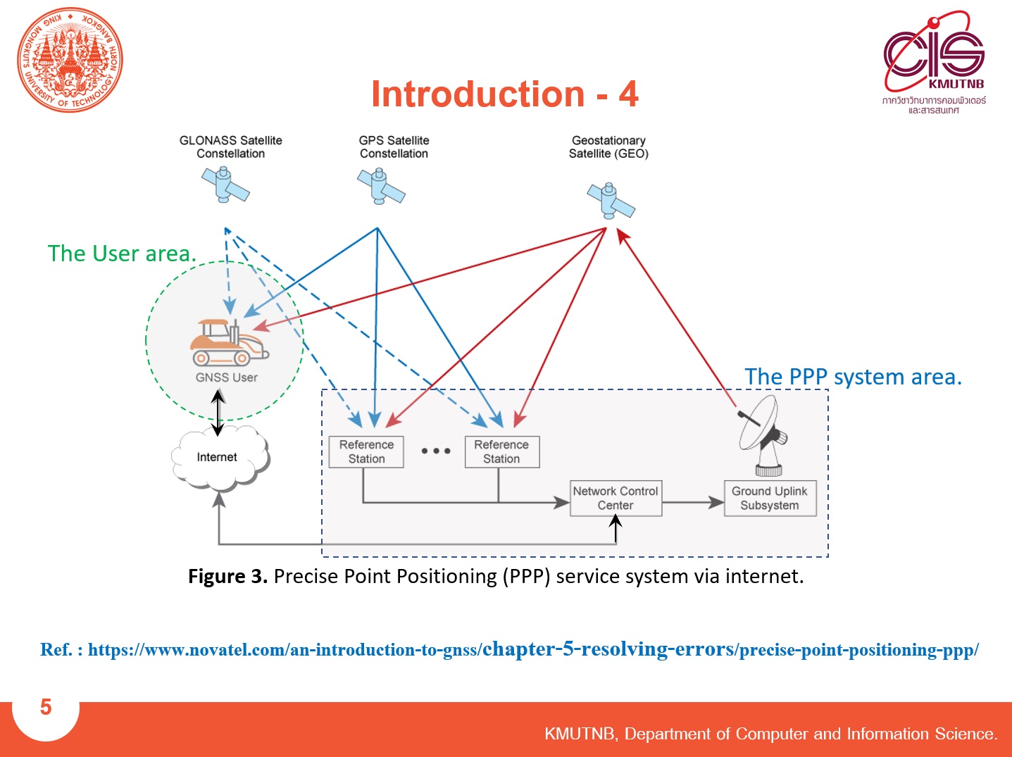 |
This is a PPP service system.
It was divided into 2 areas. That is the PPP system area and the user area.
We will focus on the user area.
|
| ICACT20210158 Slide.07
[Big Slide]
|
Chrome Click!! |
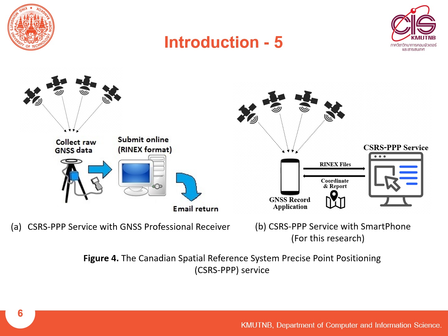 |
Generally, we use the GNSS Professional Receiver in order to record GNSS Raw Measurement from the satellite.
But our research will use the SmartPhone to record GNSS Raw measurement.
|
| ICACT20210158 Slide.08
[Big Slide]
|
Chrome Click!! |
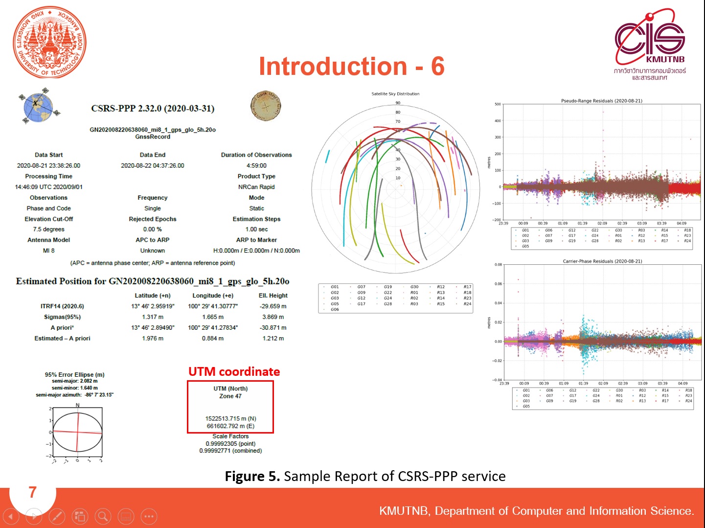 |
This is a sample report from the CSRS-PPP service by email.
|
| ICACT20210158 Slide.09
[Big Slide]
|
Chrome Click!! |
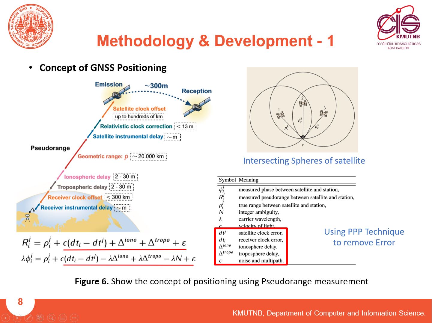 |
For the development, we use the concept of GNSS Positioning.
|
| ICACT20210158 Slide.10
[Big Slide]
|
Chrome Click!! |
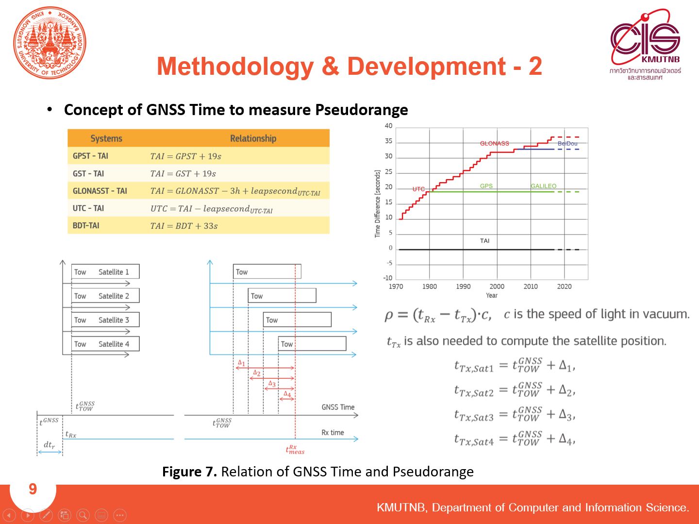 |
The difference GNSS Time.
|
| ICACT20210158 Slide.11
[Big Slide]
|
Chrome Click!! |
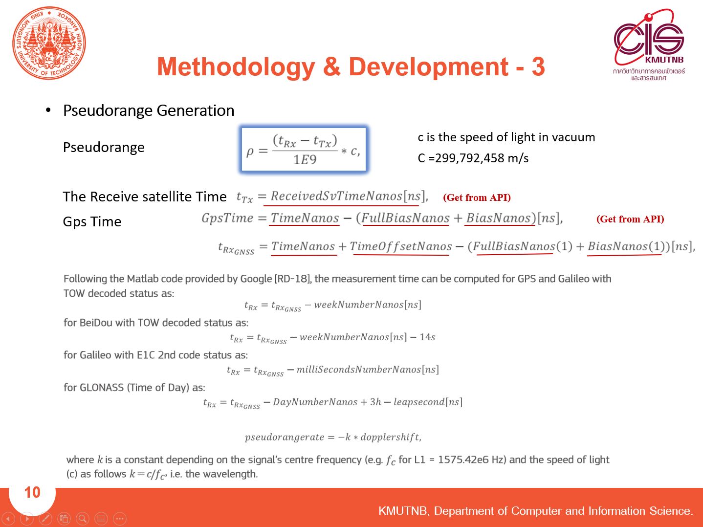 |
And Basic equations to calculate Pseudorange.
|
| ICACT20210158 Slide.12
[Big Slide]
|
Chrome Click!! |
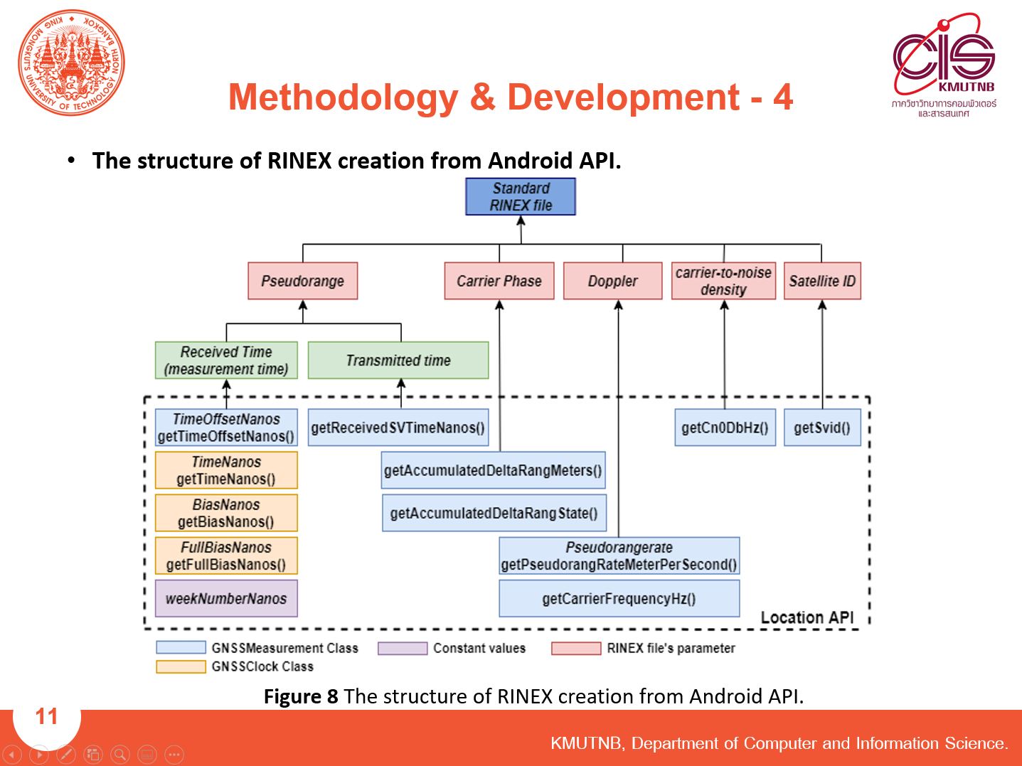 |
From what I said, we can find Pseudorang, Carrier Phase, Doppler, Carrier-to-noise density for creating RINEX file.
And We also rewrite the API function as the breakdown structure for easy to understand.
|
| ICACT20210158 Slide.13
[Big Slide]
|
Chrome Click!! |
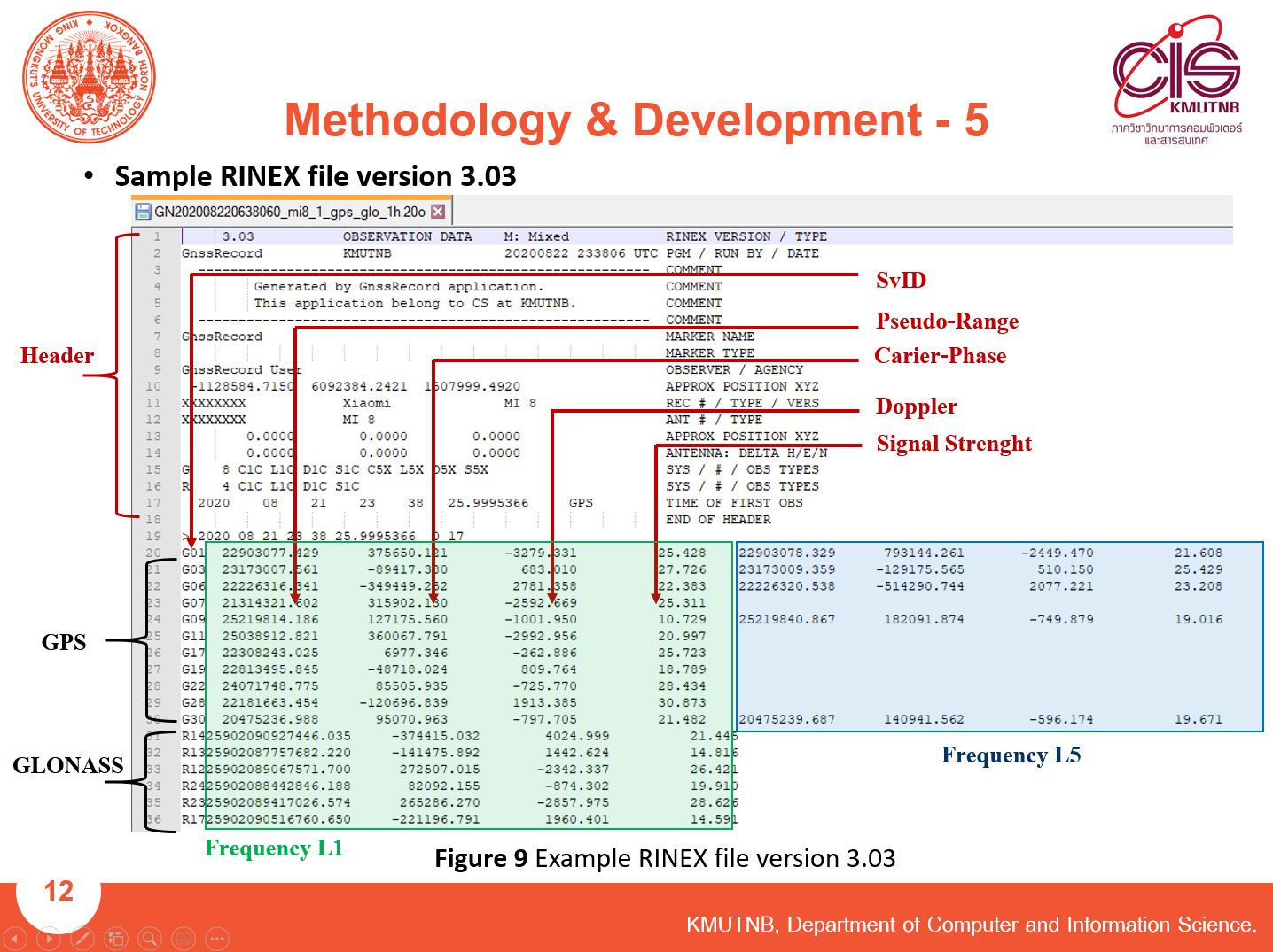 |
This is a RINEX file created by GNSS Record Application.
|
| ICACT20210158 Slide.14
[Big Slide]
|
Chrome Click!! |
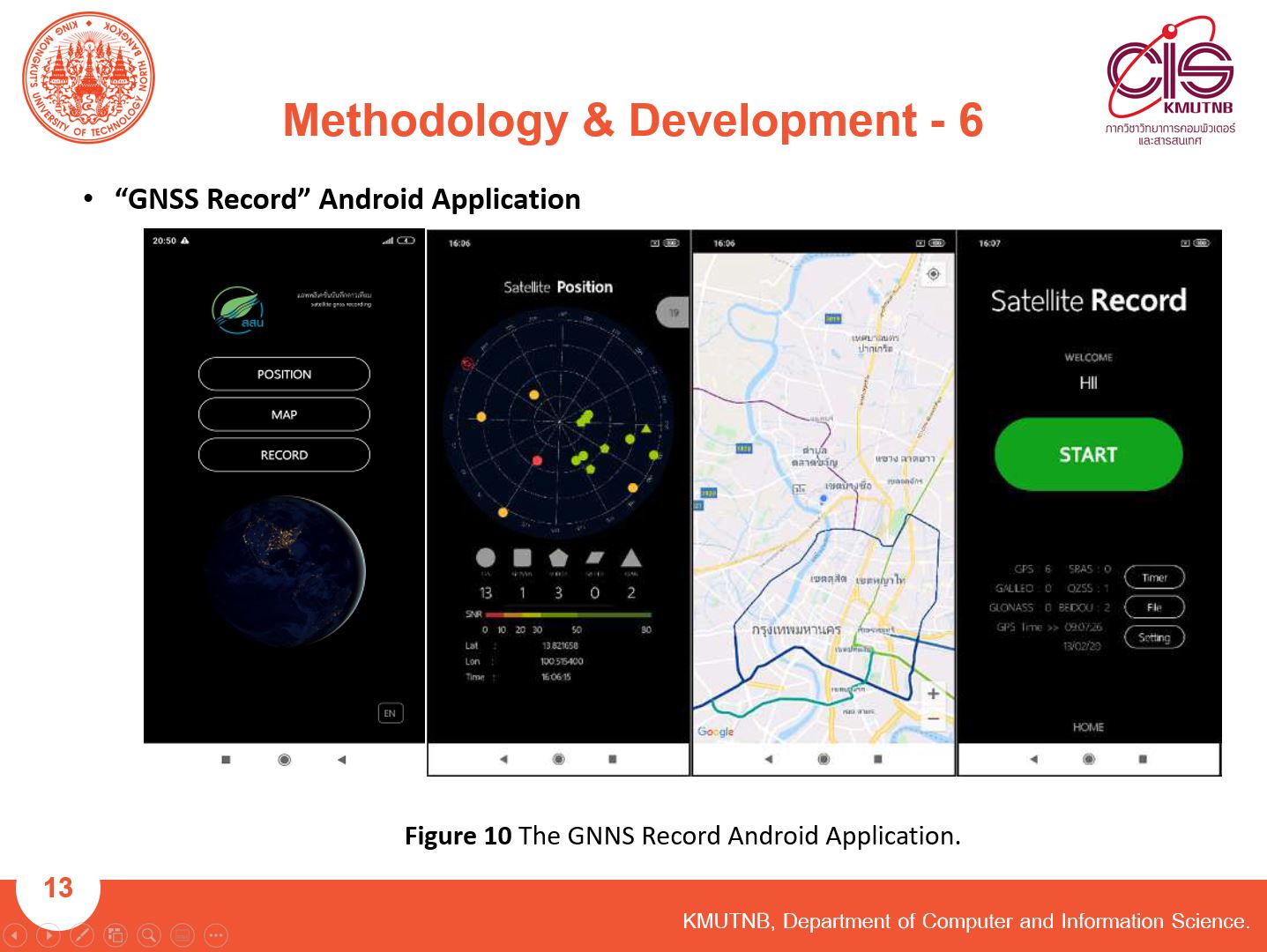 |
The GNNS Record Application that we have developed has 3 features.:
Page 1 To view the current satellite
Page 2 To show the current location on the map
Page 3 To record the satellite data to a RINEX file.
|
| ICACT20210158 Slide.15
[Big Slide]
|
Chrome Click!! |
 |
For the Experiment
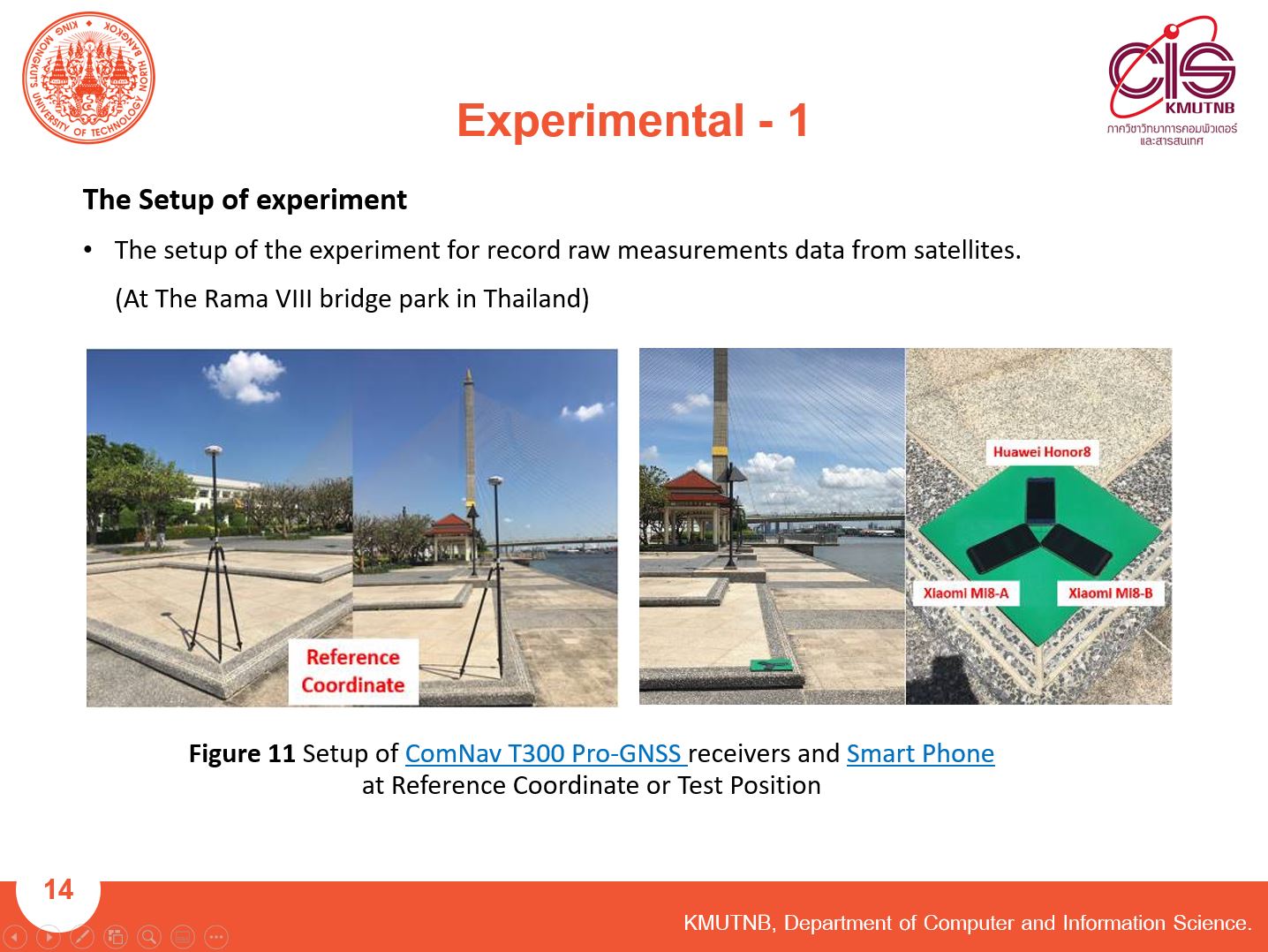
We performed an experiment one point at The Rama 8 bridge park in Bangkok, Thailand.
We used the ComNav T300 that is a Professional GNSS receiver to find the accurate reference coordinate using the RTK technique.
We used Two dual-frequency smartphones Xiaomi Mi8 and a single-frequency smartphone Huawei Honor 8.
The different observation conditions consist of GPS-only observation and GPS + GLONASS observation.
|
| ICACT20210158 Slide.16
[Big Slide]
|
Chrome Click!! |
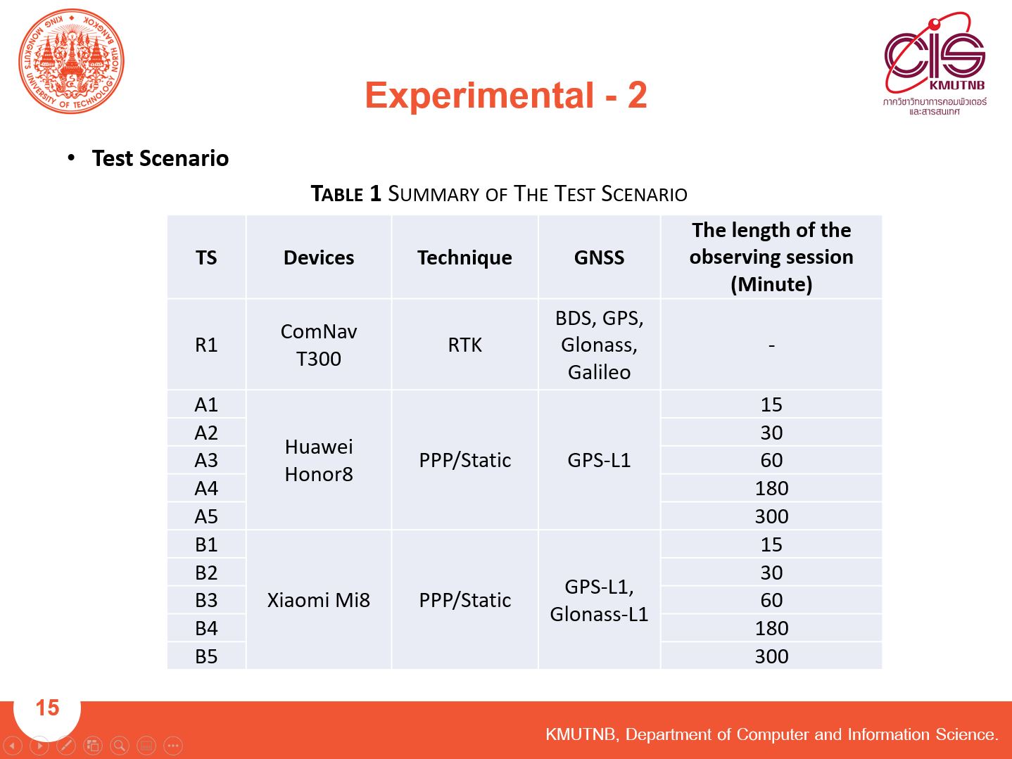 |
We wrote a summary of the test scenario to easily understand it.
Besides we use the different observation conditions, the Difference of The observation length was used in the experiment.
We use a minimum observation length of 15 minutes. the maximum of 5 hours.
|
| ICACT20210158 Slide.17
[Big Slide]
|
Chrome Click!! |
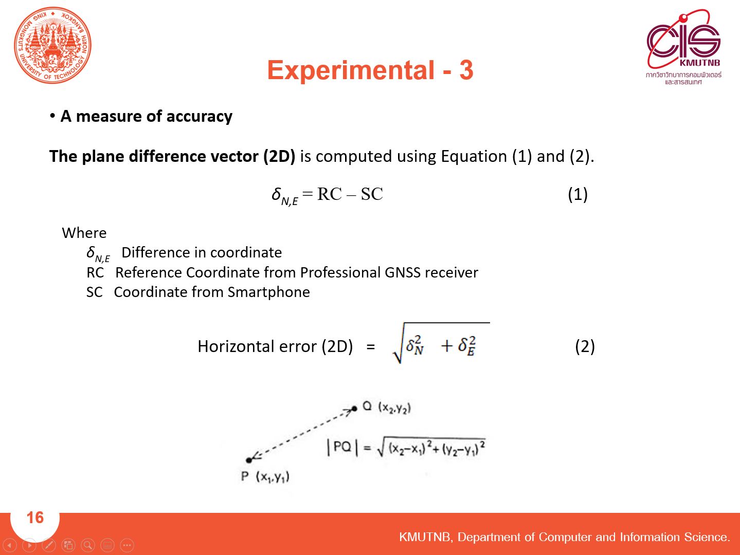 |
For the measure of accuracy, We use the plane difference vector to measure the distance of the different coordinates.
|
| ICACT20210158 Slide.18
[Big Slide]
|
Chrome Click!! |
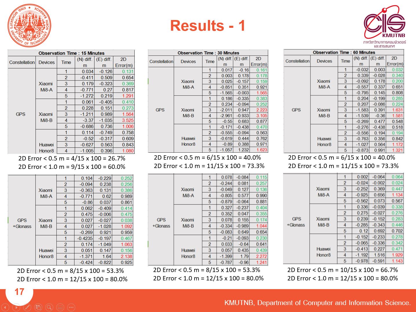 |
When we use the Smartphone record RAW measurement follows the test scenario and use a measure of the accuracy equation, we will obtain these results.
|
| ICACT20210158 Slide.19
[Big Slide]
|
Chrome Click!! |
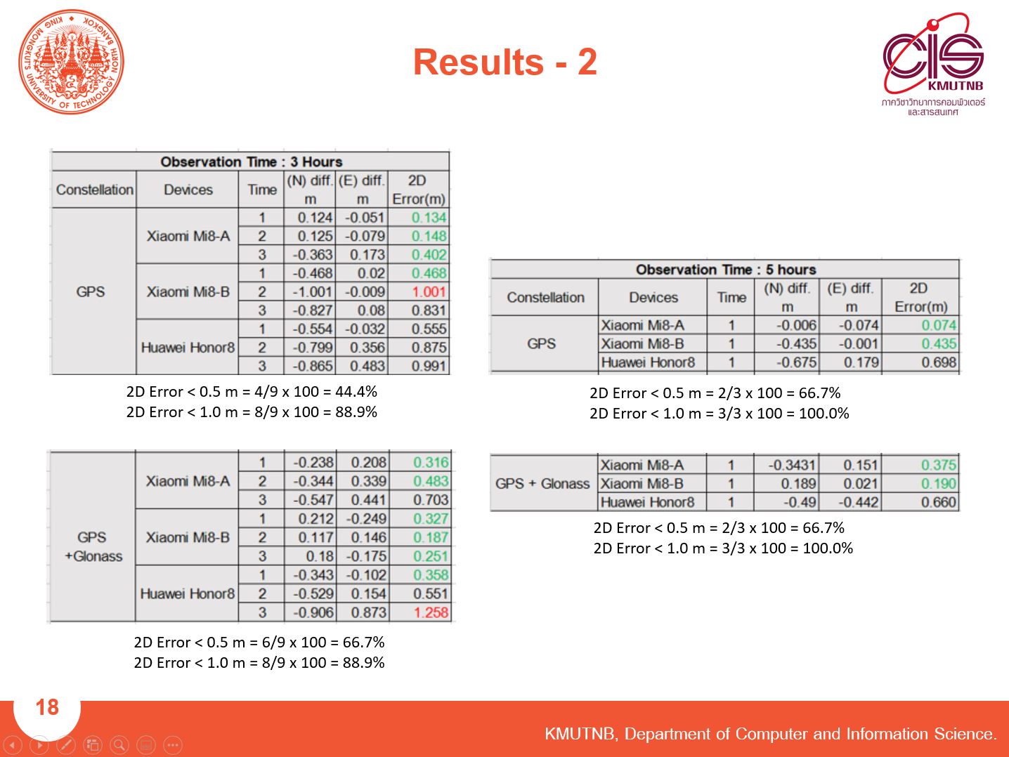 |
We count the number of 2D Errors less than 1 meter and 50cm compared with a total number of experimental.
|
| ICACT20210158 Slide.20
[Big Slide]
|
Chrome Click!! |
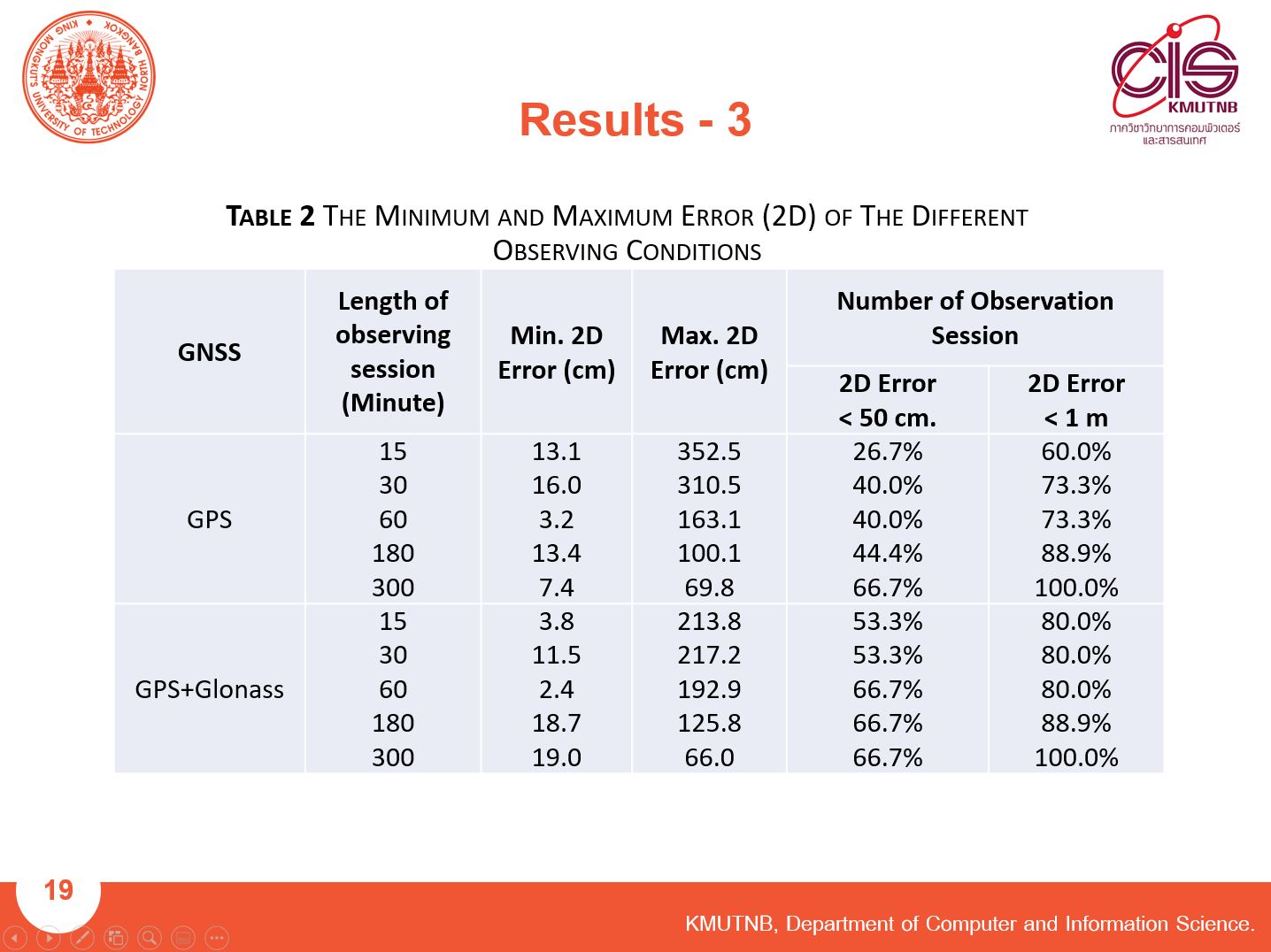 |
The experimental results showed that the length of the observing sessions significantly affects the position determination accuracy.
The accuracy of the coordinate with a longer observing session can provide more accuracy of the coordinate.
The result of the 60-minute GPS+GLONASS observation period can be an archived 2D error at 2.4 cm.
|
| ICACT20210158 Slide.21
[Big Slide]
|
Chrome Click!! |
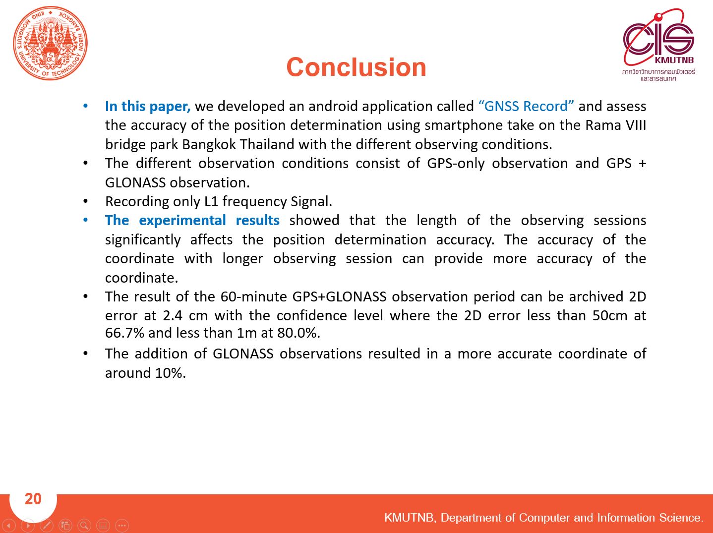 |
In this paper, we developed “GNSS Record” Application and conducted an experiment with the different observing conditions.
The different observation conditions consist of only GPS observation and GPS + GLONASS observation.
Recording only L1 frequency Signal.
The experimental results showed that the length of the observing sessions significantly affects the position determination accuracy.
The accuracy of the coordinate with a longer observing session can provide more accuracy of the coordinate.
The result of the 60-minute GPS+GLONASS observation period can be an archived 2D error at 2.4 cm.
The addition of GLONASS observations resulted in a more accurate coordinate of around 10%.
|
| ICACT20210158 Slide.22
[Big Slide]
|
Chrome Click!! |
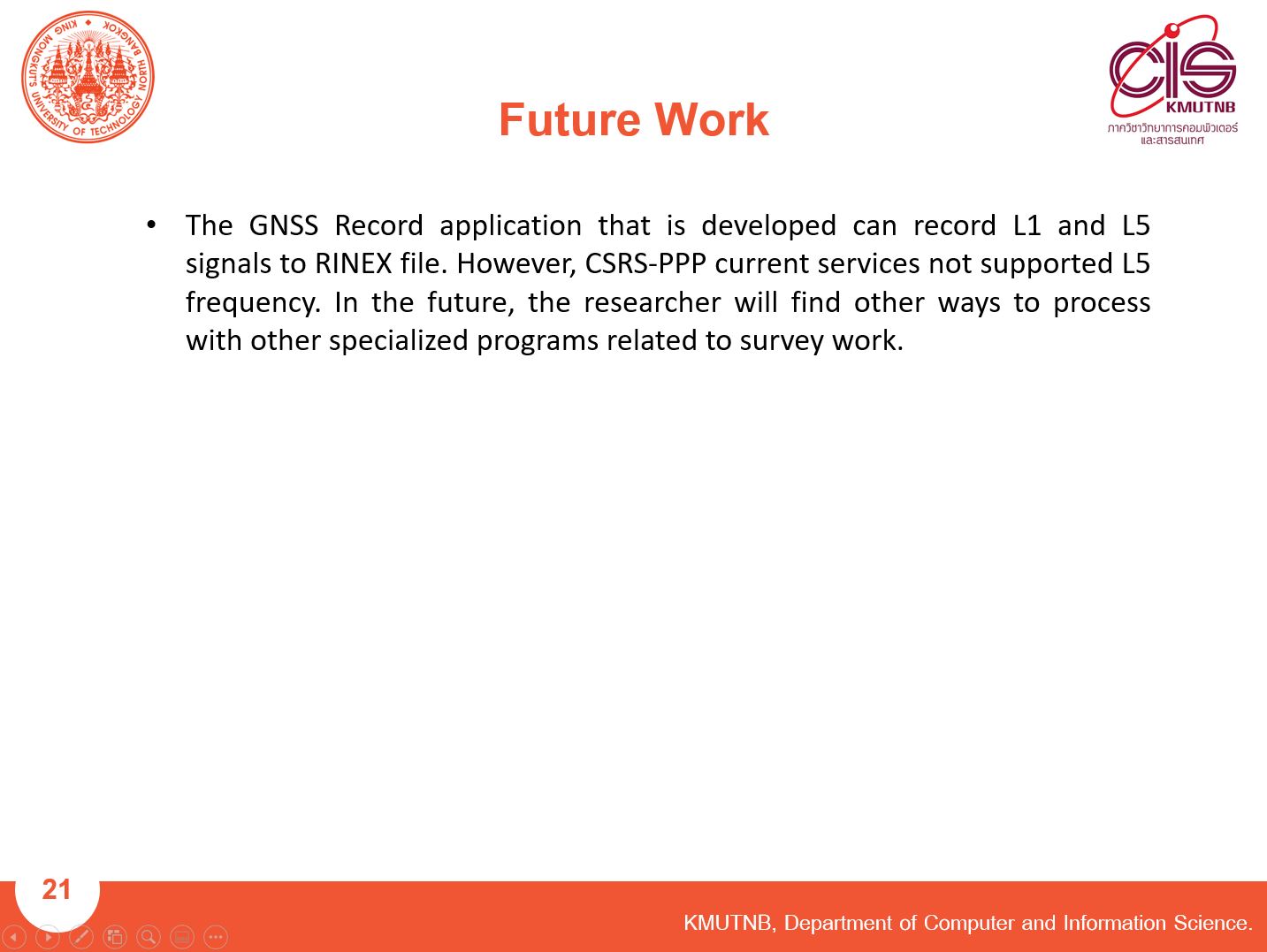 |
The GNSS Record application that is developed can record L1 and L5 signals to the RINEX file. However, CSRS-PPP's current services not supported L5 frequency. In the future, the researcher will find other ways to process with other specialized programs related to survey work.
|
| ICACT20210158 Slide.23
[Big Slide]
|
Chrome Click!! |
 |
Thank you for your attention. Do you have any questions?
|
| ICACT20210158 Slide.24
[Big Slide]
|
Chrome Click!! |
 |
end
|
| ICACT20210158 Slide.25
[Big Slide]
|
Chrome Click!! |
 |
end
|
| ICACT20210158 Slide.26
[Big Slide]
|
Chrome Click!! |
 |
end
|
| ICACT20210158 Slide.27
[Big Slide]
|
Chrome Click!! |
 |
end
|