ICACT20220398 Slide.01
[Big Slide] |
Chrome  Click!! |
 |
Hello. My name’s Bumho Kim. I am a senior researcher at ETRI.
Today I’m going to be talking about a study on the A Framework of Large-Scale Virtual City Simulation with Land-Use Model. �
|
| ICACT20220398 Slide.02
[Big Slide]
|
Chrome Click!! |
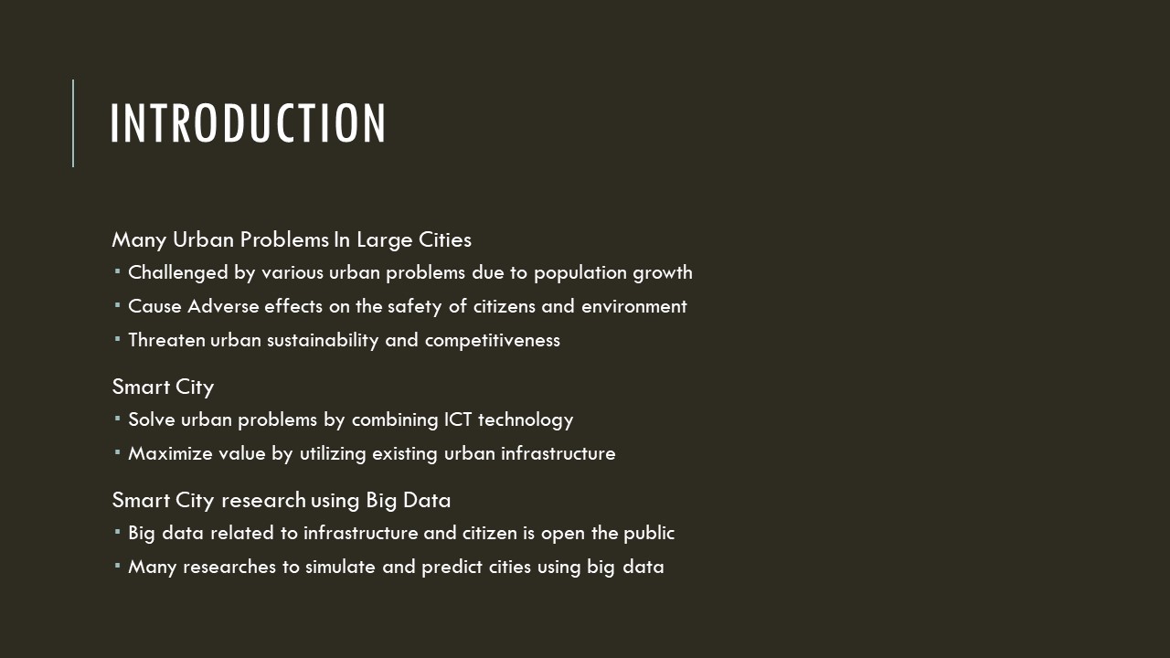 |
Most large cities are challenged by various urban problems such as housing problems, traffic congestion, lack of parking spaces due to population growth.
These problems cause adverse effects on the safety of citizens and environment, and threaten urban sustainability and competitiveness.
In order to solve these problems, many cities are trying to create Smart City.
Smart city is defined as a platform for leveraging technologies such as ICT and big data to improve the quality of life for citizens, the sustainability and the competitiveness of the city.
As the smart city service progresses, there are many researches to simulate and predict cities using big data which is open to the public.
|
| ICACT20220398 Slide.03
[Big Slide]
|
Chrome Click!! |
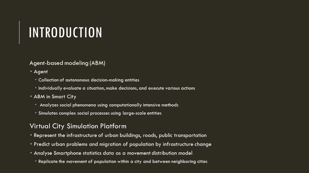 |
Among these researches, agent-based modeling is a simulation modeling technique that exploited to simulate cities and calculate urban changes.
Agent-based modeling systems are modeled as a collection of autonomous decision-making entities called agents, and each agent can make decisions and execute actions individually.
Agent-based modeling and simulation of urban society analyzes social phenomena and simulates complex social processes employing large-scale entities.
In this paper, we propose urban simulation platform to represent the infrastructure of urban buildings, roads, public transportation and to predict changes of the city.
The proposed virtual city simulation platforms can estimate population migration and various urban problems that can occur due to changes in infrastructure.
|
| ICACT20220398 Slide.04
[Big Slide]
|
Chrome Click!! |
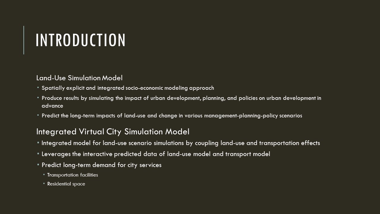 |
In this paper, we propose virtual city simulation model is an integrated model for land-use scenario simulations by coupling land-use and transportation effects.
A land-use simulation model is a spatially explicit and integrated socio-economic modeling approach that aims to predict the long-term impacts of land-use and change in various management-planning-policy scenarios.
An integrated virtual city model that leverages the interactive predicted data of land-use model and transport model can predict long-term demand for city services such as transportation facilities and residential space.
|
| ICACT20220398 Slide.05
[Big Slide]
|
Chrome Click!! |
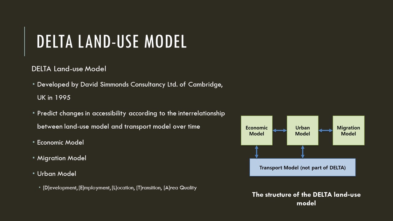 |
DELTA is a land-use model developed by David Simmonds Consultancy Ltd. of Cambridge, UK in 1995.
It aims to predict changes in accessibility according to the interrelationship between land-use model and transport model over time.
After being first applied to Edinburgh, Scotland, it is one of the representative integrated land-use models that have been used in many cities.
As shown in Figure, DELTA consists of a transport model, an economic model, an urban model, and a migration model.
The transport models are not included in Delta, but are usually linked to specialized modeling packages.
. The name DELTA was created as an acronym for these five sub-models of urban model.
|
| ICACT20220398 Slide.06
[Big Slide]
|
Chrome Click!! |
 |
I will explain the details of virtual city simulation platform.
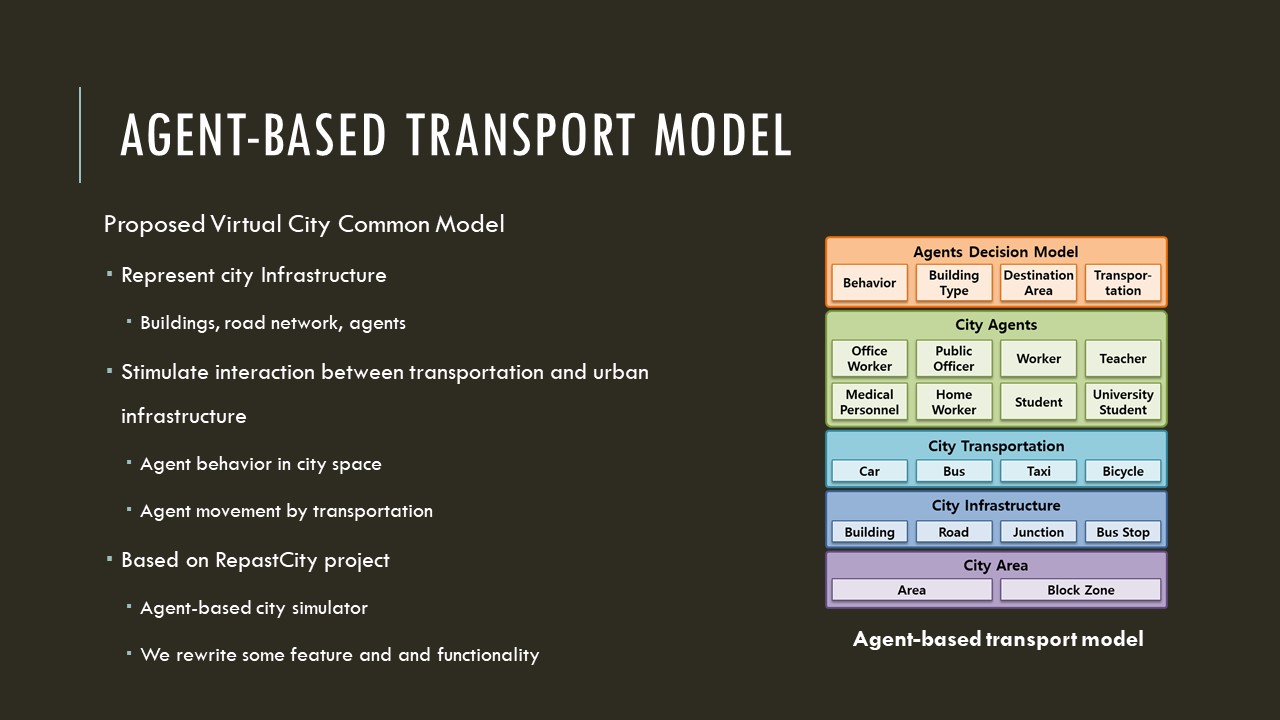
We design the virtual city common model to represent the city's diverse infrastructure such as buildings, road network, and agents.
To implement the virtual city common model, we use RepastCity project which is an agent-based simulator built on the Repast Simphony.
We rewrite some of the features and add more functionality to original project.
The Proposed virtual city common model aims to stimulate the interaction between the transportation and the urban infrastructure.
|
| ICACT20220398 Slide.07
[Big Slide]
|
Chrome Click!! |
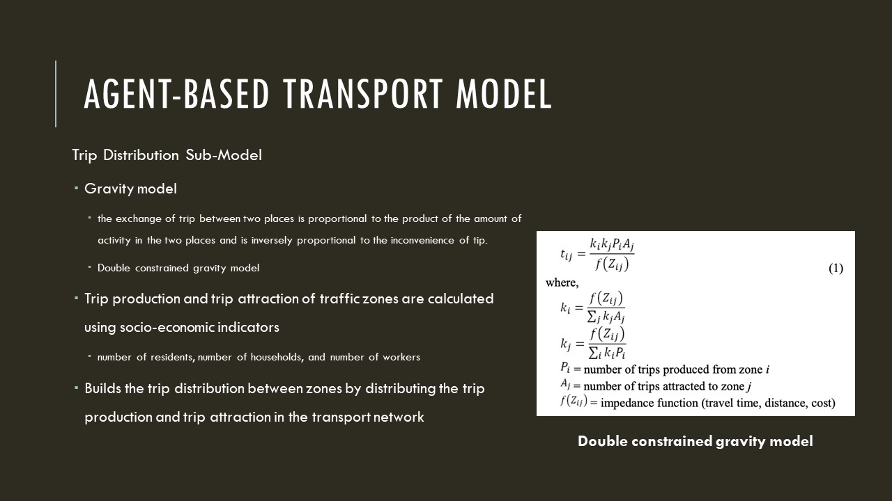 |
The destination of the agent is determined by the gravity model in the trip distribution sub-model.
The gravity model is a concept that the exchange of trip between two places is proportional to the product of the amount of activity in the two places and is inversely proportional to the inconvenience of tip.
In this paper, we use the double constrained gravity model, in which the distribution of movement for each zone is calculated by the equation shown in figure.
Trip production and trip attraction of traffic zones are calculated using socio-economic indicators such as the number of residents, number of households, and number of workers.
The trip distribution sub-model builds the trip distribution between zones by distributing the trip production and trip attraction in the transport network.
Once the agent's destination is determined, the transportation decision sub-model determines the mode of transport by considering distance, presence or absence of transport, and route.
|
| ICACT20220398 Slide.08
[Big Slide]
|
Chrome Click!! |
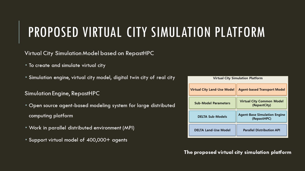 |
This slide outlines the proposed virtual city simulation platform.
To create and simulate a virtual city, we design a virtual city simulation platform which is consisting of a simulation engine, a virtual city model, and a digital twin city of the real city.
To support more than 400,000 metropolitan cities, we use the RepastHPC simulator.
Repast for High Performance Computing is an open source agent-based modeling system for large distributed computing platforms.
It implements the basic Repast Simphony concept to work in a parallel distributed environment.
|
| ICACT20220398 Slide.09
[Big Slide]
|
Chrome Click!! |
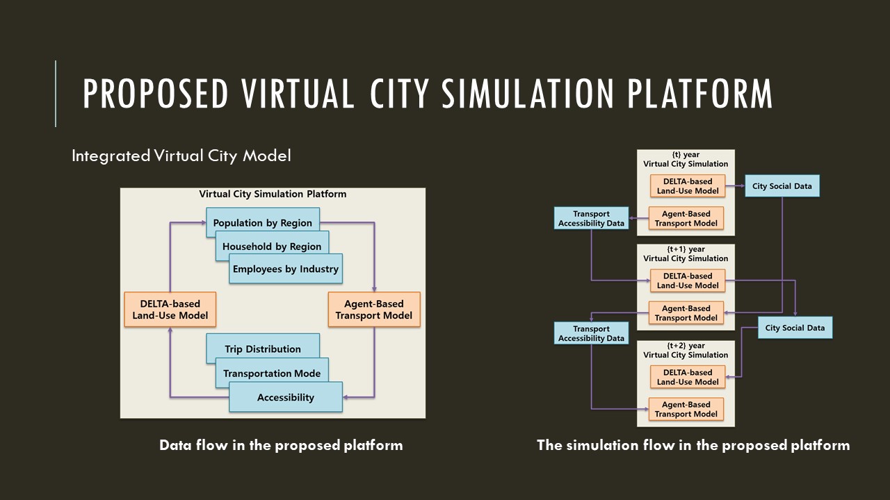 |
The integrated city model is driven by linking the land-use model and the transport model to simulate the circular relationship implemented with the flow of data.
The most basic relationship between subsystems in the integrated city model is the circular relationship between land-use and transport.
Through this relationship, the integrated model allows the agent to consider location attractiveness, location cost, travel cost, and accessibility together, and selects the location of residence and the destination of behavior.
In particular, the integrated model enables prediction of future urban spatial structure changes by simulating the process of continuously changing land-use patterns and movement patterns by repeatedly influencing the spatial distribution of new activities and the spatial distribution of accessibility.
|
| ICACT20220398 Slide.10
[Big Slide]
|
Chrome Click!! |
 |
In this paper, we implement Sejong City as a virtual city on a proposed virtual city simulation platform.
Sejong City is an administrative city with a population of about 350,000
Sejong city is a planned city created in 2012 and is a rapidly changing city that grows at an annual population growth rate of over 10 percentage.
In order to build a virtual city of Sejong City, we use public data and administrative data such as building information, road network, traffic network, and citizen data.
|
| ICACT20220398 Slide.11
[Big Slide]
|
Chrome Click!! |
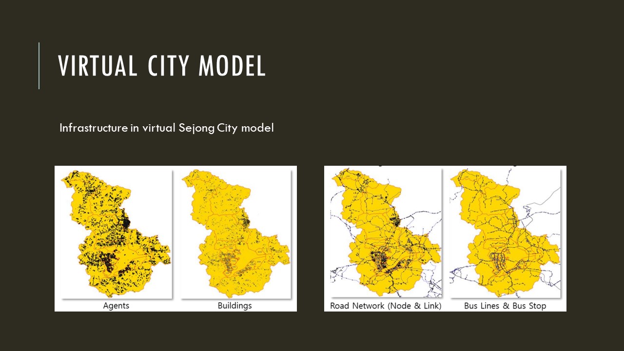 |
In order to build a virtual Sejong City, we use public data and administrative data such as building information, road network, traffic network, and citizen data.
This slide shows the constructed virtual Sejong infrastructure data on the map.
|
| ICACT20220398 Slide.12
[Big Slide]
|
Chrome Click!! |
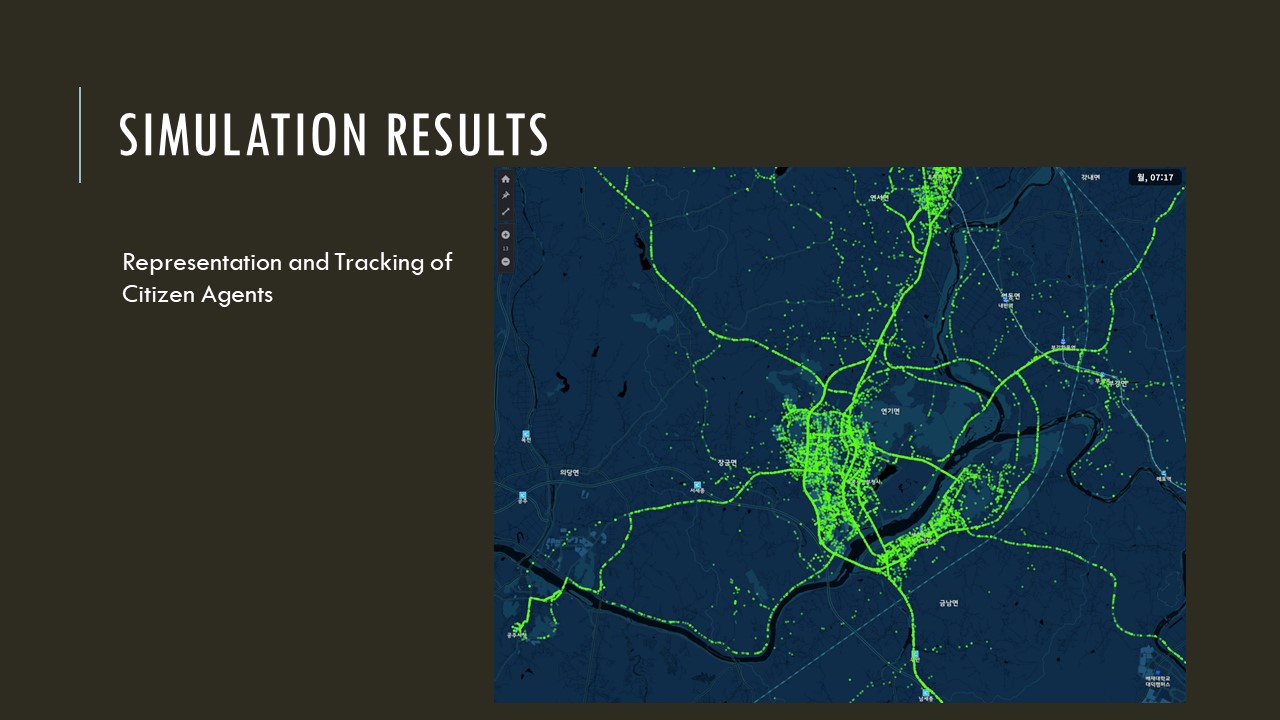 |
This figure shows the movement of agents collected as a simulation results.
Green dot indicates each citizen who is moving to destination.
|
| ICACT20220398 Slide.13
[Big Slide]
|
Chrome Click!! |
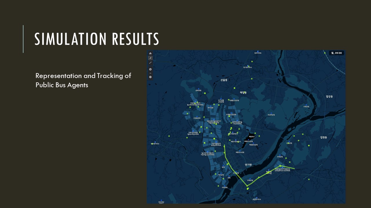 |
This slide shows the movement of public buss collected as a results of the simulation.
Green dot represents a bus moving along its own route.
|
| ICACT20220398 Slide.14
[Big Slide]
|
Chrome Click!! |
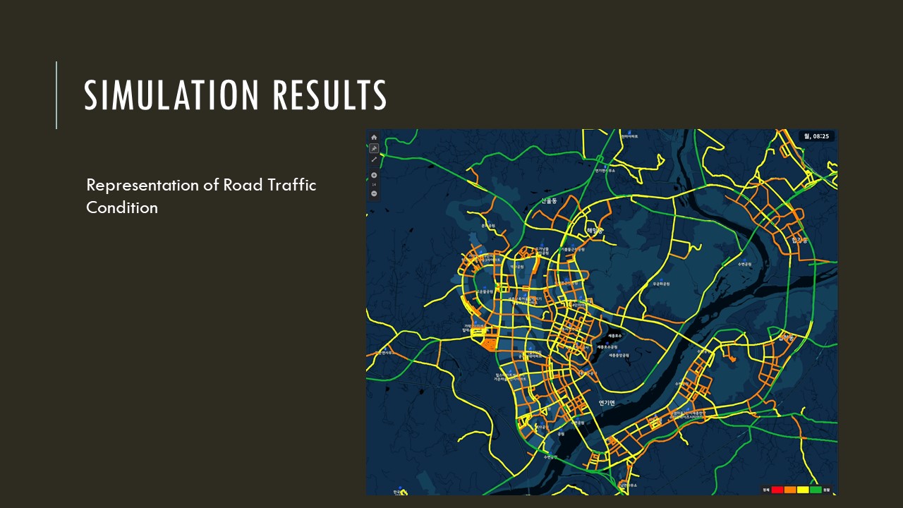 |
This slide show the representation of road traffic condition in Sejong City.
The red lines indicate that there are many vehicles on the road.
The green lines show that there are few vehicles on the road.
|
| ICACT20220398 Slide.15
[Big Slide]
|
Chrome Click!! |
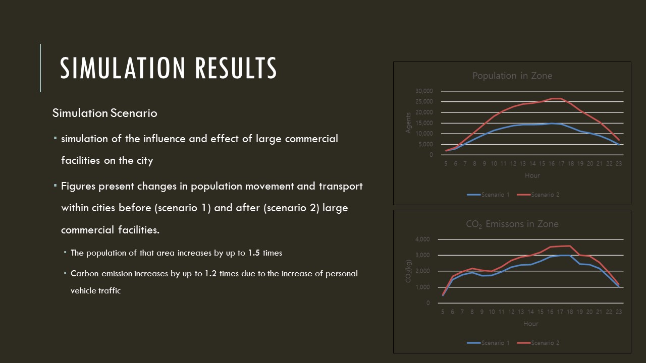 |
we performed a simulation of the influence and effect of large commercial facilities on the city.
The figures present changes in population movement and transport within cities before (scenario 1) and after (scenario 2) large commercial facilities.
The simulation results showed that when large commercial facilities are located in a specific area, the population of that area increases by up to 1.5 times, and carbon emission increases by up to 1.2 times due to the increase of personal vehicle traffic.
|
| ICACT20220398 Slide.16
[Big Slide]
|
Chrome Click!! |
 |
Now I’d like to sum up my presentation with following points.
Using digital twins that replicate the physical city to create a virtual city, we can simulate urban planning before implementation.
In this paper, we created a virtual city model that can simulate the movement of people and predict urban change and population movement.
In particular, we proposed an integrated virtual city model that utilizes the prediction data of the land-use model and the agent-based transport model to predict long-term changes in urban space and population movement.
The integrated model is judged to be useful for the purpose of supporting efficient decision-making of urban and transportation policies to seek desirable urban development.
The integrated virtual city model can be exploited for the purpose of supporting efficient decision-making of urban and transport policies to seek desirable urban development.
As a future work, we plan to validate the simulation results of urban future policy scenarios.
|
| ICACT20220398 Slide.17
[Big Slide]
|
Chrome Click!! |
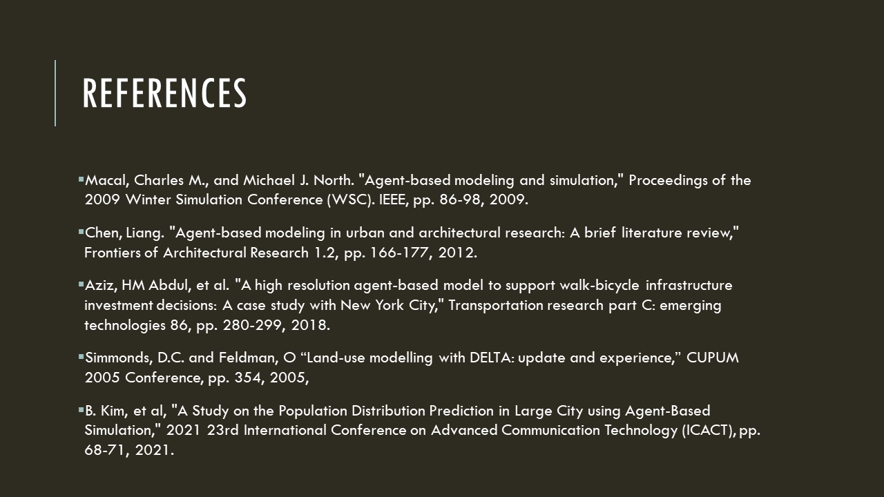 |
This last slide shows the reference papers.
Thank you very much.
|