ICACT20240333 Slide.00
[Big Slide] |
Chrome  Click!! |
 |
Title |
| ICACT20240333 Slide.01
[Big Slide]
|
Chrome Click!! |
 |
Table of contents is Introduction, related work, proposal method, simulation and conclusion. |
| ICACT20240333 Slide.02
[Big Slide]
|
Chrome Click!! |
 |
GPS is absolute coordinates providing altitude and longitude.
But this data has challenge of indoor GPS coordinate measurement �due to indoor signal strength issues.
IMU is sensor that combines accelerometers, gyroscopes and magnetometers.
This ensure high sampling rates and resolution and measure of relative coordinates instead of absolute coordinate.
|
| ICACT20240333 Slide.03
[Big Slide]
|
Chrome Click!! |
 |
ICP algorithm is used to align one point with another point scanned from a different viewpoint.
Proceeding through iterations of optimization and refinement until convergence criteria are met.
Initiating the initial estimate of the transformation (translation and rotation).
Finding corresponding points between datasets.
Transforming to minimize the squared differences between corresponding points.
|
| ICACT20240333 Slide.04
[Big Slide]
|
Chrome Click!! |
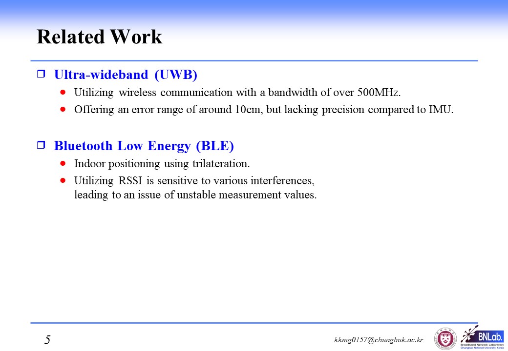 |
Ultra-wideband (UWB)is utilizing wireless communication with a bandwidth of over 500MHz.
They offer an error range of around 10cm, but lacking precision compared to IMU.
Bluetooth Low Energy (BLE)is used Indoor positioning using trilateration.
Utilizing RSSI is sensitive to various interferences, �leading to an issue of unstable measurement values.
|
| ICACT20240333 Slide.05
[Big Slide]
|
Chrome Click!! |
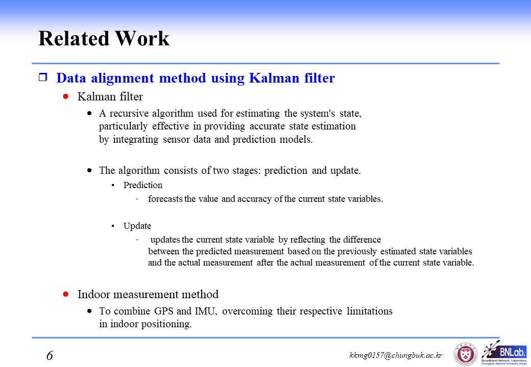 |
I tell you about Data alignment method using Kalman filter.
Kalman filter is a recursive algorithm used for estimating the system's state, particularly effective in providing accurate state estimation by integrating sensor data and prediction models.
The algorithm consists of two stages: prediction and update.
Prediction stage forecasts the value and accuracy of the current state variables.
Update stage updates the current state variable by reflecting the difference between the predicted measurement based on the previously estimated state variables and the actual measurement after the actual measurement of the current state variable.
To combine GPS and IMU, overcoming their respective limitations in indoor positioning.
|
| ICACT20240333 Slide.06
[Big Slide]
|
Chrome Click!! |
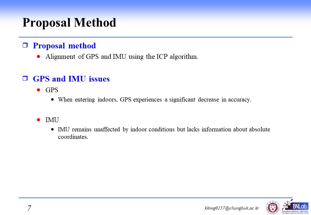 |
We propose method that alignment of GPS and IMU using the ICP algorithm.
When entering indoors, GPS experiences a significant decrease in accuracy.
IMU remains unaffected by indoor conditions but lacks information about absolute coordinates.
|
| ICACT20240333 Slide.07
[Big Slide]
|
Chrome Click!! |
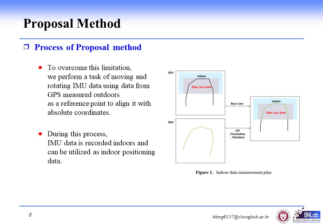 |
To overcome this limitation, we perform a task of moving and rotating IMU data using data from GPS measured outdoors as a reference point to align it with absolute coordinates.
During this process, IMU data is recorded indoors and can be utilized as indoor positioning data.
|
| ICACT20240333 Slide.08
[Big Slide]
|
Chrome Click!! |
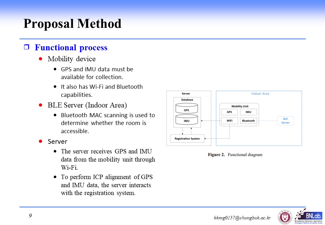 |
Next, I tell you functional process in our method.
First, Mobility device must be available for GPS and IMU data collection.
It also has Wi-Fi and Bluetooth capabilities.
Second, BLE Server (Indoor Area).
Bluetooth MAC scanning is used to determine whether the room is accessible.
And last one is Server.
The server receives GPS and IMU data from the mobility unit through Wi-Fi.
To perform ICP alignment of GPS and IMU data, the server interacts with the registration system.
|
| ICACT20240333 Slide.09
[Big Slide]
|
Chrome Click!! |
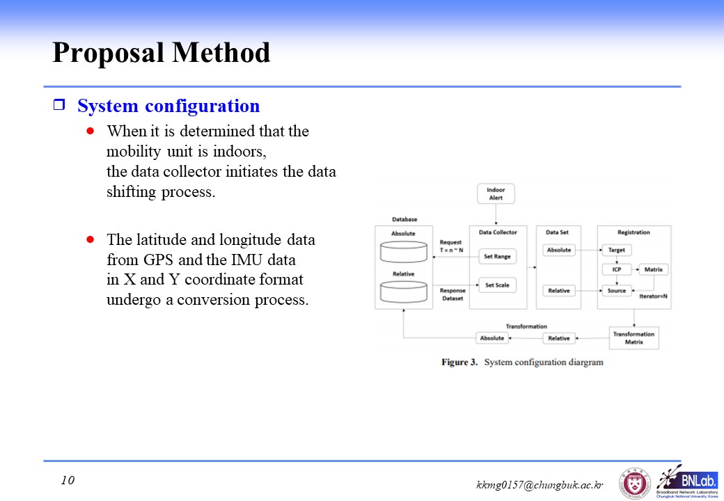 |
Figure 3 is System configuration.
When it is determined that the mobility unit is indoors, �the data collector initiates the data shifting process.
The latitude and longitude data from GPS and the IMU data �in X and Y coordinate format undergo a conversion process.
|
| ICACT20240333 Slide.10
[Big Slide]
|
Chrome Click!! |
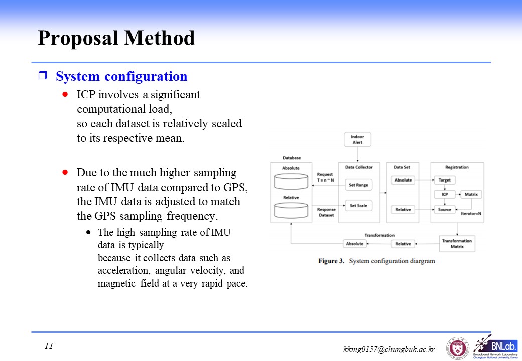 |
ICP involves a significant computational load, so each dataset is relatively scaled to its respective mean.
Due to the much higher sampling rate of IMU data compared to GPS, the IMU data is adjusted to match the GPS sampling frequency.
The high sampling rate of IMU data is typically because it collects data such as acceleration, angular velocity, and magnetic field at a very rapid pace.
|
| ICACT20240333 Slide.11
[Big Slide]
|
Chrome Click!! |
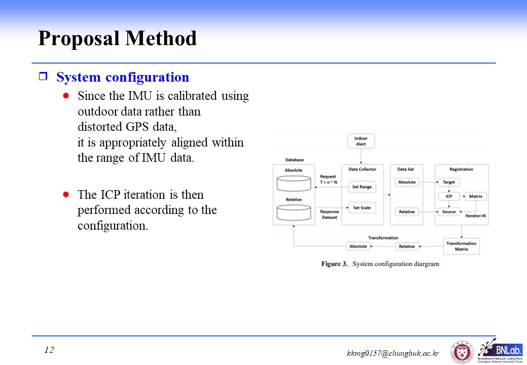 |
Since the IMU is calibrated using outdoor data rather than distorted GPS data, it is appropriately aligned within the range of IMU data.
The ICP iteration is then performed according to the configuration.
|
| ICACT20240333 Slide.12
[Big Slide]
|
Chrome Click!! |
 |
Our simulation used GPS and IMU data.
GPS is a total of 1294 localization data set for SLAM provided by ETH Zurich.
And IMU data was randomly generated based on GPS data.Also, the number is the same
|
| ICACT20240333 Slide.13
[Big Slide]
|
Chrome Click!! |
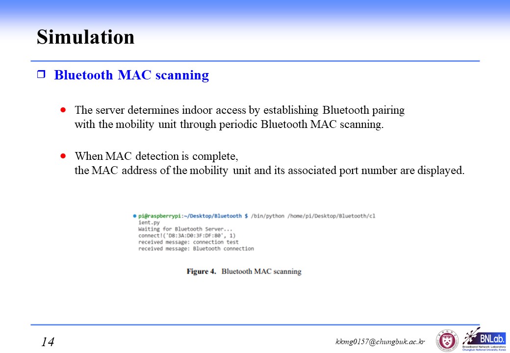 |
The server determines indoor access by establishing Bluetooth pairing with the mobility unit through periodic Bluetooth MAC scanning.
When MAC detection is complete, the MAC address of the mobility unit and its associated port number are displayed.
|
| ICACT20240333 Slide.14
[Big Slide]
|
Chrome Click!! |
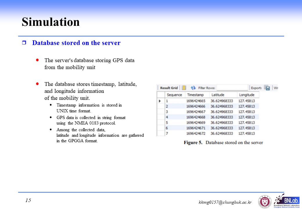 |
The server's database storing GPS data from the mobility unit.
The database stores timestamp, latitude, and longitude information of the mobility unit.
Timestamp information is stored in UNIX time format.
GPS data is collected in string format using the NMEA 0183 protocol.
Among the collected data, latitude and longitude information are gathered in the GPGGA format.
|
| ICACT20240333 Slide.15
[Big Slide]
|
Chrome Click!! |
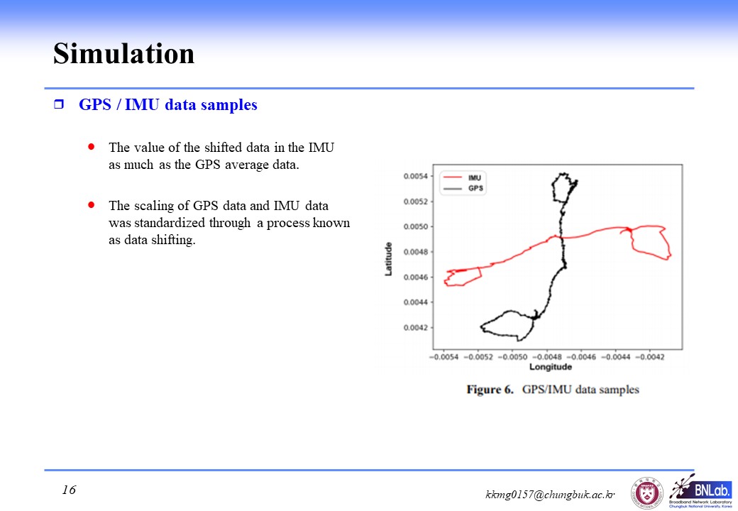 |
The value of the shifted data in the IMU as much as the GPS average data.
The scaling of GPS data and IMU data was standardized through a process known as data shifting.
|
| ICACT20240333 Slide.16
[Big Slide]
|
Chrome Click!! |
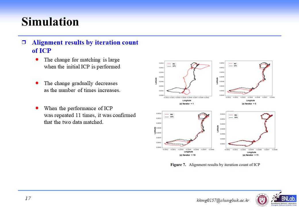 |
The change for matching is large when the initial ICP is performed
The change gradually decreases as the number of times increases.
When the performance of ICP was repeated 11 times, it was confirmed that the two data matched.
|
| ICACT20240333 Slide.17
[Big Slide]
|
Chrome Click!! |
 |
We proposed a method for aligning GPS and IMU data to measure indoor positioning.
After going through several data preprocessing steps, GPS and IMU data alignment were achieved through iterative execution of ICP.
Simulation results confirmed the successful alignment of data from both GPS and IMU data.
|
| ICACT20240333 Slide.18
[Big Slide]
|
Chrome Click!! |
 |
We have more challenge, so we plan further research.
IMU has the issue of accumulating errors.
Difficulties arise in addressing accumulated errors during prolonged indoor stays.
To address this issue, we plan to explore supplementary methods in the future, such as collaboration with other devices.
|
| ICACT20240333 Slide.19
[Big Slide]
|
Chrome Click!! |
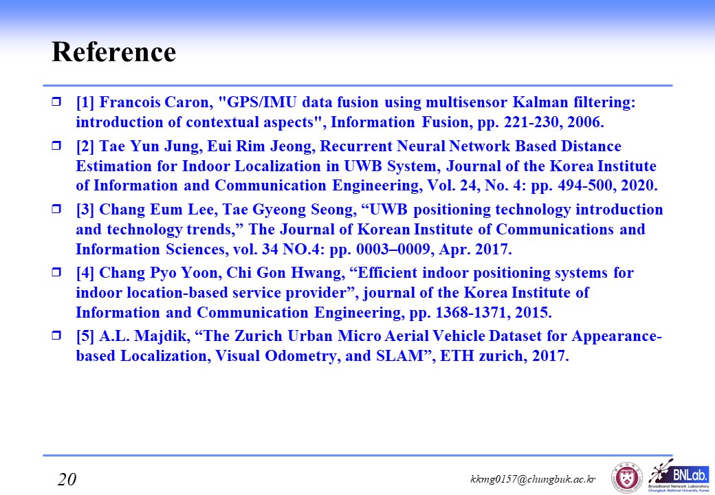 |
I'll end the presentation with a reference. |