Now 5083 visitors
Today:0 Yesterday:0
Total: 147091
212S 50P 4R
2026-10-20, Week 43 |
| Member Login |
| TACT Journal Homepage |
| Call for Paper |
| Committee |
| Find My Paper |
| Author Homepage |
| Statistics & History |
| Welcome Message |
| Paper Procedure |
| FAQ |
| Paper Archives |
| Outstanding Papers |
| Author Homepage |
| - Paper Procedure |
| - Journal Procedure |
| - Presentation Tips |
|
| Program & Proceedings |
| Program with Papers |
| Plenary Session |
| Tutorial Session |
|
| Presentation Platform |
| Hotel & Travel Info |
| About Korea |
| Accommodation |
| Transportation |
| VISA |
| Other Infomation |
|
| Photo Gallery |
| Scheduler Login |
| Seminar |
| Archives Login |
|
| Sponsors |

|

|

|

|

|

|

|

|

|

|
|
|
|
|
 ICACT20260251 Slide.01
[Big Slide] |
Chrome  Click!! |
 |
Good morning everyone, and thank you for attending our presentation.
My name is Bi-Shiun Hu, from National Taitung University in Taiwan.
Today, I will present our work titled “Performance Analysis of UAV-Based Environmental Monitoring Integrating ISAC and 5G Simulation.”
This study evaluates how integrated sensing and communication (ISAC) can be combined with UAV platforms and 5G networks to support real-time environmental monitoring. In this presentation, I will introduce the motivation, system architecture, methodology, experimental results, and future directions of this work. |
| ICACT20260251 Slide.02
[Big Slide]
|
Chrome Click!! |
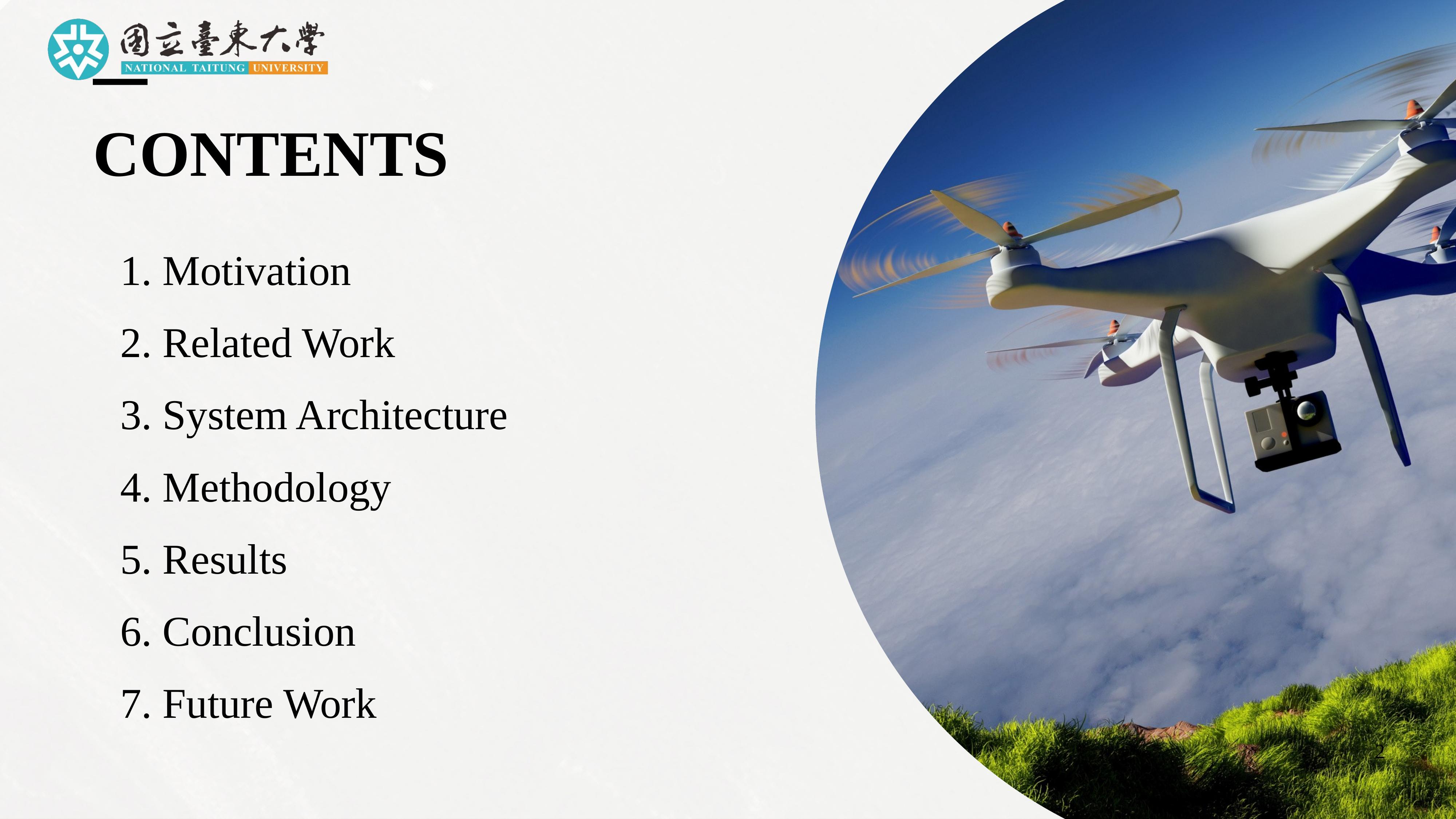 |
This presentation is organized into seven parts. I will begin with the motivation for this study, followed by a review of related work. Then I will introduce the system architecture and explain our methodology in detail. After that, I will present the experimental results, draw conclusions, and finally discuss future work. |
| ICACT20260251 Slide.03
[Big Slide]
|
Chrome Click!! |
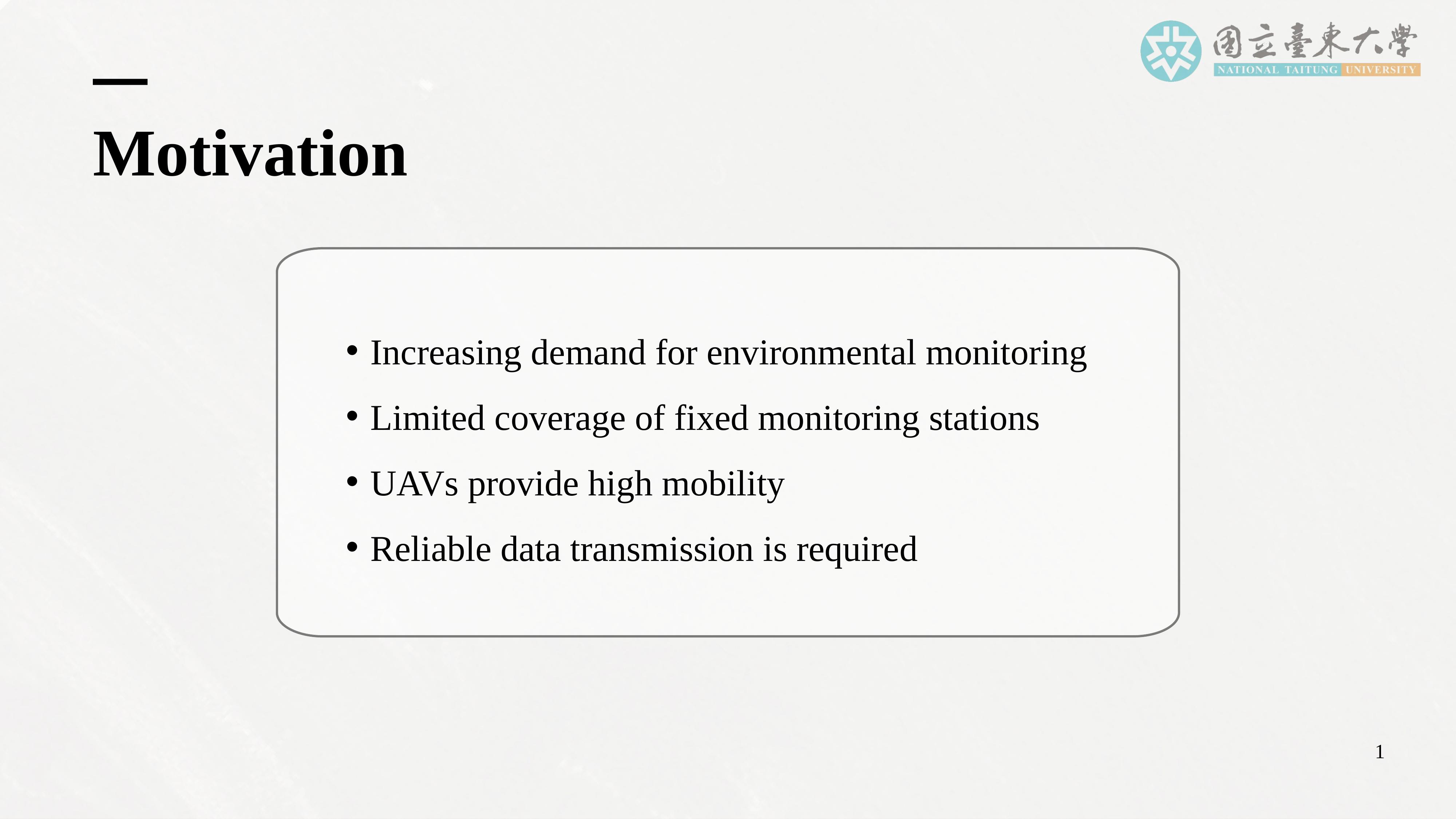 |
Let me begin with the motivation behind this work.
In recent years, environmental pollution and climate change have significantly increased the demand for real-time, flexible, and high-resolution environmental monitoring. Traditional fixed monitoring stations provide stable and reliable data, but they suffer from several limitations. First, their spatial coverage is limited. Second, they lack deployment flexibility. And third, they cannot quickly respond to sudden events such as air pollution spikes, forest fires, or industrial accidents.
Uncrewed Aerial Vehicles, or UAVs, offer a promising alternative. UAVs have high mobility, can be rapidly deployed, and can dynamically adjust their monitoring areas. As a result, UAVs can complement fixed stations and enhance environmental monitoring capabilities, especially in remote or rapidly changing environments.
However, UAV-based monitoring also introduces new challenges. One of the most critical challenges is reliable data transmission. Environmental sensing is only useful if the collected data can be transmitted back to a ground station in a timely, reliable, and energy-efficient manner.
This leads us to Integrated Sensing and Communication, or ISAC. ISAC aims to use a single waveform or signal for both sensing and communication. While ISAC improves spectrum efficiency and system integration, it also introduces trade-offs between sensing performance, communication reliability, and resource allocation.
In UAV-based systems, these trade-offs become even more complex because of mobility, dynamic distance changes, limited onboard energy, and varying communication conditions.
Therefore, our main motivation is to build a simulation framework that can quantitatively analyze how distance and bandwidth affect communication performance and energy efficiency in a UAV-ISAC-based environmental monitoring system.
|
| ICACT20260251 Slide.04
[Big Slide]
|
Chrome Click!! |
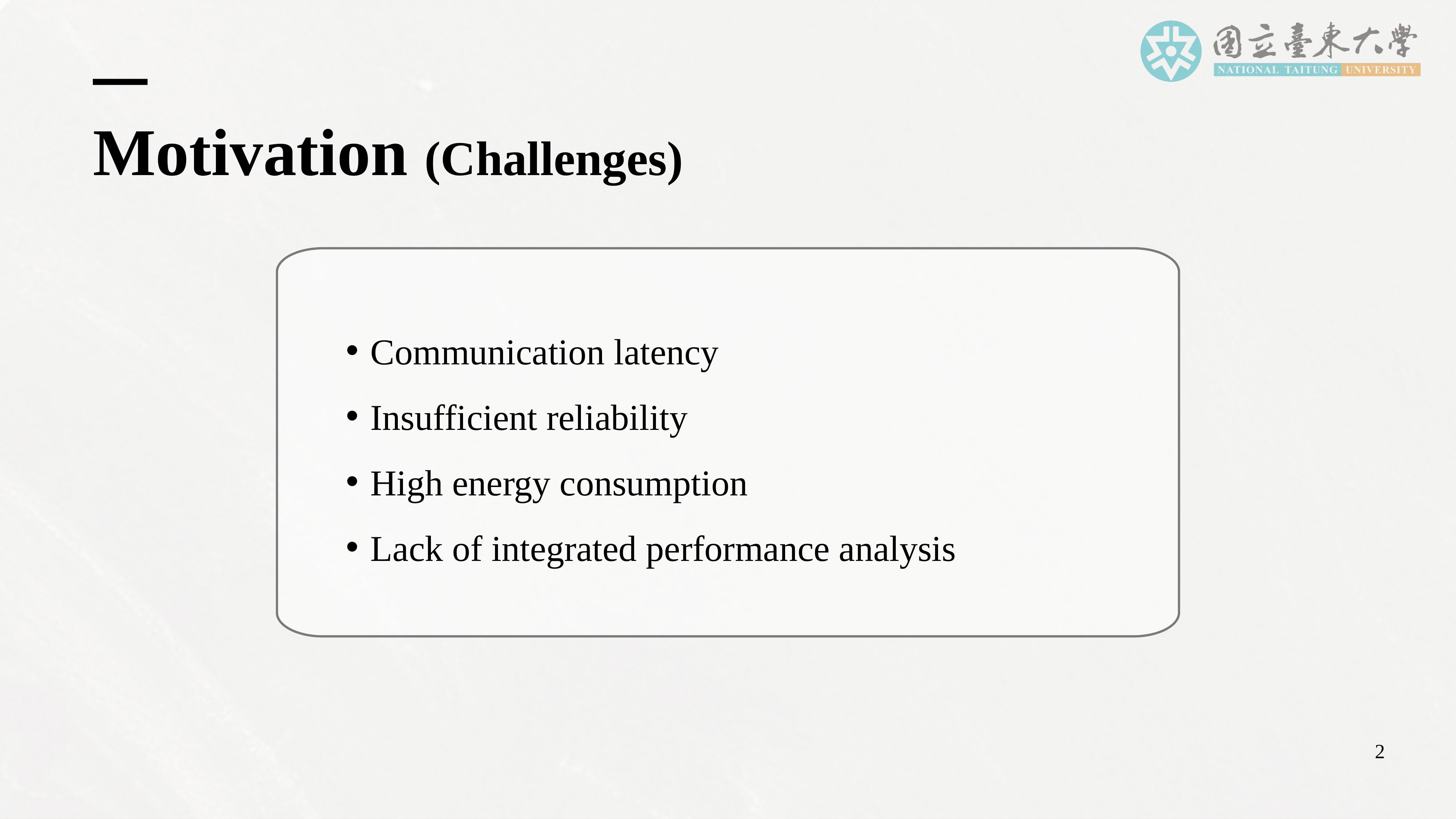 |
Before discussing our framework, let me briefly summarize the main challenges.
First, communication latency increases as UAVs move farther from the base station, potentially preventing real-time sensing applications.
Second, reliability degrades at longer distances, leading to packet loss and reduced data integrity.
Third, energy consumption increases significantly during long-distance transmission, directly reducing UAV mission endurance.
Finally, existing studies often focus on UAV communication or ISAC separately. Still, there is a lack of an integrated, quantitative performance analysis that combines UAV flight behavior, ISAC, and 5G communication simulation within a unified framework.
|
| ICACT20260251 Slide.05
[Big Slide]
|
Chrome Click!! |
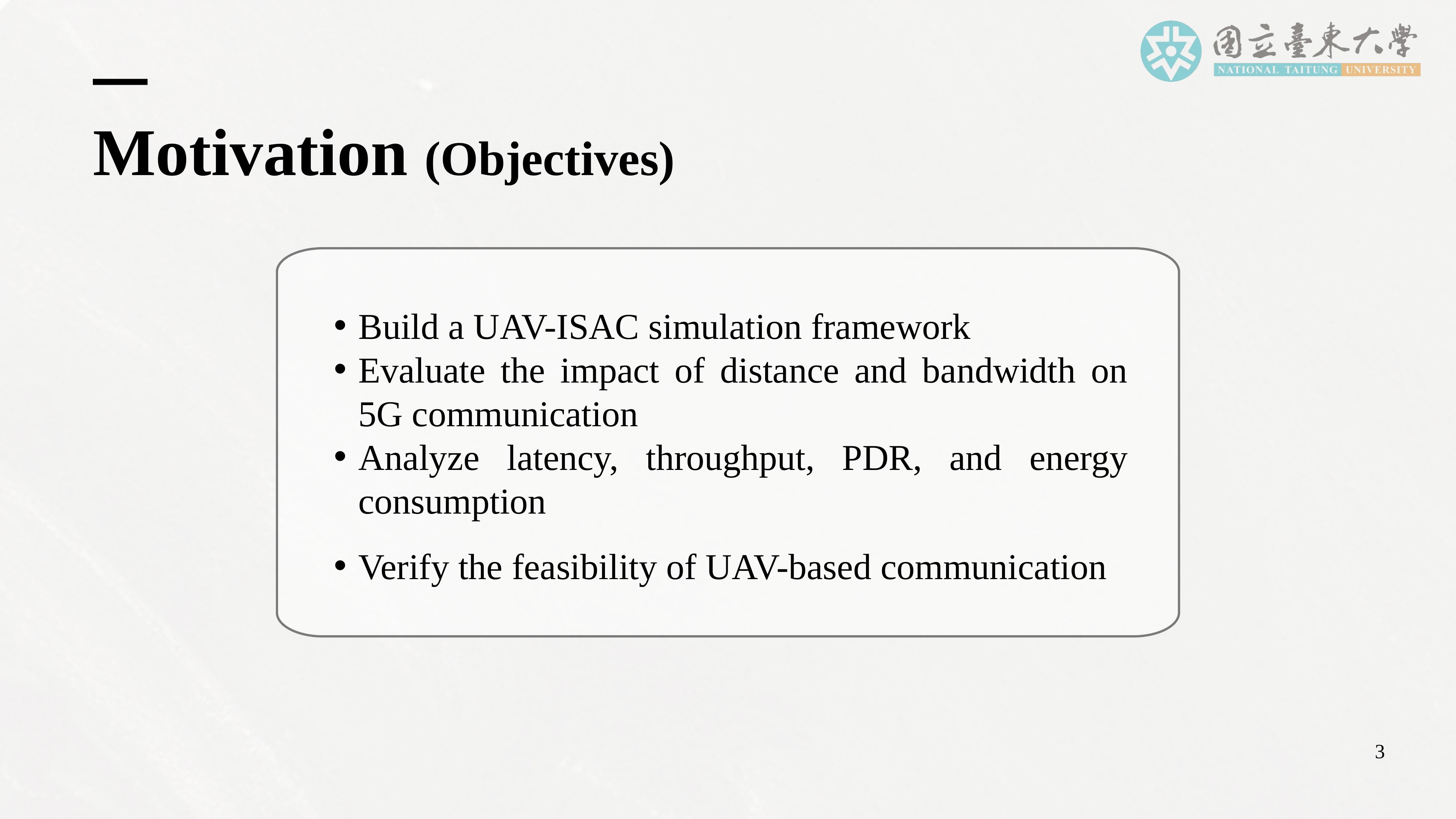 |
To address these challenges, this study sets four main objectives. First, we aim to build a UAV-ISAC simulation framework that integrates UAV flight control, sensing data generation, and 5G communication simulation into a unified system.
Second, we seek to evaluate how distance and bandwidth affect key communication performance metrics, including latency, throughput, packet delivery ratio, jitter, and energy consumption.
Third, we analyze the trade-offs between communication performance and energy efficiency, particularly under long-distance transmission conditions.
Finally, we verify the feasibility of UAV-based ISAC for real-time environmental monitoring and provide quantitative insights that can support future system design and optimization. |
| ICACT20260251 Slide.06
[Big Slide]
|
Chrome Click!! |
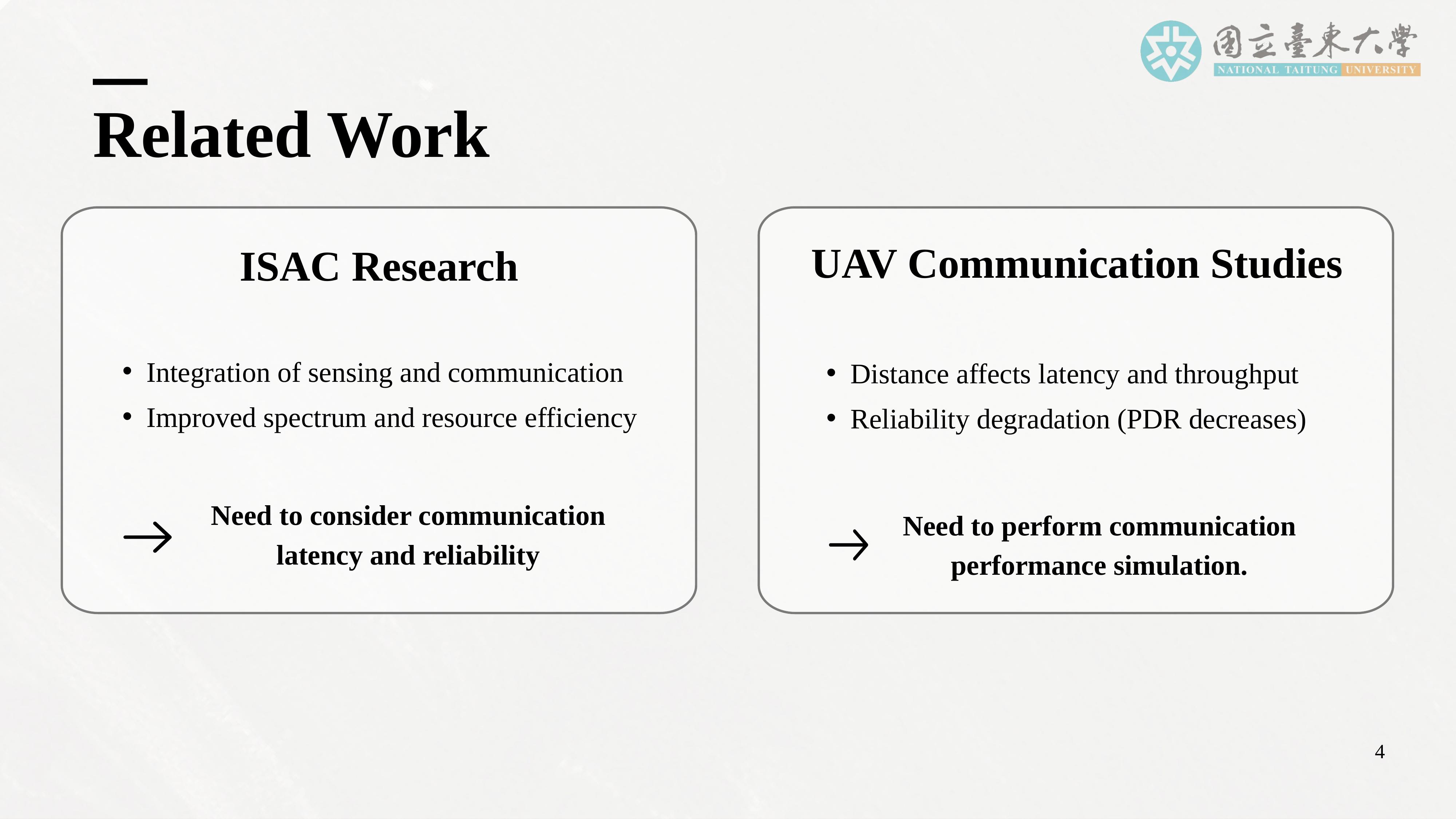 |
Now, I will briefly review related work in ISAC and UAV communications. ISAC has emerged as a key research direction in next-generation wireless networks, including 5G and beyond. The core idea of ISAC is to use a single signal or waveform to perform sensing and communication functions simultaneously. This approach improves spectrum efficiency and system integration but also introduces trade-offs between sensing accuracy, communication reliability, and resource allocation.
In parallel, extensive research has been conducted on UAV communications in 5G and 6G networks. These studies show that UAVs can enhance coverage, support relaying, and enable flexible network deployment. However, they also highlight that distance, altitude, trajectory design, and mobility significantly affect communication performance, particularly latency, throughput, and reliability. |
| ICACT20260251 Slide.07
[Big Slide]
|
Chrome Click!! |
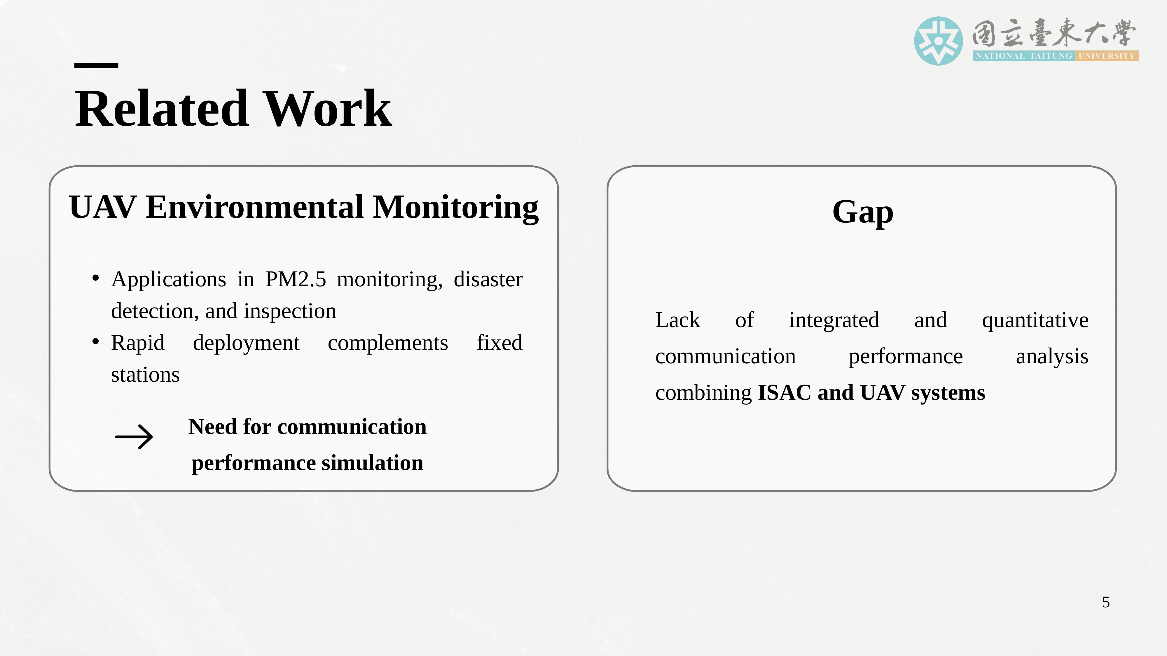 |
In environmental monitoring, UAVs have been widely used for tasks such as PM2.5 sensing, disaster detection, agricultural monitoring, and infrastructure inspection. These applications demonstrate that UAVs can rapidly deploy and effectively complement fixed monitoring stations, especially in remote or hazardous environments.
However, despite this progress, existing studies rarely conduct integrated, quantitative communication performance analysis that jointly considers ISAC, UAV mobility, and 5G simulation within a unified framework. Most works focus on either sensing performance or communication performance alone. This gap motivates our work, which aims to provide a comprehensive, system-level evaluation of UAV-ISAC-based environmental monitoring. |
| ICACT20260251 Slide.08
[Big Slide]
|
Chrome Click!! |
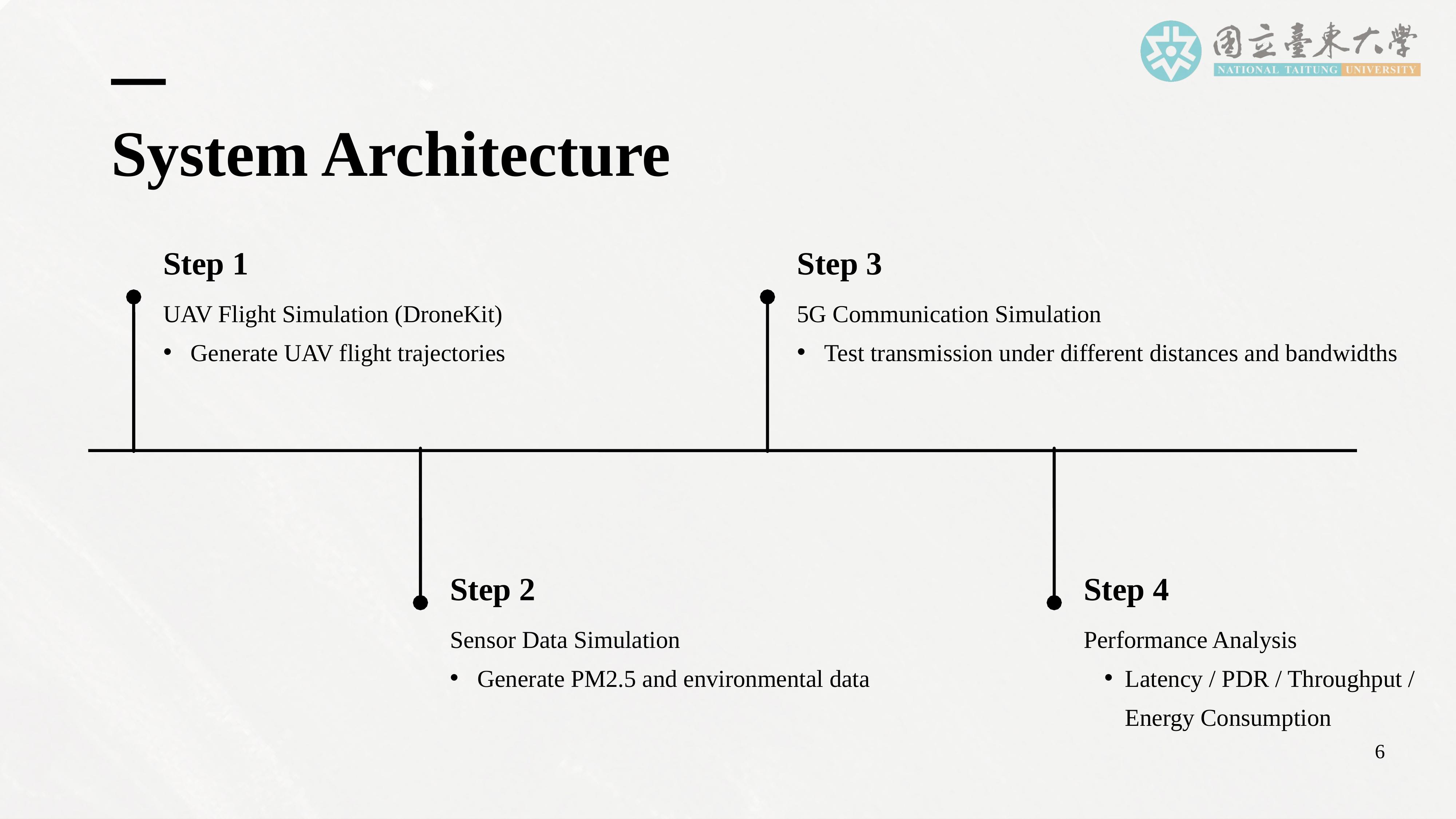 |
This slide presents the overall system architecture of our proposed framework. The system begins with UAV flight simulation, using DroneKit to generate UAV trajectories from predefined missions and waypoints. These trajectories define the UAV’s movement in space and time.
Next, environmental sensor data, such as PM2.5 concentration values, are generated based on the UAV’s position and time. This simulated sensing data represents realistic environmental measurements collected during flight.
Then, 5G communication simulation is performed using NS-3. This step models the wireless transmission of sensing data between the UAV and the ground base station under different distances and bandwidth configurations.
Finally, performance analysis is conducted by collecting and analyzing key metrics, including latency, throughput, packet delivery ratio, jitter, and energy consumption. Together, these components form an integrated pipeline for evaluating the end-to-end performance of the UAV-ISAC system. |
| ICACT20260251 Slide.09
[Big Slide]
|
Chrome Click!! |
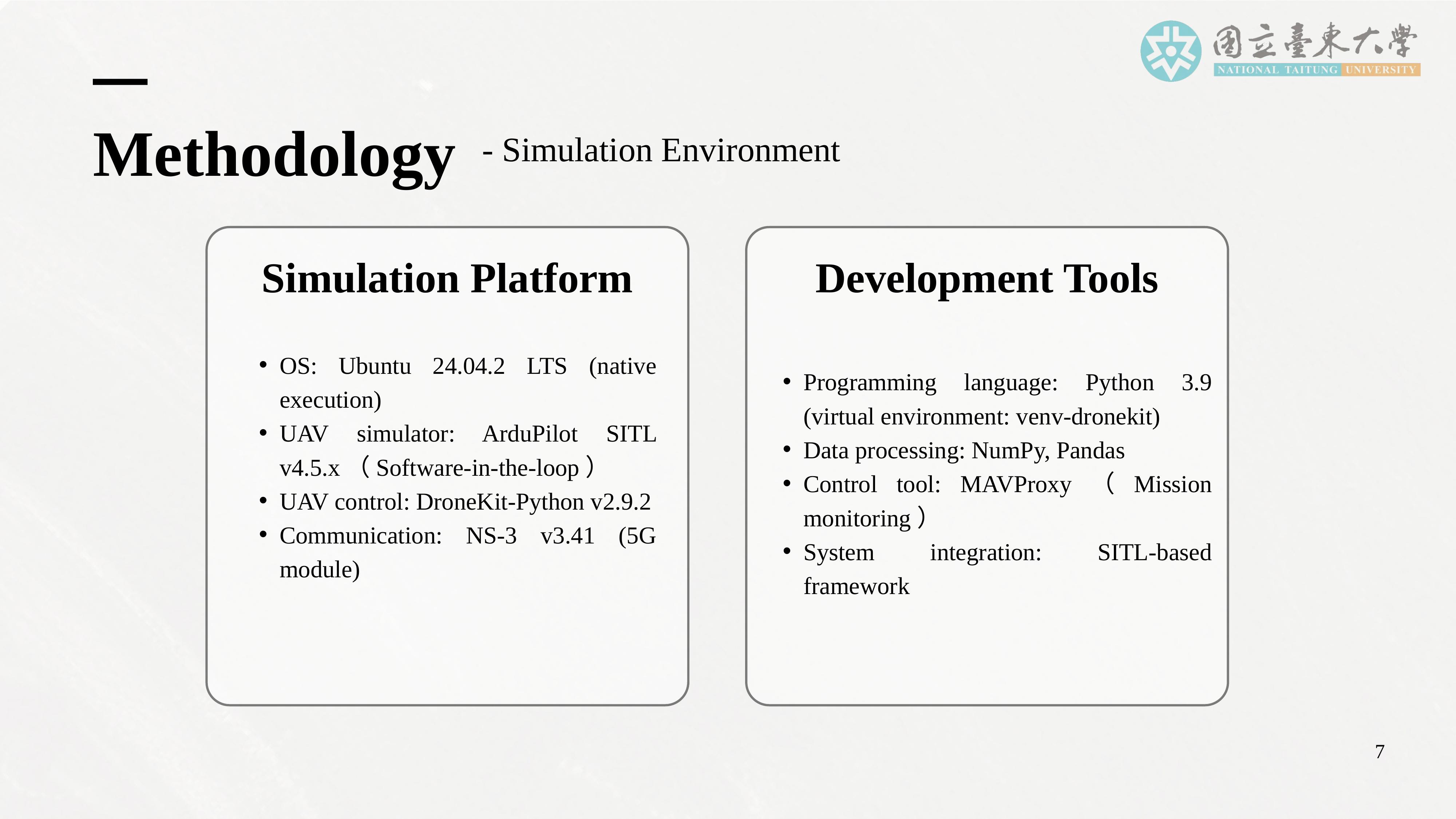 |
Let me now describe the simulation environment used in this study. All simulations are conducted on Ubuntu 24.04.2 LTS using native execution. UAV flight behavior is simulated using ArduPilot SITL, which provides a realistic software-in-the-loop environment for UAV control and flight dynamics.
DroneKit-Python is used to define UAV missions, generate trajectories, and control the UAV during simulation. For communication simulation, we use NS-3 version 3.41 with a 5G module, which allows us to model realistic wireless network behavior.
Data processing and performance analysis are performed using Python, along with NumPy and Pandas for numerical computation and data handling. MAVProxy is used for mission monitoring and control. This environment enables realistic and repeatable simulation of UAV flight and wireless communication within a unified framework. |
| ICACT20260251 Slide.10
[Big Slide]
|
Chrome Click!! |
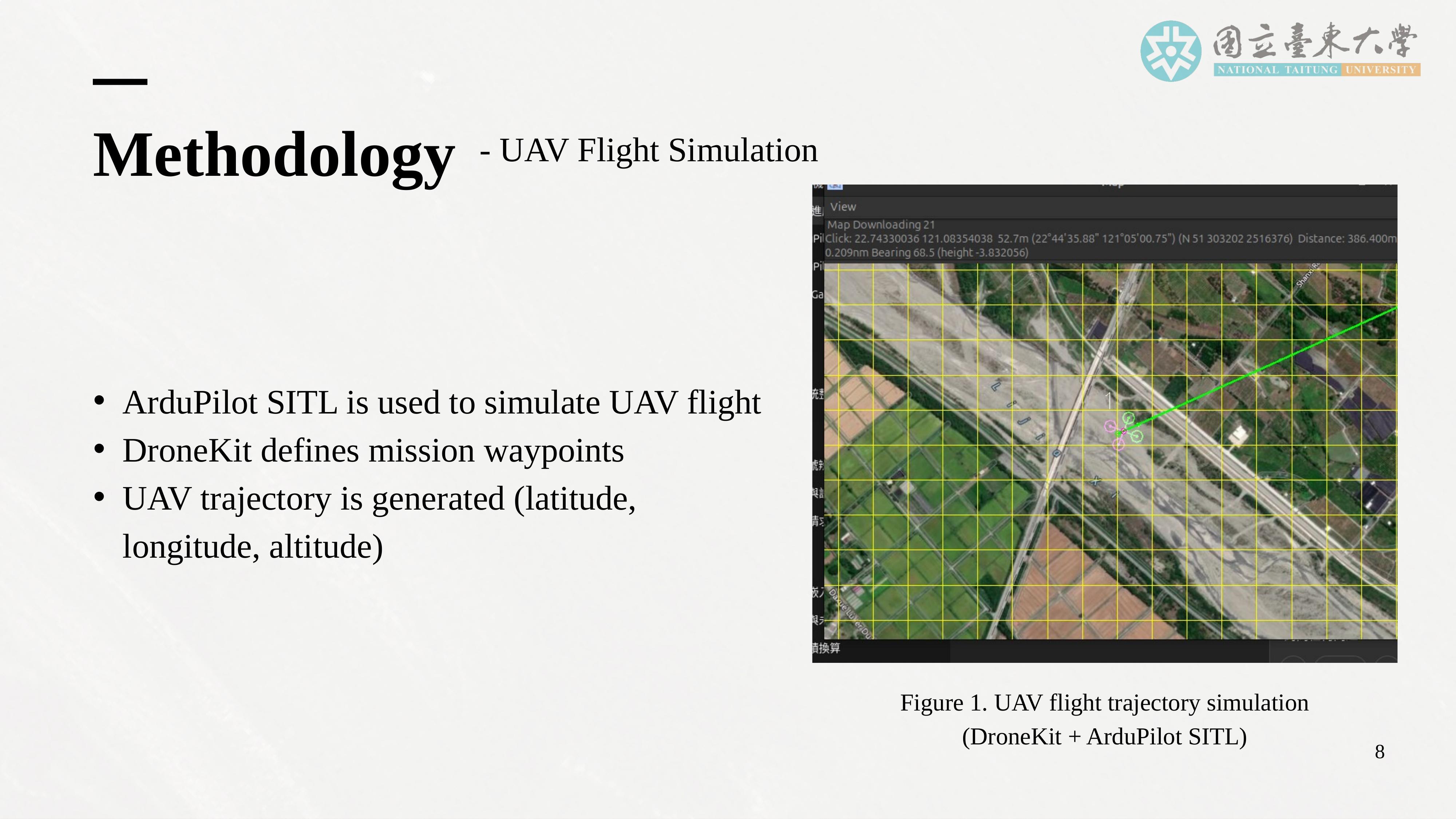 |
This slide explains how UAV flight is simulated in our framework. We use DroneKit to define UAV missions by specifying waypoints, altitudes, and flight paths. The UAV follows these predefined missions and generates a time series of latitude, longitude, and altitude coordinates.
In this study, we adopt a simplified two-dimensional rectangular patrol trajectory. The UAV flies around a fixed base station at a constant altitude of 100 meters. This design creates continuous distance variation between the UAV and the base station as the UAV moves along the rectangular path.
Although this trajectory is simplified, it serves an important purpose. It allows us to systematically evaluate the impact of distance on communication performance while maintaining a controlled and reproducible simulation environment. Moreover, the framework is designed to support future extensions to complex three-dimensional trajectories and multi-UAV scenarios. |
| ICACT20260251 Slide.11
[Big Slide]
|
Chrome Click!! |
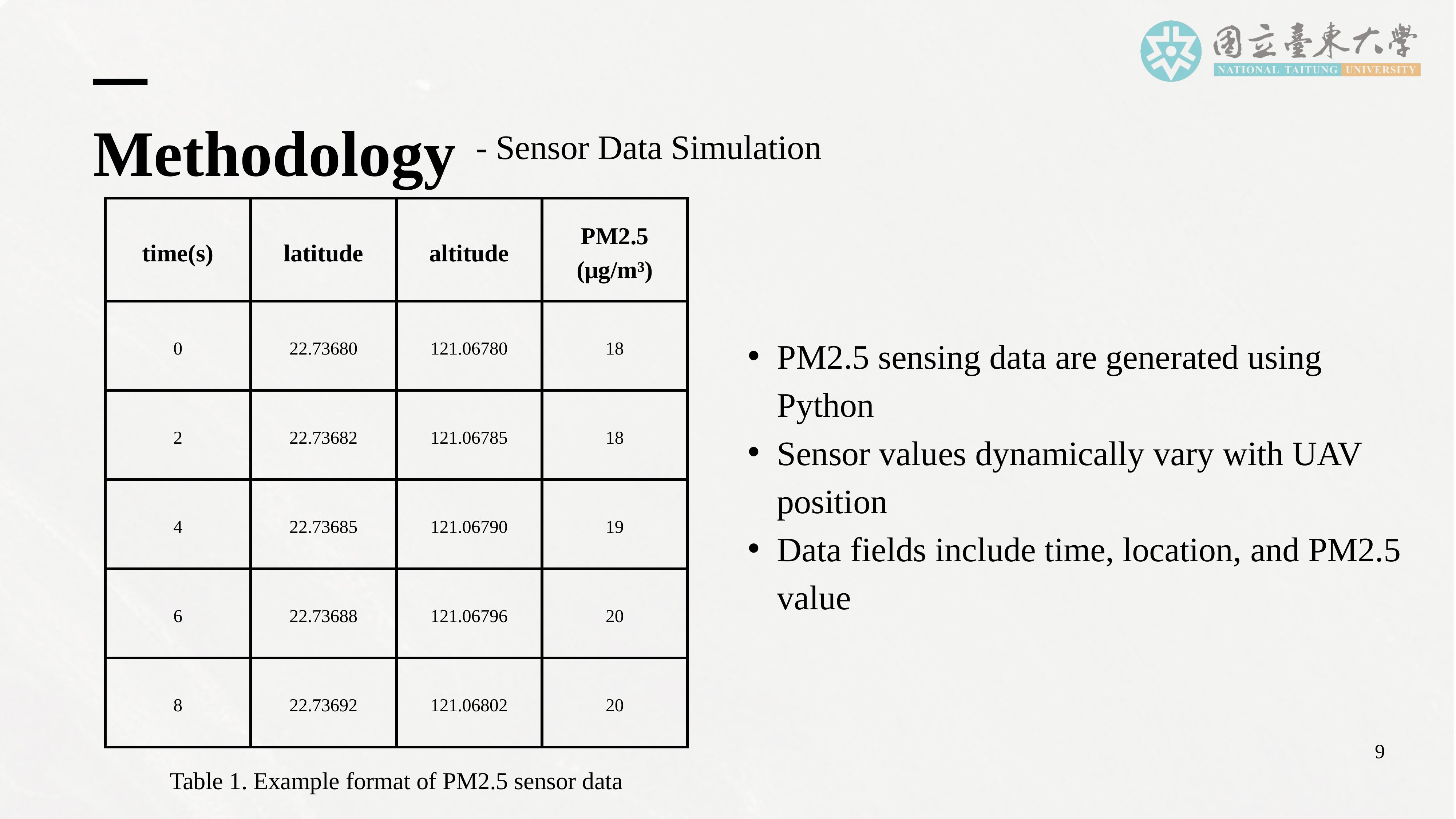 |
Next, I will explain how environmental sensing data are simulated. We generate synthetic PM2.5 sensor data using Python. The sensor values vary dynamically with the UAV’s position and time, simulating realistic spatial and temporal variations in air quality.
Each data packet includes a timestamp, geographic coordinates, and a PM2.5 concentration value. These data packets are transmitted from the UAV to the ground server through the simulated 5G network.
This approach allows us to evaluate not only the communication performance but also the integrity, timeliness, and reliability of environmental sensing data delivery, which are critical for real-time monitoring applications. |
| ICACT20260251 Slide.12
[Big Slide]
|
Chrome Click!! |
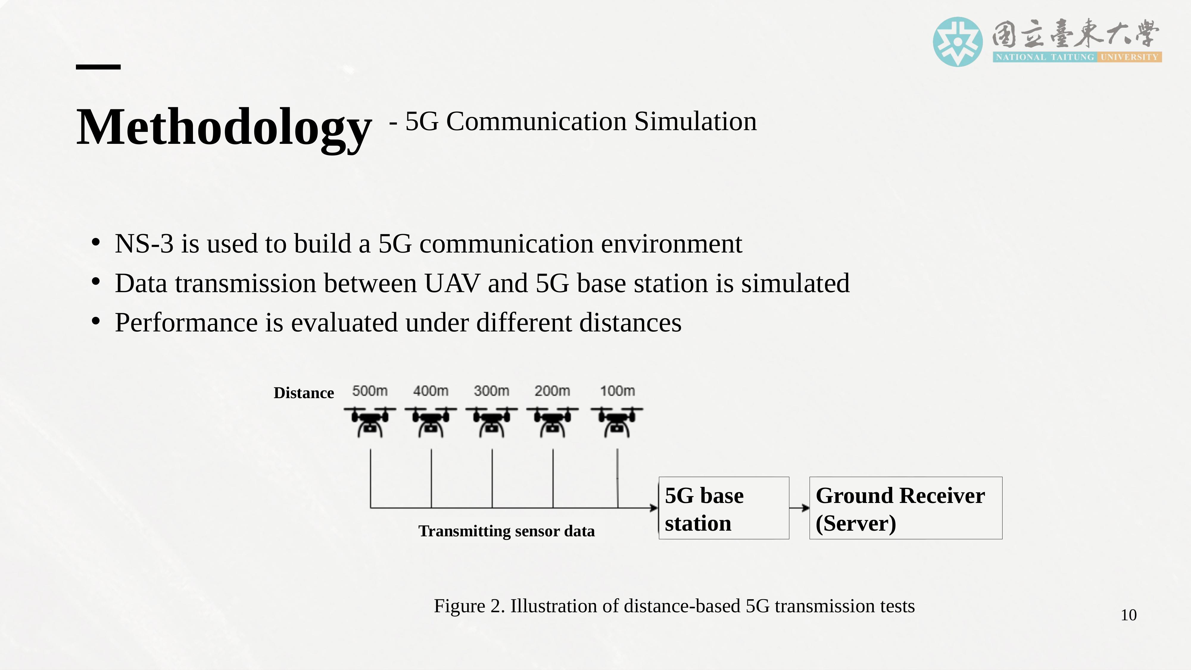 |
This slide describes the 5G communication simulation process. We use NS-3 to build a 5G network environment, modeling the UAV as a mobile node and the base station as a fixed node.
As the UAV moves along its trajectory, the distance between the UAV and the base station changes dynamically. Data transmission is simulated under these varying distance conditions. The UAV maintains a fixed altitude of 100 meters relative to the base station and the ground receiver to ensure consistent path-loss modeling.
We also vary bandwidth configurations to evaluate the sensitivity of communication performance to available spectrum resources. This allows us to analyze how bandwidth allocation can mitigate or exacerbate performance degradation under different distance conditions. |
| ICACT20260251 Slide.13
[Big Slide]
|
Chrome Click!! |
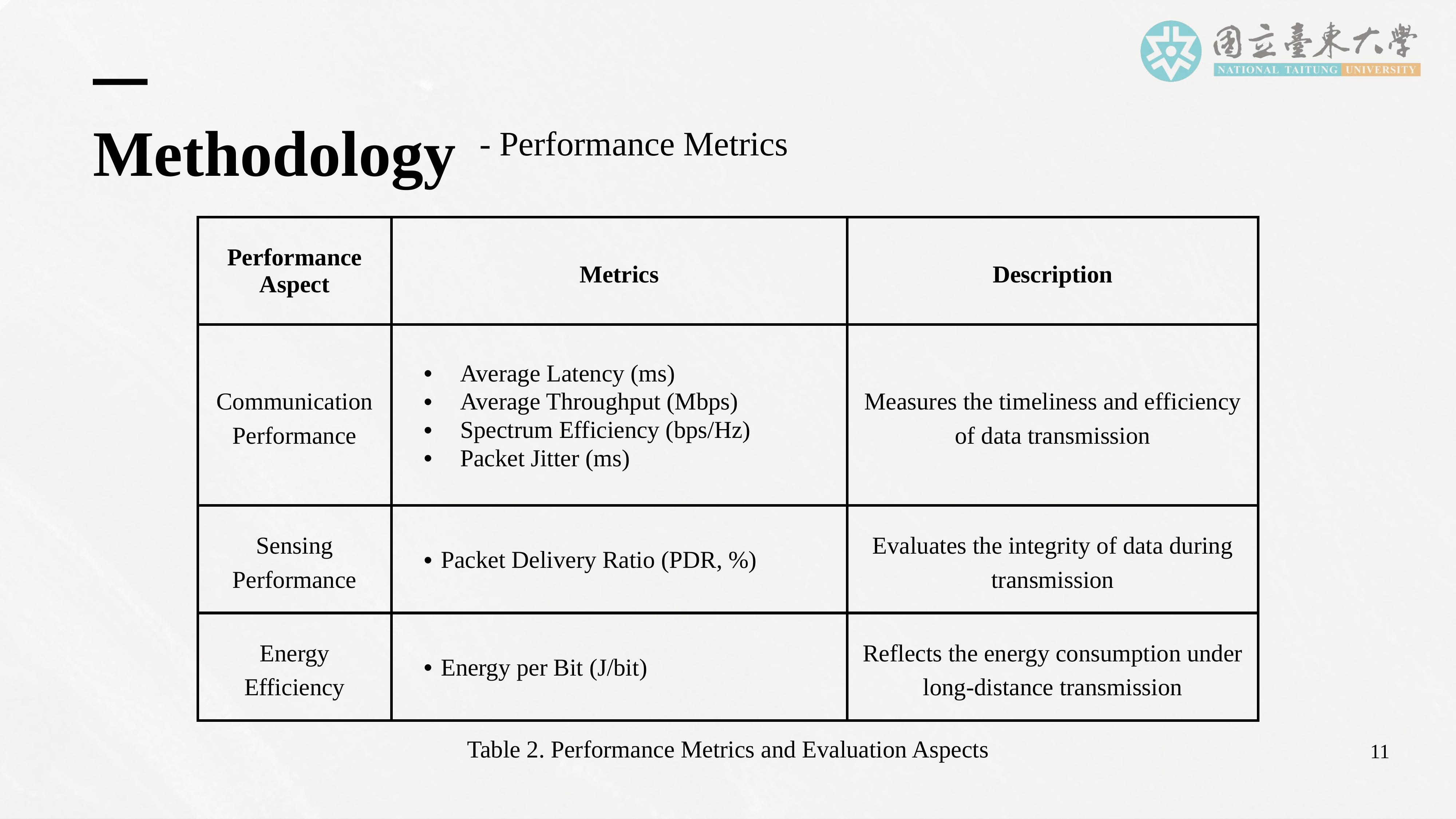 |
This slide introduces the performance metrics used in our evaluation. For communication performance, we measure average latency, average throughput, spectrum efficiency, and packet jitter. These metrics reflect the timeliness, efficiency, and stability of data transmission.
For sensing performance, we measure the packet delivery ratio (PDR), which indicates the proportion of successfully delivered packets and reflects data integrity.
For energy efficiency, we measure energy per bit, which quantifies the energy cost required to transmit each bit of data. This metric is especially important in UAV systems, where energy is a limited resource and directly affects mission endurance.
Together, these metrics provide a comprehensive, quantitative evaluation of the UAV-ISAC systems performance. |
| ICACT20260251 Slide.14
[Big Slide]
|
Chrome Click!! |
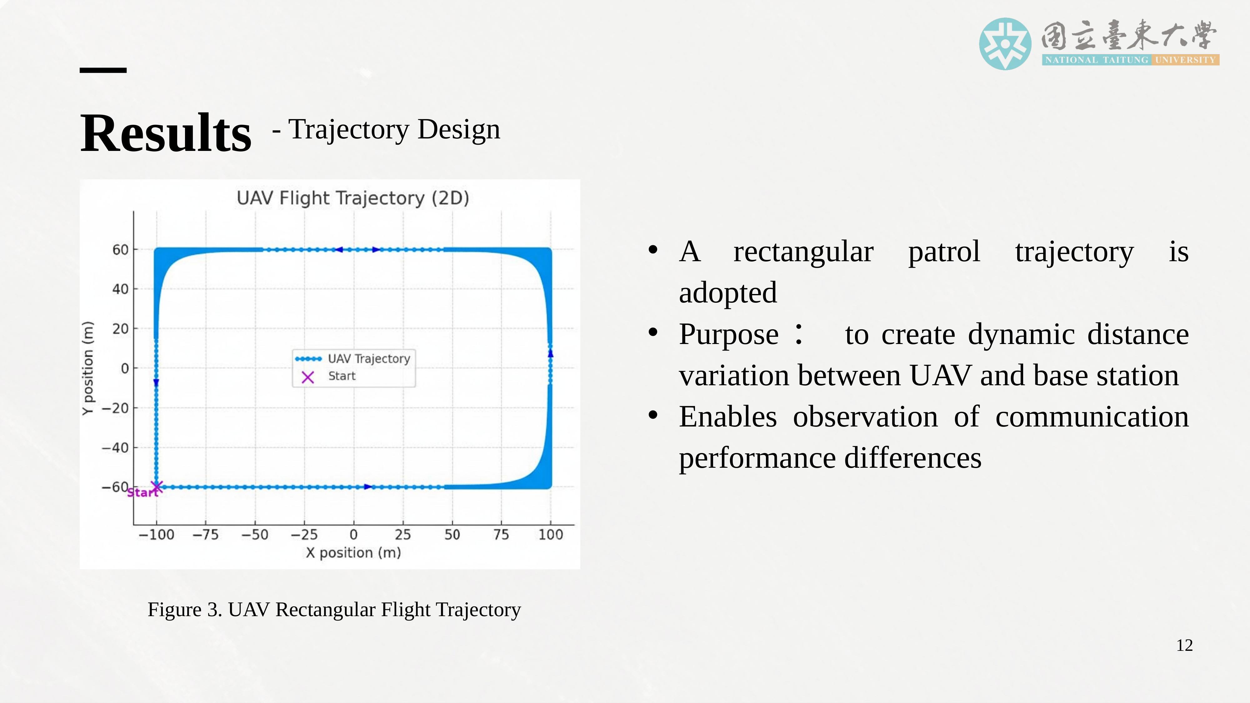 |
Now, I will present the simulation results, starting with the UAV flight trajectory. We adopt a rectangular patrol trajectory with the base station placed at a fixed central location. The UAV flies clockwise along the rectangular path, and arrows indicate the direction of flight along each segment.
This design ensures continuous variation in distance between the UAV and the base station, ranging from 50 meters to 500 meters. This setup simulates realistic UAV patrol behavior and provides a controlled environment for analyzing how distance affects communication performance. |
| ICACT20260251 Slide.15
[Big Slide]
|
Chrome Click!! |
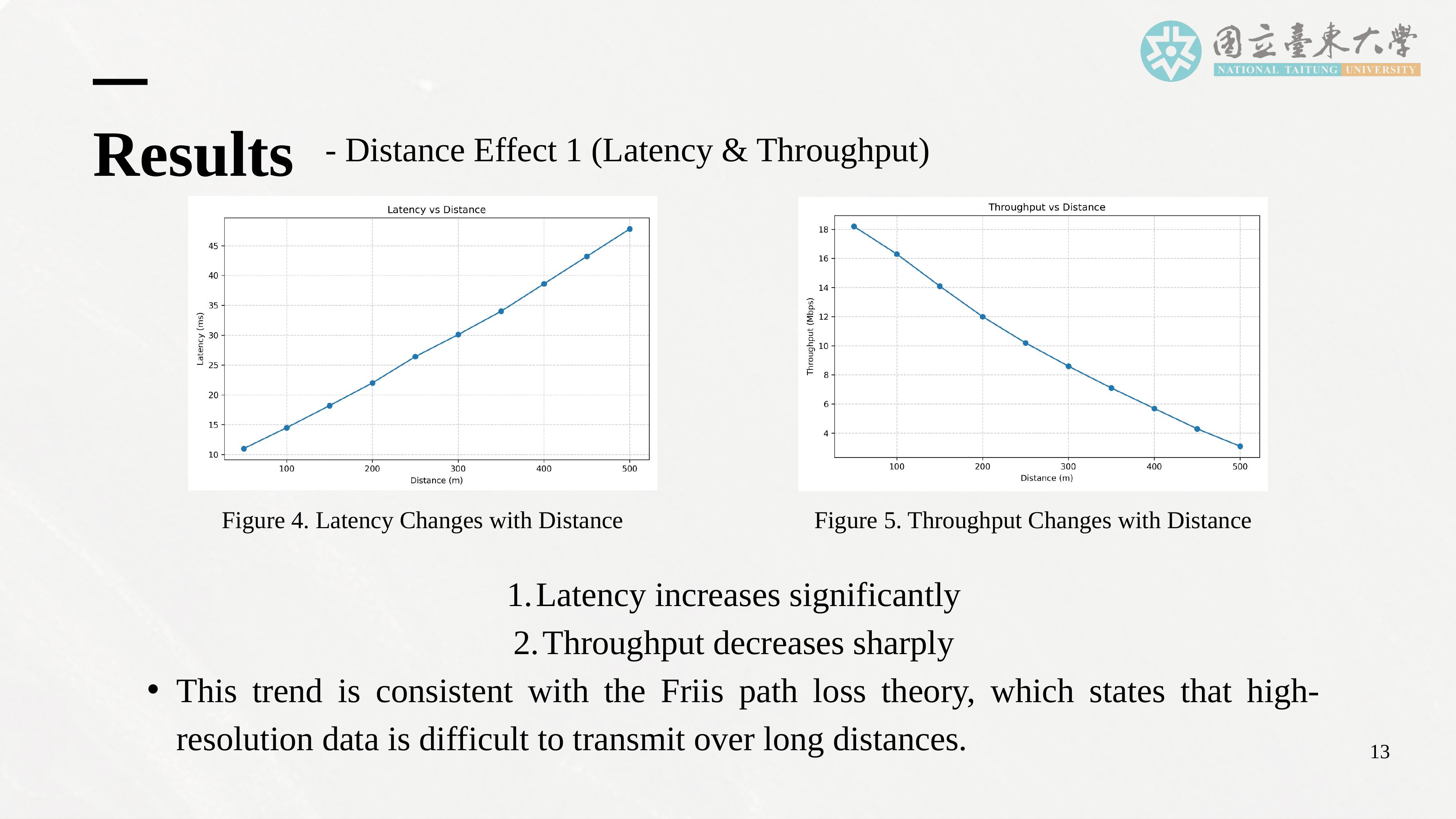 |
This slide shows how distance affects latency and throughput. As the distance between the UAV and the base station increases from 50 meters to 500 meters, average latency rises from approximately 11 milliseconds to about 48 milliseconds. At the same time, throughput decreases from around 18 megabits per second to about 3 megabits per second.
This trend is consistent with Friis path-loss theory, which states that signal power decreases with distance, leading to reduced signal quality and transmission efficiency. These results demonstrate that long-distance transmission significantly challenges real-time environmental monitoring applications, particularly when high-resolution or high-frequency data must be transmitted. |
| ICACT20260251 Slide.16
[Big Slide]
|
Chrome Click!! |
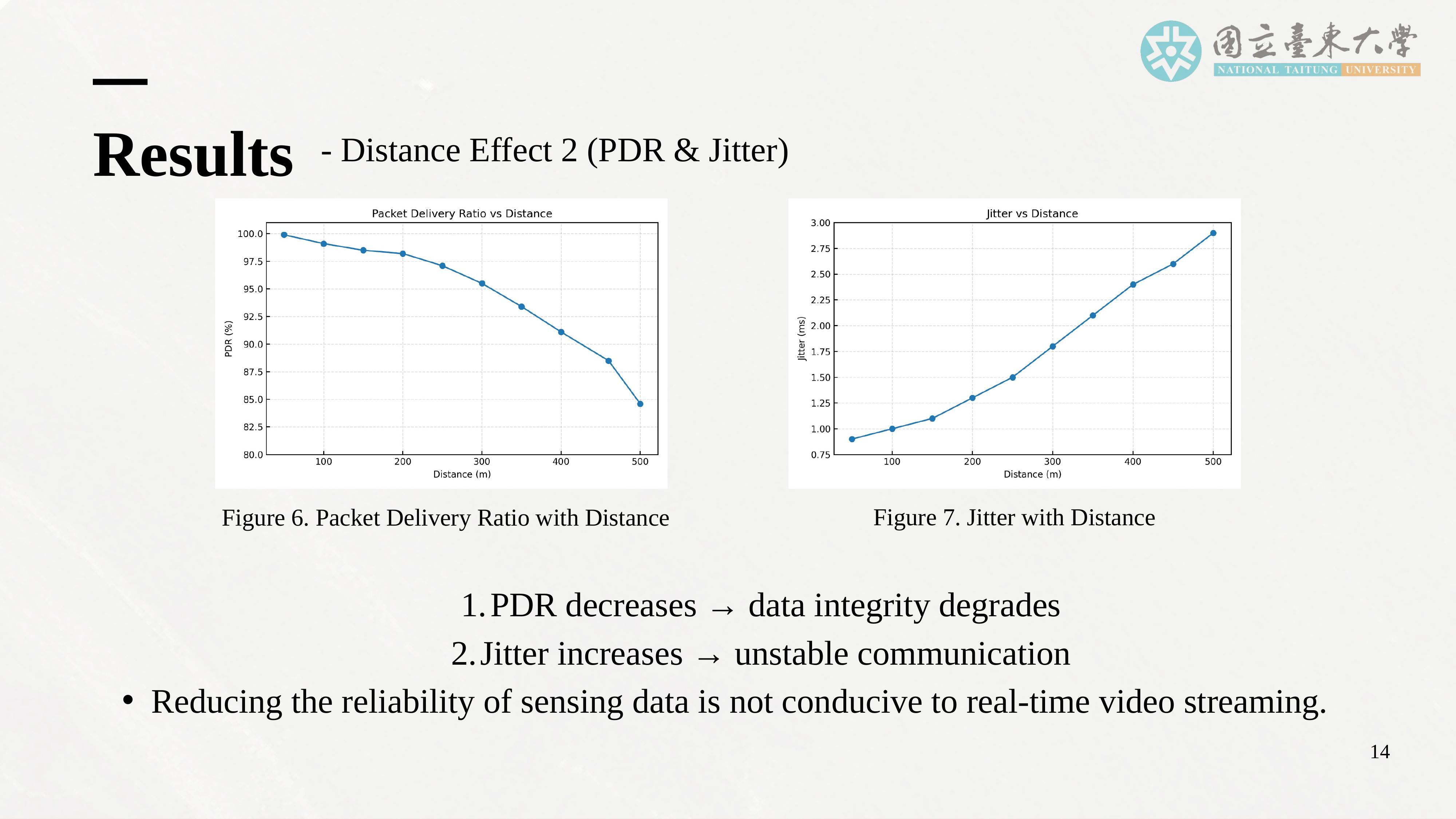 |
This slide focuses on packet delivery ratio and jitter. As distance increases, packet delivery ratio decreases from approximately 99 percent at short distances to around 85 percent at long distances. This indicates that data integrity deteriorates significantly over long distances.
At the same time, jitter increases from about 1 millisecond at short distances to nearly 3 milliseconds at long distances. This means that latency becomes not only higher but also more unstable. Such instability is particularly harmful to applications such as real-time video streaming and time-sensitive environmental sensing, where consistent and predictable communication performance is essential. |
| ICACT20260251 Slide.17
[Big Slide]
|
Chrome Click!! |
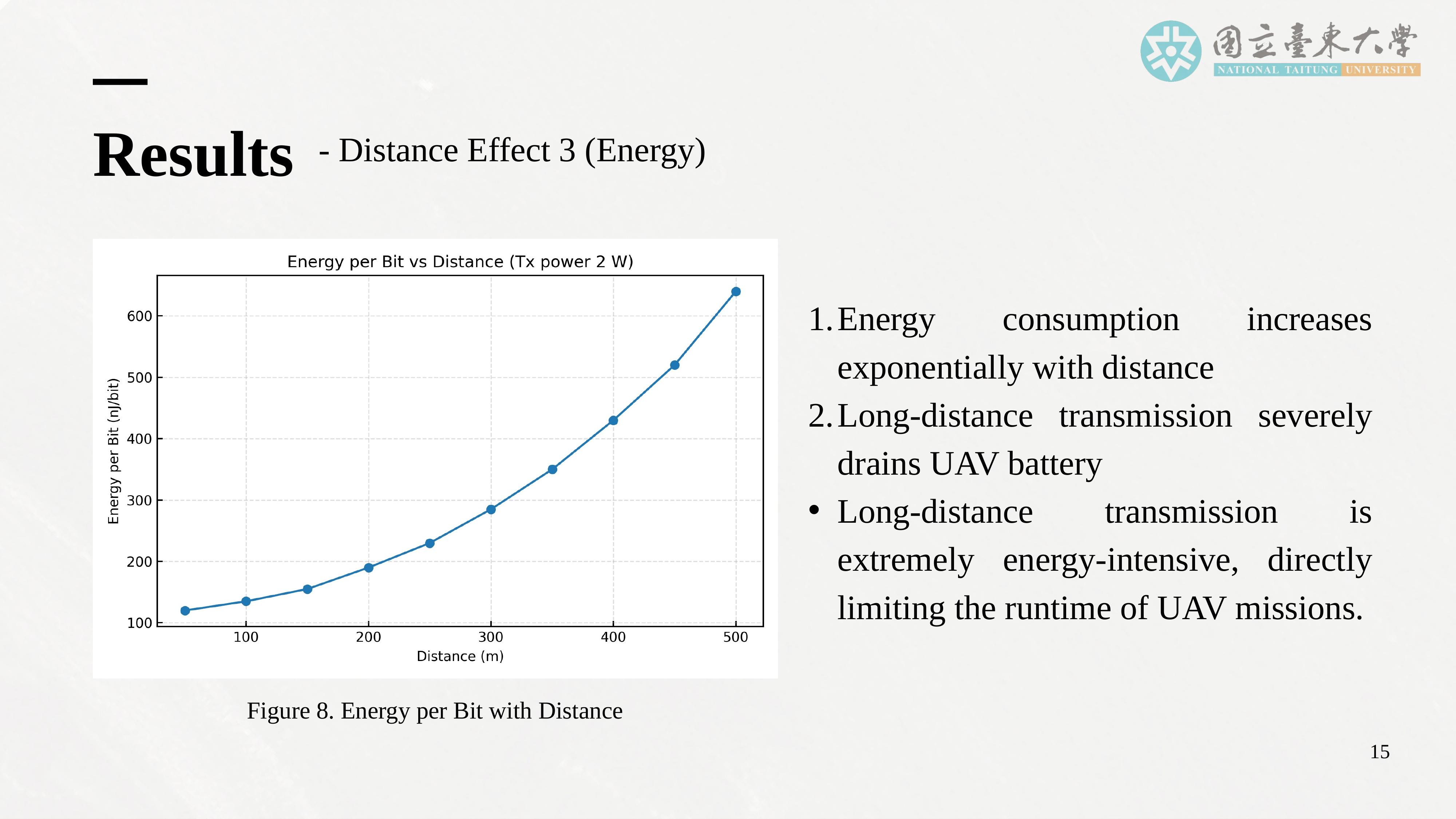 |
Up to this point, I have shown how distance affects latency, throughput, packet delivery ratio, and jitter. Now, I will focus on energy efficiency, which is often the most critical constraint in UAV systems.
This figure shows the relationship between distance and energy per bit. At short distances, energy consumption remains relatively low, typically between 120 and 160 nanojoules per bit. However, as the distance increases, energy per bit rises sharply and exceeds 600 nanojoules per bit at 500 meters.
This exponential increase means that long-distance transmission severely drains the UAV’s battery, directly reducing mission endurance. Even if communication performance remains technically acceptable, the energy cost may make such missions impractical. Therefore, energy efficiency is not only a secondary concern but a primary design constraint in UAV-ISAC systems. |
| ICACT20260251 Slide.18
[Big Slide]
|
Chrome Click!! |
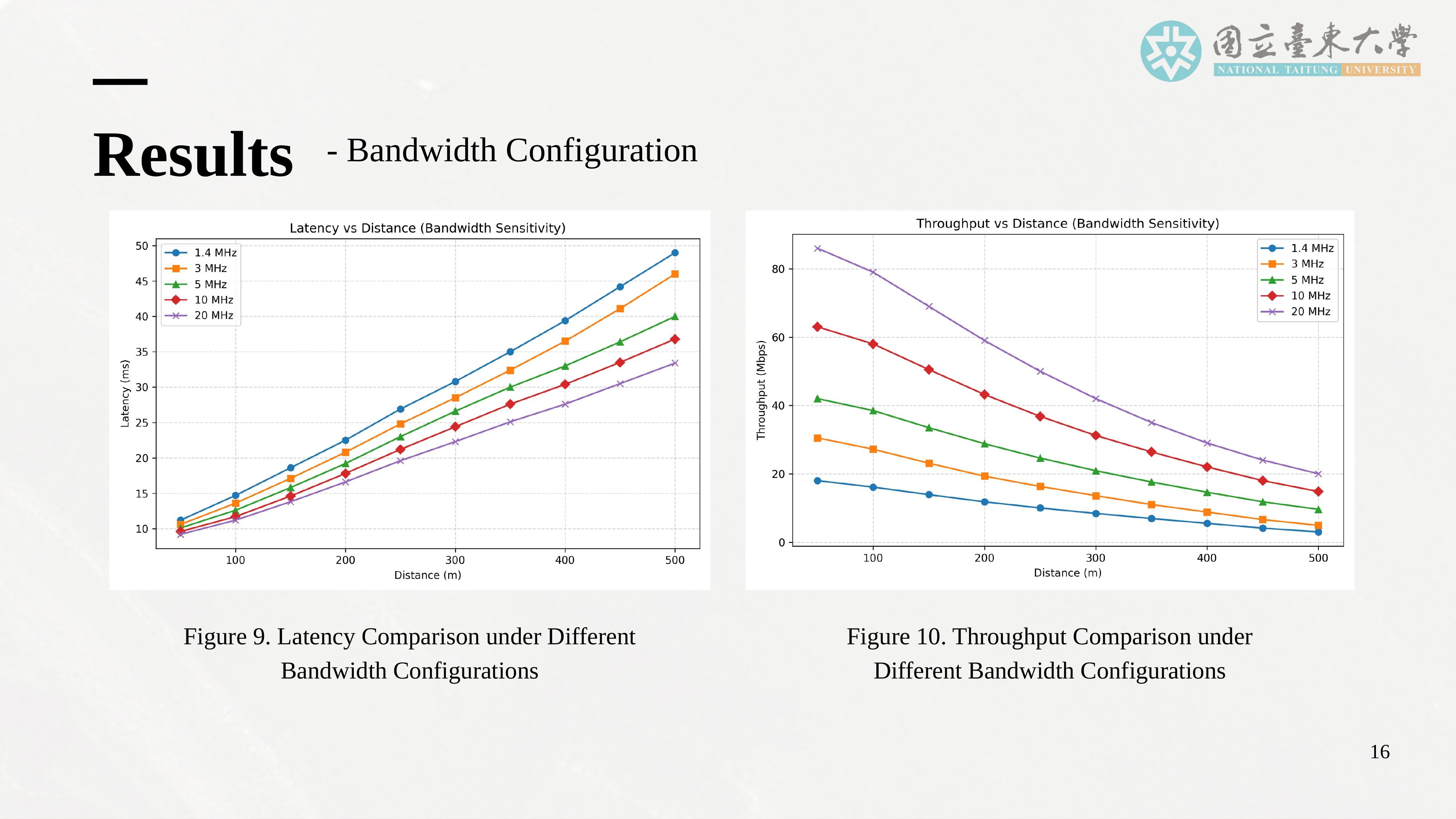 |
Having established the impact of distance, I will now discuss how bandwidth configuration influences communication performance. This slide presents the visual comparison of latency and throughput under different bandwidth settings.
This figure shows a consistent trend across all tested distances: as bandwidth increases, latency decreases, and throughput increases. At shorter distances, the improvement is noticeable but moderate. At longer distances, especially around 400 to 500 meters, the throughput gain becomes more significant.
However, it is important to emphasize that although increasing bandwidth improves performance, it does not eliminate the fundamental impact of distance. Even with higher bandwidth, performance at long distances remains significantly worse than at short distances. This figure visually confirms that bandwidth expansion is an effective but limited optimization strategy. |
| ICACT20260251 Slide.19
[Big Slide]
|
Chrome Click!! |
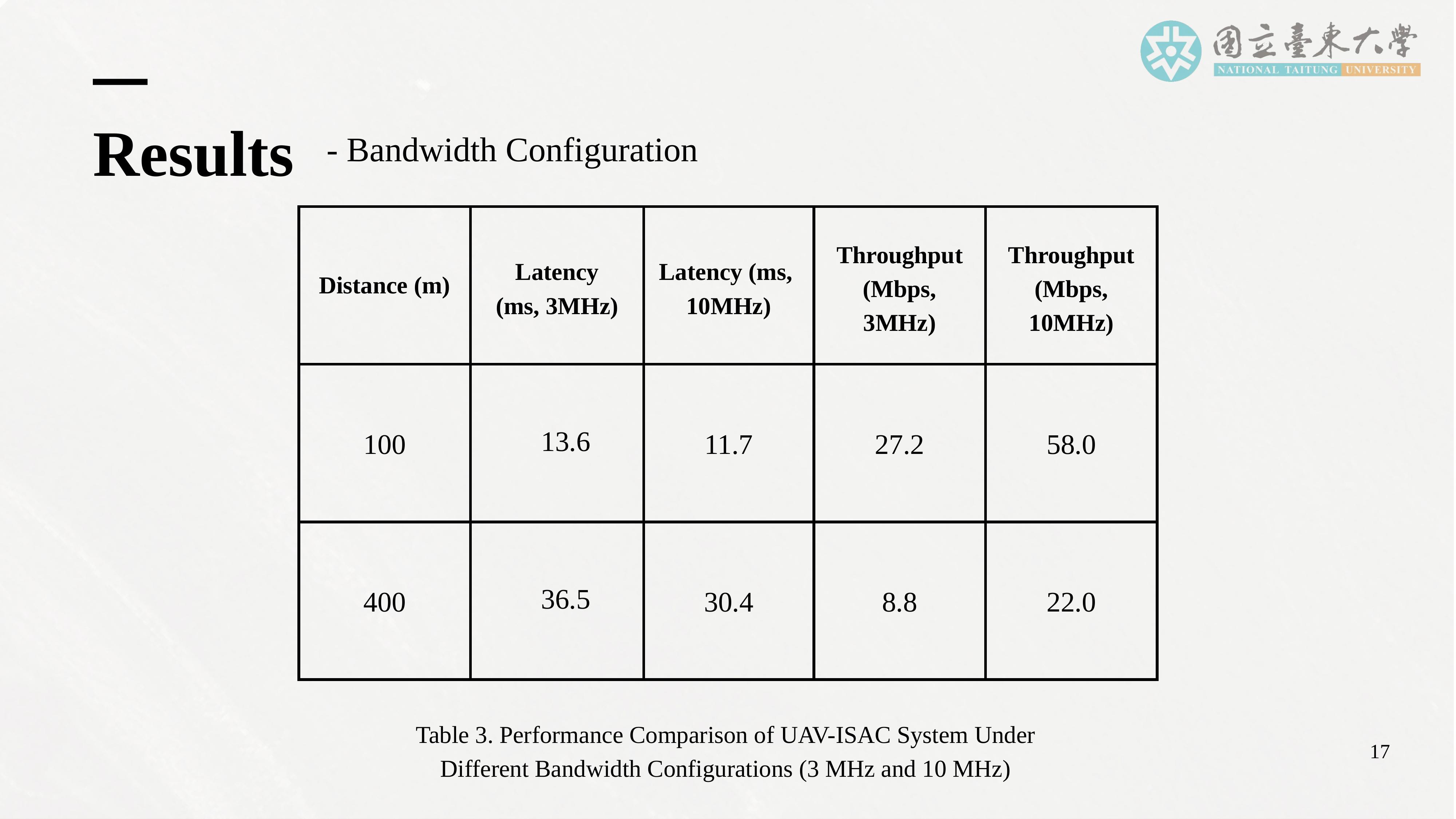 |
This slide provides the numerical values corresponding to the previous figure, enabling us to make precise comparisons. The table compares performance under two bandwidth settings, 3 megahertz and 10 megahertz, at distances of 100 meters and 400 meters.
At 100 meters, latency decreases from 13.6 milliseconds to 11.7 milliseconds, while throughput increases from 27.2 megabits per second to 58.0 megabits per second when bandwidth is increased from 3 to 10 megahertz.
At 400 meters, latency decreases from 36.5 milliseconds to 30.4 milliseconds, and throughput increases from 8.8 megabits per second to 22.0 megabits per second.
These values quantitatively demonstrate that bandwidth expansion significantly improves both latency and throughput. However, even at higher bandwidth, performance at longer distances remains substantially worse than at shorter distances, reinforcing the conclusion that distance remains the dominant limiting factor.
|
| ICACT20260251 Slide.20
[Big Slide]
|
Chrome Click!! |
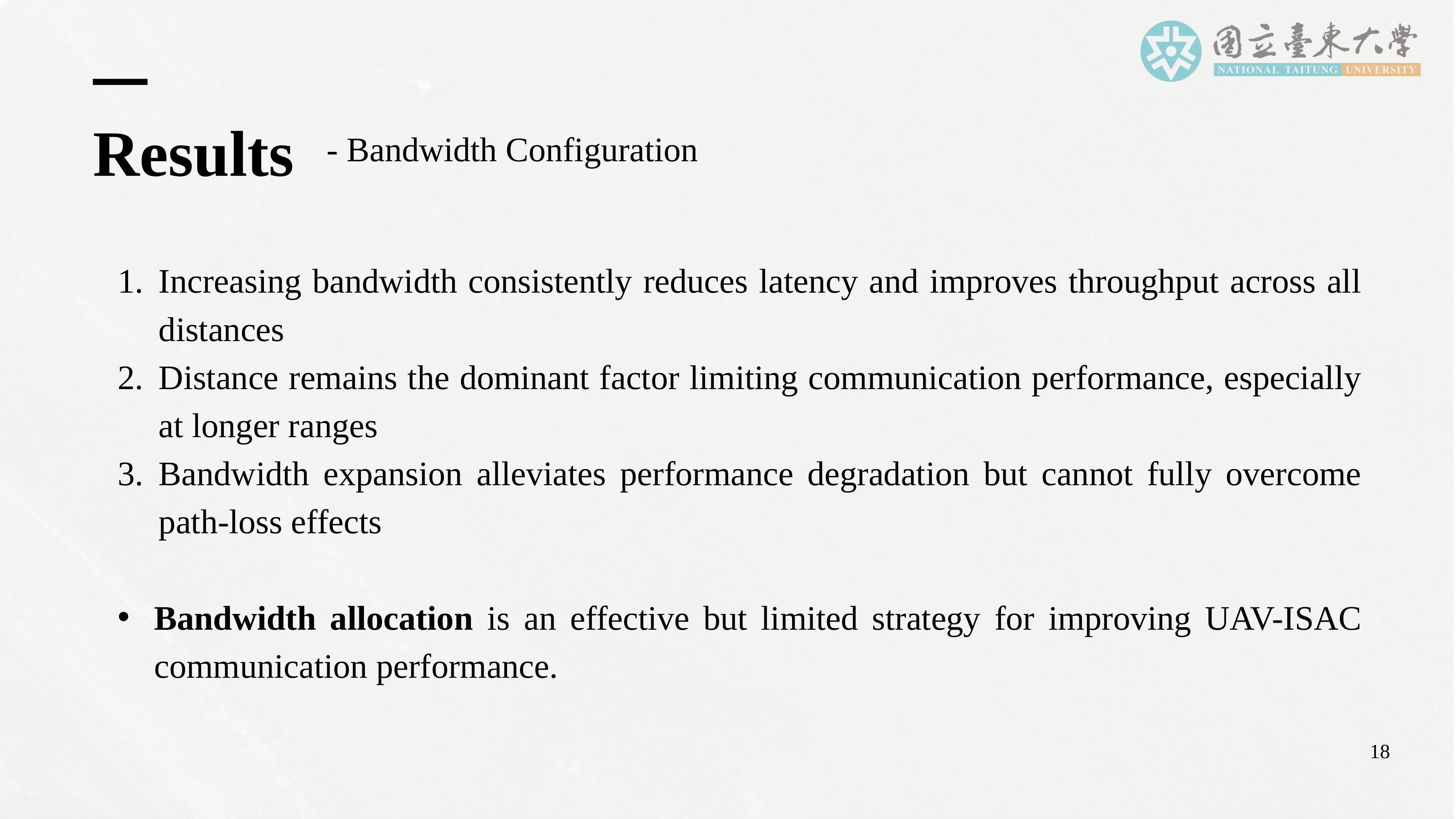 |
This slide summarizes the key findings regarding bandwidth configuration. The results show that increasing bandwidth consistently reduces latency and improves throughput across all tested distances. This means that allocating more spectrum resources can significantly enhance communication performance, especially in terms of transmission speed and responsiveness.
However, distance remains the dominant factor limiting communication performance, particularly at longer ranges. Even with increased bandwidth, the effects of path loss cannot be fully eliminated. Communication quality at long distances is still substantially worse than at short distances.
Overall, these findings indicate that bandwidth expansion is an effective but limited strategy. While it can alleviate performance degradation, it cannot fully overcome the fundamental constraints imposed by distance and path loss. Therefore, bandwidth allocation alone is insufficient and must be combined with distance-aware trajectory planning and energy-efficient communication strategies for practical UAV-ISAC deployment.
|
| ICACT20260251 Slide.21
[Big Slide]
|
Chrome Click!! |
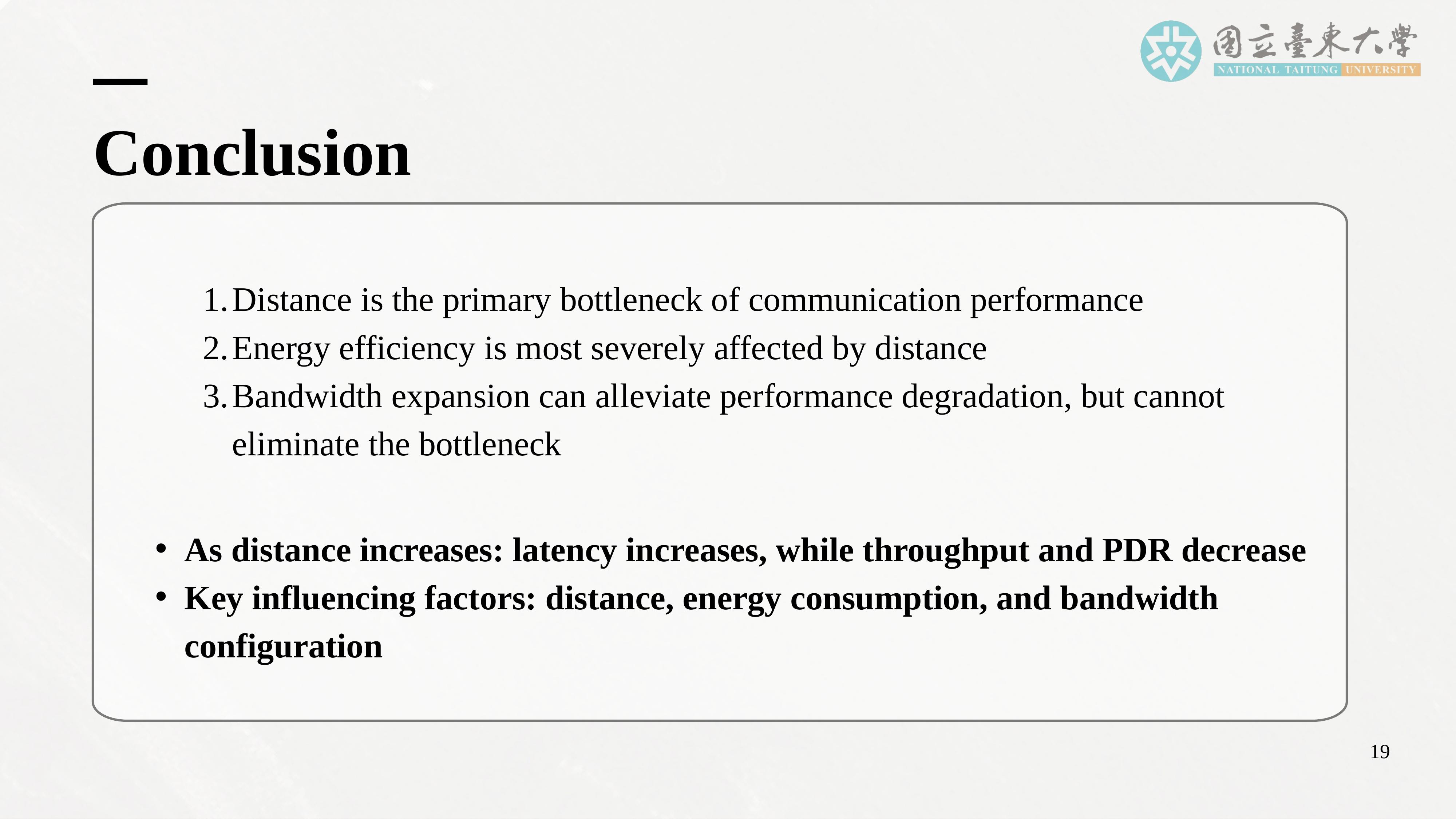 |
The results clearly show that distance is the primary bottleneck affecting communication performance in UAV-ISAC systems. As the UAV moves farther from the base station, communication quality degrades significantly.
Energy efficiency is the most severely affected performance aspect. Long-distance transmission dramatically increases energy consumption per bit, directly limiting the UAV’s mission endurance and operational range.
Although increasing bandwidth can alleviate performance degradation to some extent, it cannot eliminate the fundamental bottleneck caused by distance and path loss. As distance increases, latency rises, while throughput and packet delivery ratio decrease. Overall, the key influencing factors in the performance of the UAV-ISAC system are distance, energy consumption, and bandwidth configuration. |
| ICACT20260251 Slide.22
[Big Slide]
|
Chrome Click!! |
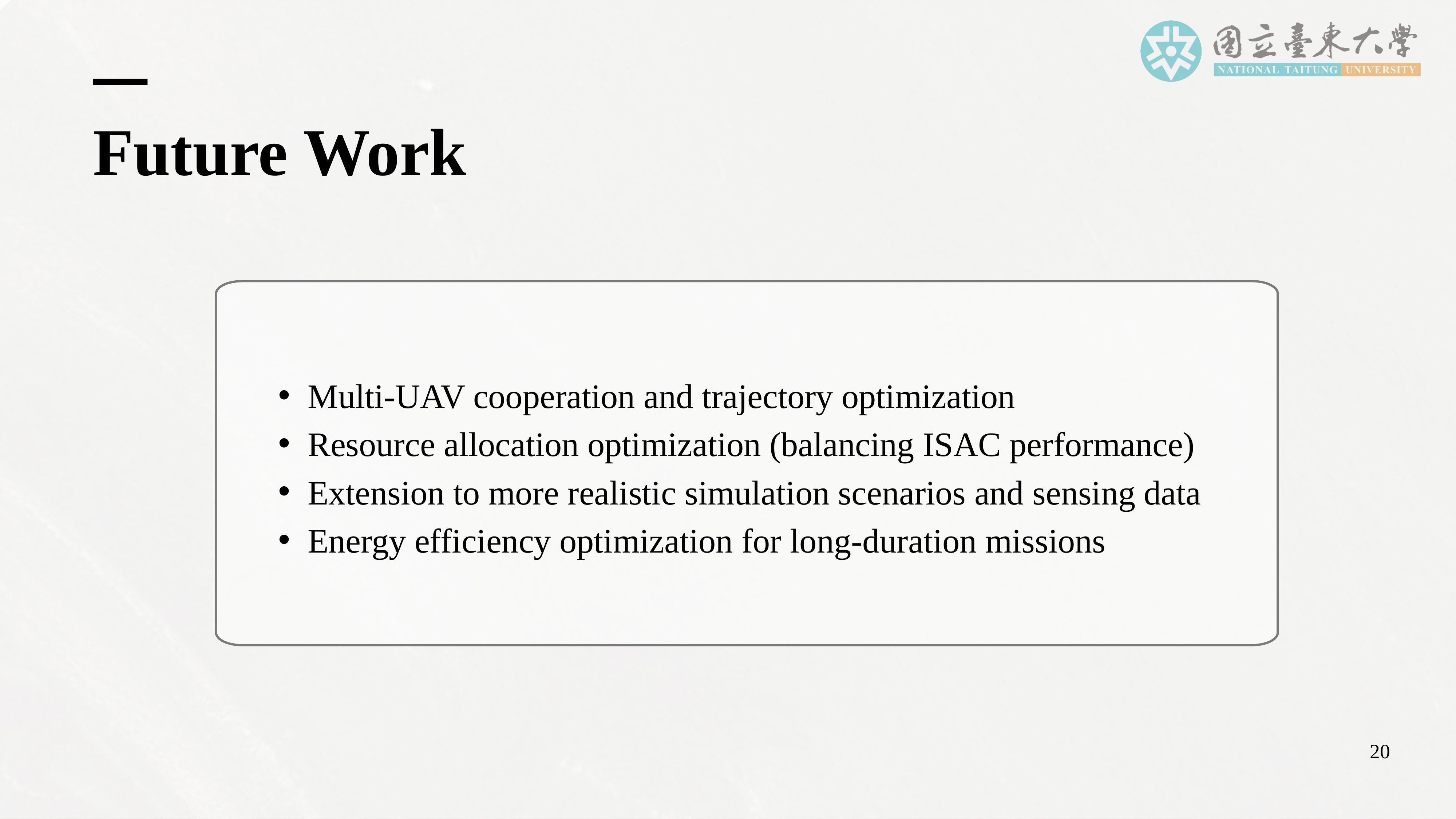 |
First, we plan to extend the framework to multi-UAV cooperation scenarios and trajectory optimization, allowing us to analyze monitoring efficiency and communication stability under more complex mission conditions.
Second, we will focus on optimizing resource allocation to balance sensing and communication performance in ISAC systems.
Third, we will extend the simulation framework to more realistic scenarios and sensing data, including complex three-dimensional flight paths and heterogeneous environmental data.
Finally, we will focus on energy-efficiency optimization for long-duration UAV missions, aiming to improve mission endurance and system sustainability. |
| ICACT20260251 Slide.23
[Big Slide]
|
Chrome Click!! |
 |
This concludes my presentation. Thank you very much for your attention. I would be happy to answer any questions or discuss any part of this work further. |
| |